JamesCaruso
Staff member
Still catching up on 2024 chase reports. This particular Saturday's target was the Fort Stockton area. I have always had an aversion to going down there, and can't remember the last time I did. It's a no-man's land, with a very limited road network, and it's at the extreme southwestern edge of typical chase territory. But with activity - and therefore our trip - winding down, and the next day's target likely to be in the Lubbock area, I decided to go for it. After all, how many times do we see on radar a rogue isolated supercell chugging along down there?
My son and I ended up really enjoying the day! I think my anti-Fort Stockton bias is gone! Sure, it's not a place where you have much hope of getting close to a tornado if that's your thing, but there are plenty of opportunities for structure shots over interesting landscapes.
We arrived in Fort Stockton early and sat for a couple of hours in a gas stop parking lot right off the I-70 interchange. When the first couple of cells formed, we drifted west on I-70 and then south on route 67. We stopped to let the northern cell drift toward us.
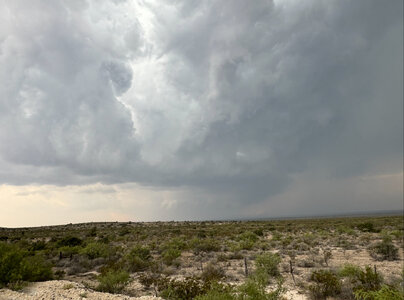
Then we shifted south a bit to this location, and a TOR warning was issued shortly thereafter. The tiny polygon is because the storm was moving only 5 mph.
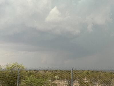
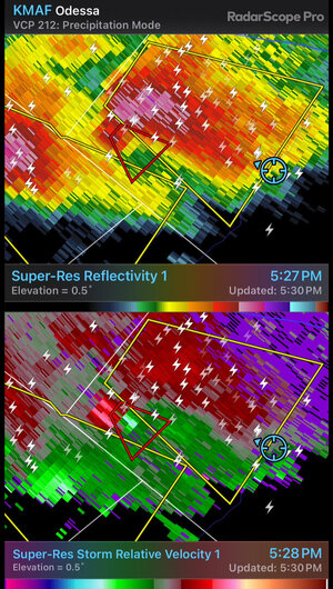
The forward flank of the storm coming up from the southwest overtook our meso, which I expected would be only a matter of time. We dropped further south for a look at this other storm.
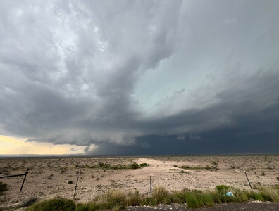
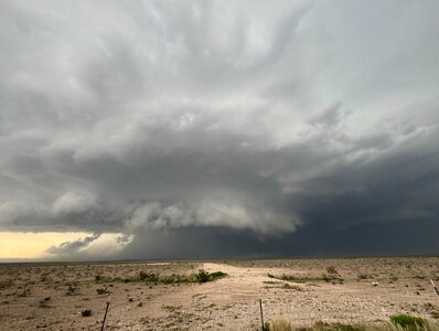
Eventually this storm crossed route 67, and this is where the lack of roads hurt. We had to go all the way down to route 90 before we were able to go east, and it was at this time that the storm was TOR-warned in the road void between 90, 67, 385 and I-70.
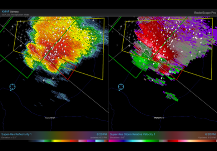
Once in Marathon, we watched new development to the south of the previous storm.
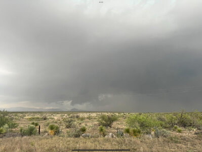
It was shortly after 7pm CDT, and I decided to call the chase at this point. I wanted to get back to Odessa, which is normally a 2-hour drive, but the storms were blocking 385 north out of Marathon, so I would have to go east to Sanderson and then up 285 (a 3-hour drive), or west back to 67 and then north (a 2.5-hour drive). I am often torn between staying on a storm until dark "just in case" something happens, and wanting to get a decent sit-down dinner. Given how things were looking, and also considering that the hail core was already getting pretty to close to the east road we would need to use to stay with the storm, dinner won.
Seven minutes after heading back west, we had just gotten through Marathon when I took another look at the radar. Velocity showed that the meso had ramped up, so I instantly began to second-guess my decision. But at this point I would have had even less of a chance to go east on 90 without the hail core impacting it. It also occurred to me that, with the MAF radar nearly 130 miles away, the velocity scan was probably looking at a higher-altitude slice of the storm, so the radar image was not a fair representation of surface winds (correct me if I'm wrong on that!)
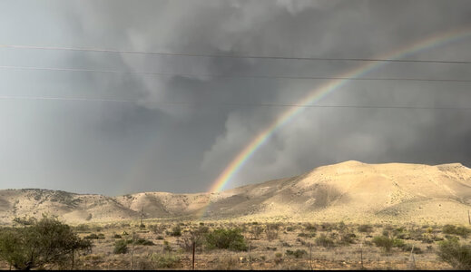
Continuing west toward 67, we scored a nice rainbow and a great landscape/skyscape combo with side-lighting on falling hail.
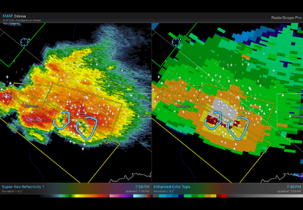
On the way home, on 67 behind the storms, I noticed donut holes on reflectivity, co-located with 60k feet tops. I started to again regret that maybe I had bailed too soon, but at this point the storm was over route 90 anyway.
And yes, we did get that nice dinner, at Cork & Pig in Odessa, open until 11pm on Saturday nights!
My son and I ended up really enjoying the day! I think my anti-Fort Stockton bias is gone! Sure, it's not a place where you have much hope of getting close to a tornado if that's your thing, but there are plenty of opportunities for structure shots over interesting landscapes.
We arrived in Fort Stockton early and sat for a couple of hours in a gas stop parking lot right off the I-70 interchange. When the first couple of cells formed, we drifted west on I-70 and then south on route 67. We stopped to let the northern cell drift toward us.

Then we shifted south a bit to this location, and a TOR warning was issued shortly thereafter. The tiny polygon is because the storm was moving only 5 mph.


The forward flank of the storm coming up from the southwest overtook our meso, which I expected would be only a matter of time. We dropped further south for a look at this other storm.


Eventually this storm crossed route 67, and this is where the lack of roads hurt. We had to go all the way down to route 90 before we were able to go east, and it was at this time that the storm was TOR-warned in the road void between 90, 67, 385 and I-70.

Once in Marathon, we watched new development to the south of the previous storm.

It was shortly after 7pm CDT, and I decided to call the chase at this point. I wanted to get back to Odessa, which is normally a 2-hour drive, but the storms were blocking 385 north out of Marathon, so I would have to go east to Sanderson and then up 285 (a 3-hour drive), or west back to 67 and then north (a 2.5-hour drive). I am often torn between staying on a storm until dark "just in case" something happens, and wanting to get a decent sit-down dinner. Given how things were looking, and also considering that the hail core was already getting pretty to close to the east road we would need to use to stay with the storm, dinner won.
Seven minutes after heading back west, we had just gotten through Marathon when I took another look at the radar. Velocity showed that the meso had ramped up, so I instantly began to second-guess my decision. But at this point I would have had even less of a chance to go east on 90 without the hail core impacting it. It also occurred to me that, with the MAF radar nearly 130 miles away, the velocity scan was probably looking at a higher-altitude slice of the storm, so the radar image was not a fair representation of surface winds (correct me if I'm wrong on that!)
Continuing west toward 67, we scored a nice rainbow and a great landscape/skyscape combo with side-lighting on falling hail.

On the way home, on 67 behind the storms, I noticed donut holes on reflectivity, co-located with 60k feet tops. I started to again regret that maybe I had bailed too soon, but at this point the storm was over route 90 anyway.

And yes, we did get that nice dinner, at Cork & Pig in Odessa, open until 11pm on Saturday nights!
