2024-05-28 EVENT: TX/NM/OK/KS

Joined
Mar 30, 2008
Messages
1,428
Location
Norman, OK
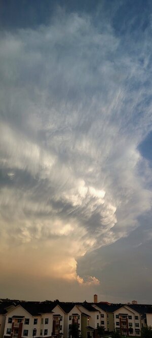
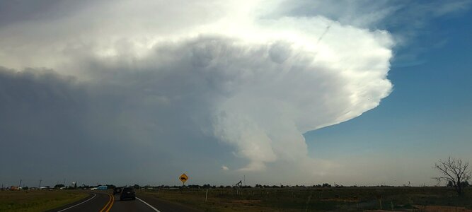
Tomorrow looking like a solid day. All CAMs this afternoon are blowing up supercells along the dryline.

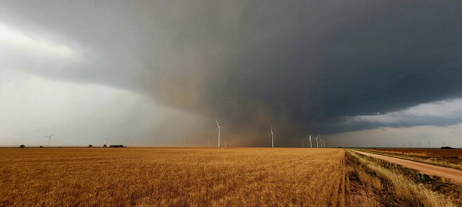
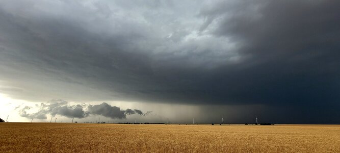
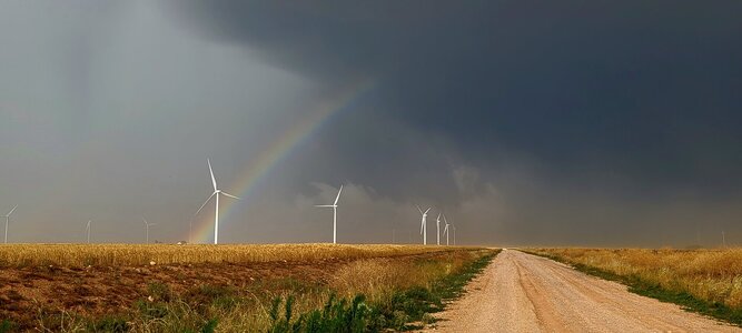
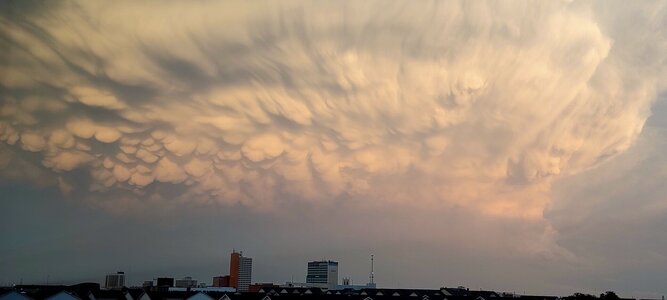
Subtle 500mb flow to about 35 knots will provide ample support and shear for supercells. The 18Z NAM seems to create a beast-mode creates-its-own-environment supercell down around Snyder. Worried with high PWAT's that far west as well as slower speed winds up top we'll be dealing with some HP modes.

Here's a cherry picked sounding from the inflow area of said NAM supercell above. This would be a repeat of Thursday to say the least.

nam_2024052718_030_32.31--100.49.png
 
It's a challenging day with the models disagreeing where the dryline progresses and because of the challenges (and opportunities!) of boundaries from the morning convection. I think the best areas are north of Amarillo and south of Midland. Between there strikes me as more conditional. We are playing the southern target because we are already in the vicinity.
 
While that turned out to be a "kind" of bust day , still saw some good sites regardless! .. caught some 2inch hail, a lot of 1inch . You could see the cells were wanting but the hodograph story out of Lubbock said moat of what it needed to down low .. but there were 2 cells that really tried to produce ..I started in Sudan and ended up in Tahoka.
 

Attachments

  • 20240528_203436.jpg
    20240528_203436.jpg
    54.5 KB · Views: 4
  • 20240528_184650.jpg
    20240528_184650.jpg
    254.1 KB · Views: 3
  • 20240528_183354.jpg
    20240528_183354.jpg
    208.3 KB · Views: 3
  • 20240528_185421.jpg
    20240528_185421.jpg
    235.7 KB · Views: 3
  • 20240528_204721.jpg
    20240528_204721.jpg
    136.8 KB · Views: 3
  • 20240528_191435.jpg
    20240528_191435.jpg
    358.2 KB · Views: 3
  • 20240528_191423.jpg
    20240528_191423.jpg
    293.7 KB · Views: 3
  • 20240528_163522.jpg
    20240528_163522.jpg
    344 KB · Views: 4
  • 20240528_170831.jpg
    20240528_170831.jpg
    121.3 KB · Views: 5
I have a question for those that chased or even just analyzed this day. Always trying to improve my forecasting, which is probably much worse than it should be after this many years (but in my defense, as a chase vacationer even 25+ years of chasing adds up to maybe a year of actual chasing/forecasting :confused:).

I set a target area for roughly Lamesa to Big Spring. It was embarrassing to find out that my target area actually fell *between* two separate SPC MSD's and not within either of them. When the watches came out, my target area was in the northern portion of the SVR watch and not in the TOR watch.

Below is a screenshot of an 18Z surface map, with my target area outlined. What was "wrong" with this area, and why was the TOR risk greater to the north and the TOR watch not inclusive of my target area? Clearly my target was on the outflow boundary, had adequate convergence near the dryline, backed winds, sufficient moisture, and T/Td spreads not meaningfully different from those to the immediate north where the TOR watch began.

Thanks in advance for your corrective insights and perhaps it will help with the relatively similar setup for today 5/30!


SC.jpg
 
James for me , and why I chose where I did was the best intersection of mid level flow to near surface conditions from the dry line to the residual outflow boundary..I kinda played the triple point area ..and honestly none of the cells that formed really generated much .. you're area sfc wise was good.. I just think the mid level support wasn't nearly as strong there with the 700mb trof location compared to where I was further north.
 
James, I targeted Rankin because I thought the shear profiles up north were worse than those to the south--though I wasn't impressed with them anywhere. But I felt our odds were better in the south. I was surprised that a tornado watch was issued for the northern target (as opposed to a severe thunderstorm watch).

In the end Rankin was a bad choice because of the combination of outflow from the morning and the storms in Mexico disrupting low level wind/moisture. But I did get caught in quite a dust storm, which was exciting.

Ironically, if Tuesday hadn't been my last chase day I would have targeted north to be in better position for Wednesday.
 
Back
Top