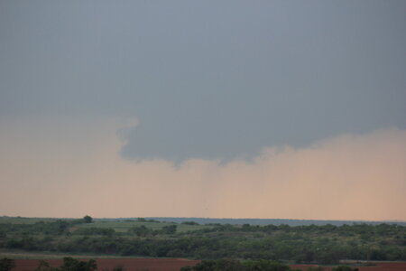
I left Altus, OK at around 3:30pm and headed west on US-62, with the goal of targeting somewhere along the US-83 corridor. Once I reached the US-62/US-83 intersection, I checked radar and saw two supercells ongoing to my west. The northern storm was the one that produced the tornado near Clarendon, TX. The southern storm was just west of Memphis, TX. I decided to target the southern storm, since it appeared as if it would eventually impact and possibly cutoff the northern storm. I proceeded west on TX-256 towards Memphis. I stopped on a hill just east of Memphis and was able to observe my target cell for the first time. It looked like it was trying to strengthen, but another cell to its south had fired north of Turkey and was already getting in the way of my original target. This new cell looked good on radar and so I adjusted south on US-287 towards Estelline.
Being so close to the canyons and such in this part of the Panhandle, the road network to my west was frustrating to say the least. Going down to Childress and around the long way to Turkey seemed to be the best option for getting a good up close view of the storm, but I had no idea how long that would take, nor did I have any clue how long this storm would stay discrete. Instead I decided to head west on TX-86 from Estelline just to see what I could see. I figured worst case I head back east and then go around. Boy oh boy am I glad I went west on TX-86! The next hour and a half or so were some of the best moments of my chase career (which admittedly isn’t saying much, but still.)
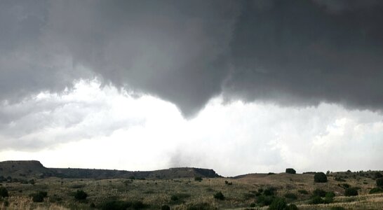
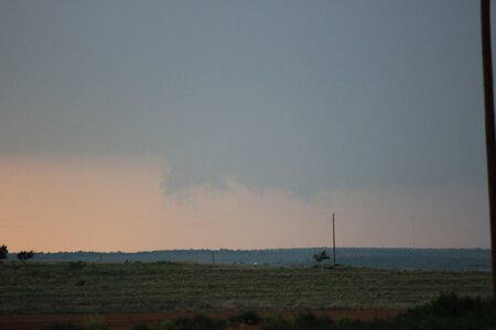
I went about 10 miles west of Estelline before I pulled over at the top of a ridge, and by some miracle I actually had a good view under the meso that was about another 10-12 miles to my west, several miles north of Turkey. I broke out my big lens and tripod, dialed in some settings, and settled in.

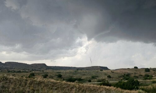
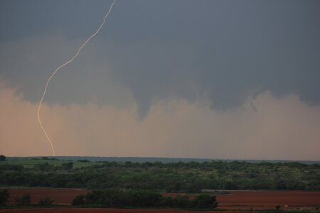
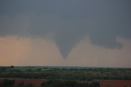
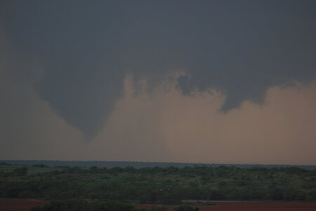
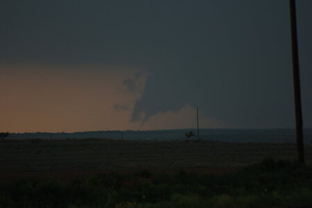
The storm was nearly stationary, and it cycled at least once while I was sitting there. I saw a few short lived funnels, but it wasn’t until about 15 minutes after the previous image that I saw my first substantial funnel, which could possibly be my first tornado of the day. Being so far away, I imagine it is entirely plausible that it touched down briefly without being fully condensed and I just couldn’t tell.


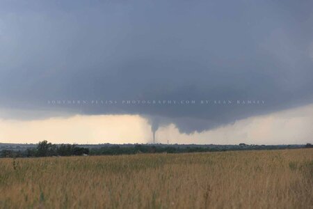
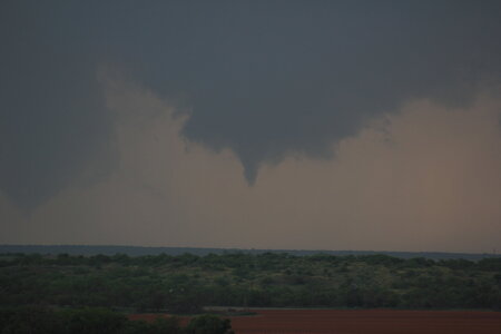
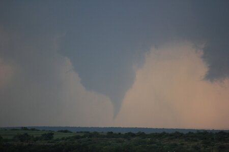
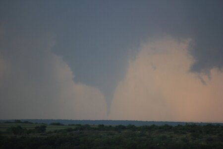
As the first funnel was lifting, a new area of circulation was forming slightly to the NE of it. This new area produced a funnel, while simultaneously the first area was trying again to produce a tornado. For a few brief moments, I thought I was about to see twins!


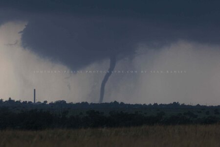
Referencing the above photo, the funnel on the right dissipated, while the one on the left became my first confirmed tornado of the day!


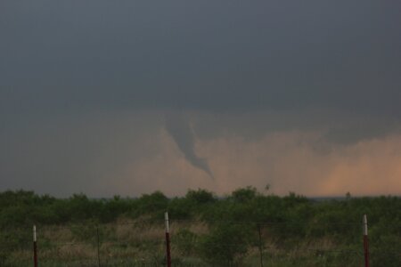
Now I should mention that after looking through my photos again, it is also possible that this tornado and the previous possible tornado could have been the same one the whole time and it just wasn’t fully condensed until the time of the above photos. The tornado didn’t last but a minute or so and lifted again. At this time, I was starting to get rained on and with an apparent lull in the action, I pushed back east a little bit to stay out of the precipitation and keep my camera dry. As I was driving, I looked out my rearview mirror and saw what appeared to be another fully condensed tornado! I suspect that the newer circulation I had noticed earlier finally decided to produce. I pulled over real quick and swung my camera around, jacking up the manual focus in the process. As a result I have no coherent photos of it condensed, but here is the least blurry photo I have of it as it was lifting. Note how perfectly in focus the barbed wire fence right next to me was. This marks confirmed tornado #2 of the day!

At this point, precipitation had shrouded my view under the meso, and so I pulled off for a radar check and to plan my next move. A new cell had formed just to the west of Turkey, and it appeared on radar to be quite healthy. Once again, the weird road network kept me from being able to get much closer. TX-86 meandered through what was now a rather robust hail core, and going down and around would take forever. But my luck for the day hadn’t run out quite yet, and I was able to see underneath the new meso to my SW, despite again being 10-12 miles or so away.

A few minutes after settling in, this storm also produced a tornado. #3 for the day!

I hung around for several more minutes, but as it got closer to sunset, and the storms to my west were becoming more crowded, I was losing sunlight. I drove south towards Childress to try for another look to the west, but the storms were starting to cluster together and there wasn’t any more visibility to be had. I hopped back on US-62 in Childress and headed home.
What a freakin day!! 3 confirmed tornadoes, with a possible 4th, is worlds better than I had any right to expect for this day! As for how I conducted this chase, I really don’t think I could have done any better, given the circumstances. As much as I would have loved getting a closer view of these tornadoes, there was no guarantee that had I gambled with the hail cores that I would have gotten a better view. In fact, if I had committed that far on the first storm, I likely would have missed the second one entirely. If being too careful is my only critique, then I consider that an excellently executed chase. Til the next one!
