I was one of the lucky few who captured the Greenville, IL tornado on April 2nd.
I am frequently very wishy washy when it comes to choosing a target for local chases. Typically there is a "northern" threat that sets up near the Quad Cities and runs along the I-80 corridor to the Indiana border, as well as a "southern target" across central and southern IL that I will consider. Northern target usually wins for me since I am about an hour south of Chicago and prefer that terrain (minus Chicago and the IL river valley) rather than driving couple hours south and dealing with more questionable terrain the farther you go. Not only did the day prior to the event start to show model runs hinting at the northern target recovering nicely and having a more robust severe threat, but the morning of the event had models \ highlighting the possibility of supercells raking Indiana and even Ohio before the eventual qlcs at night. I quickly ruled that target out because of drive times. To me, it seemed like my only clear option was to head down 57 towards Effingham and adjust west from there - I70 would provide great east/west travel at the highest speeds, which would be necessary given the forecast storm speeds of 60+ MPH. During the morning hours of April 2, HRRR drastically backed off on the progress and linear nature of the morning convection and had numerous supercells tracking across that corridor. So that was it - I left around Noon and expected to know what to do when I got to the target area. Easy!
After getting to the Champaign area and diddling around for a bit, I was really torn on what to do. Storms had started firing along a line from about Bloomington IL to Bowling Green MO, but I was really enticed by the parameter space being shown on RAP meso analysis moving forward.

I had a feeling these developing storms could really take off, but given my current position and the storm motion vectors, I felt like I had no choice but continuing on to Effingham and hit I-70 west for the storms models had agreed would form and march across the area over the next few hours. I started eyeing a persistent tornado warned supercell in eastern Missouri that was progged to cross into Illinois just south of St. Louis and planned an intercept just east of that area along I-70, giving me the best spot for directional roads and the ability to try and keep up with the fast storm speeds. You can imagine my dismay when the line of supercells began popping off to my North and West, prompting tornado warning across Central Illinois and marching off into the best terrain and road network combination in the world. I was super flustered and thought for sure I had completely botched this chase - expecting to see videos of all the tornadoes I missed while I drove around in fast moving slop down south without any good views.
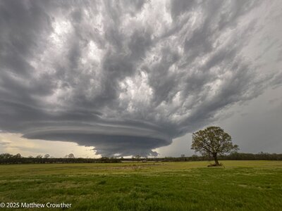
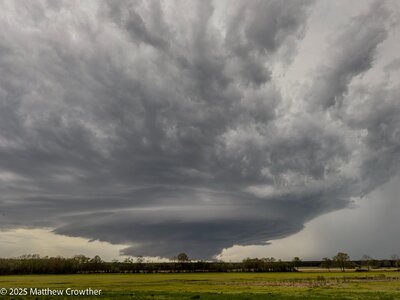
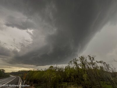
But I had to set these feelings aside and try to salvage what I could down south. As the target supercell approach the river crossing, things predictably started to get messy - I had to keep my attention fixe on radar to track where the storm was moving as flanking storms began encroaching on the once isolated cell. Initially, I plotted an intercept just south of Highland, IL where there appeared to be some good vantages, and made sure to keep road options close by so I could attempt to stay east ahead of it. Storm speeds were 50mph minimum according to RadarScope. With rain filling in everywhere as the core approached, it was was obvious nothing was ongoing and I needed to use that time to relocate to the east/northeast. I first used state highways that paralleled the interstate, but it was obvious I needed more space, and quickly! I hopped on to 70 with a decent view of the RFD/area of interest right behind my in the rearview mirror

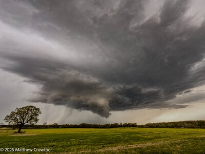
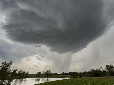
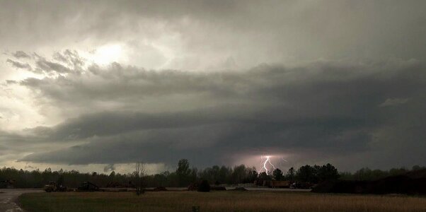
I started chugging ahead to the east while doing the occasional "dummy check" (shoutout to Skip) and suddenly when I glanced out my right side mirror - "Oh SHIT" instinctively came out and I pulled off to the shoulder as fast I could as I saw the long cone tornado appear from the rain.

It dawned on me that this thing was moving straight at me - and fast! I milked the view for as long as possible, as it was obvious time was running out before I would be in danger. I had barely had time to report this to the NWS and take a few photos/videos, but time was up. Here's a video clip right before I scrambled -
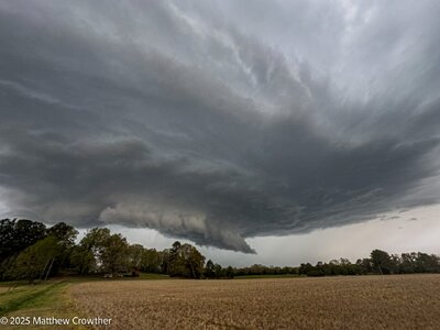
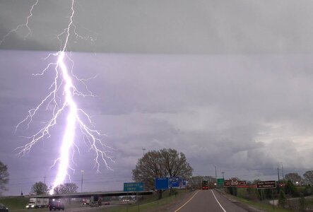
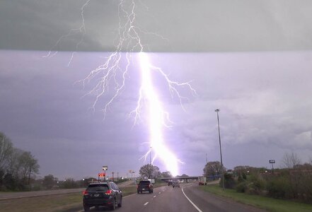
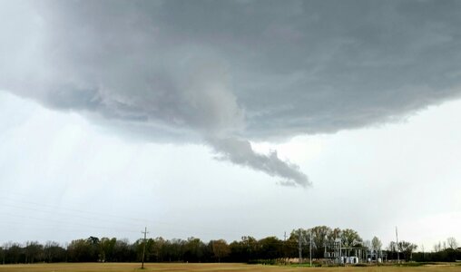
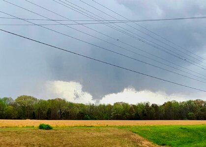
I tried stopping a couple more times down the highway to get more footage, but each time it was apparently I was barely putting distance between us, and I didn't feel comfortable in the moment with trying to shoot at close range. As a result I have nothing from the gnarly rope out as it crossed I-70; this is my only gripe with my chase that day. I stuck with the storm as it quickly became part of a growing QLCS, surfing I-70 just to the south of it. It ended producing a real long track embedded tornado along the way, but I was never again able to get visuals on any tornado, despite going almost the entire length of the interstate in Illinois. Eventually darkness set in and I backtracked to the 57 interchange to head home. As you can see below, I did well to move when I did, as the tornado crossed right about where I was observing.