Cody Dunkle
Enthusiast
Left Omaha, Nebraska at 0830z toward what ended up being an ENH for eastern OK, NE TX, and W AR. It has been a few weeks so I do not have the proper observation data analysis available, however what I *can* tell you is a broad storm system with multiple shortwaves were ejecting off of the southern Rockies, focusing the first of multiple shortwaves for the multi-day event over eastern Oklahoma and Arkansas. By late afternoon a pseudo-warm front extended over northern Oklahoma and another boundary extended southward over central Oklahoma well ahead of the attendant cold front. Jimmy Sienicki and I targeted southeastern Oklahoma just ahead of the north-south boundary and had a late lunch in McAlester, Oklahoma with another chaser waiting for storms to fire. While eating in McAlester, convective showers started firing ahead of the main boundary, indicating building instability after a morning storm complex moved through the area.
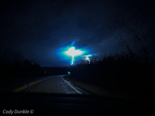
We dropped further south toward Atoka as it was apparent the first shortwave would help initiate sustained convection in south-central Oklahoma. At around 20z storms indeed fired off of the boundary in southern Oklahoma and tracked northeastward. It took a long time for the storms to congeal, so we let the storm organize and decided to trek into the Ouachita Mtns. early on to have a chance ag staying ahead of the storm. The storm continued to not do much until we got to Wilburton. We could see the storm finally organizing on radar as we were stopped for gas in Wilburton and continued north toward Quinton. About halfway between Wilburton and Quinton, positive Cg lightning production skyrocketed what felt like instantaneously and started throwing bolts very close to us while coming down the north side of the mountain range. Attached below is a photo I managed to capture while my partner was driving. Gorgeous blue bolts lighting up the beautiful mountains. Minimal editing on the photo.
A tornado was reported by another chaser right before we came into Quinton. We went east from Quinton to try to get a good north option that would keep us ahead of the storm and not running into the RFD. Just past Kinta, I noticed a tornado on the ground in the frequent lightning flashes and asked to pull over. The next few shots are looking northeast from approximately 2 miles ESE of Kinta. My partner appears to have photographed (not pictured in this post) twin tornadoes at approximately 6:54 pm local, followed by a very large and well defined wall cloud photographed by me and then a potential large “Wedge” tornado (I use this terminology sparingly, but this appears to be a tornado more than large enough to be classified as such) at approximately 6:57 pm local time. Footage will be attached below with screenshots and other photography. Because I shot these stills and video with my iPhone and we were still chasing, I didn’t have time to look at the photography in depth until after we were done chasing in MS/AL on the 3rd. We were pretty confident we saw the wedge with our own eyes, but given distance and low light, we didn’t report it as the tornado had already been reported earlier on further west. I instead relayed my photography and videography with detailed description to the local NWS office later that week, however still have not received a response. After looking at the data later that week, it seems the NWS didn’t know about the Wedge we photographed as the first report came about ten minutes before what we saw with no subsequent reports or surveys done. The storm produced one more tornado we did not see near Tamaha and then fell apart as it crossed into Arkansas. We finished the chase and after being awake nearly 36 hours (my partner was much more well rested than I was) we slept for about six outside Ft. Smith before heading southeast to chase the next day in Dixie. Bolts coming off of the northern side of the mountain range approaching Quinton from the south.

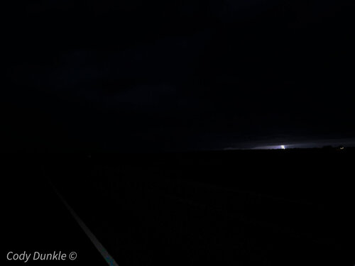
Large wall cloud looking NW from ESE of Kinta. You may have to zoom in to see it clearly.
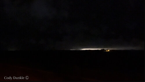
 Potential large “wedge” tornado looking NW from SE of Kinta toward SW of Whitefield. Approx. time 6:57 pm. Below is a short clip of the potential wedge. I have a few more not posted. Please disregard my voice as in the moment I thought of sharing to twitter but refrained because I didn’t want to post something that may not have been a tornado after all. Still waiting on a response from NWS before I call this what it very clearly looks like to me. Said Stigler because that was the bearings I had at the moment, though the storm was closer to Whitefield at the time than Stigler.
View attachment trim.FF139F54-C5F7-45B7-9BFE-982EA20E696B.MOV
We dropped further south toward Atoka as it was apparent the first shortwave would help initiate sustained convection in south-central Oklahoma. At around 20z storms indeed fired off of the boundary in southern Oklahoma and tracked northeastward. It took a long time for the storms to congeal, so we let the storm organize and decided to trek into the Ouachita Mtns. early on to have a chance ag staying ahead of the storm. The storm continued to not do much until we got to Wilburton. We could see the storm finally organizing on radar as we were stopped for gas in Wilburton and continued north toward Quinton. About halfway between Wilburton and Quinton, positive Cg lightning production skyrocketed what felt like instantaneously and started throwing bolts very close to us while coming down the north side of the mountain range. Attached below is a photo I managed to capture while my partner was driving. Gorgeous blue bolts lighting up the beautiful mountains. Minimal editing on the photo.
A tornado was reported by another chaser right before we came into Quinton. We went east from Quinton to try to get a good north option that would keep us ahead of the storm and not running into the RFD. Just past Kinta, I noticed a tornado on the ground in the frequent lightning flashes and asked to pull over. The next few shots are looking northeast from approximately 2 miles ESE of Kinta. My partner appears to have photographed (not pictured in this post) twin tornadoes at approximately 6:54 pm local, followed by a very large and well defined wall cloud photographed by me and then a potential large “Wedge” tornado (I use this terminology sparingly, but this appears to be a tornado more than large enough to be classified as such) at approximately 6:57 pm local time. Footage will be attached below with screenshots and other photography. Because I shot these stills and video with my iPhone and we were still chasing, I didn’t have time to look at the photography in depth until after we were done chasing in MS/AL on the 3rd. We were pretty confident we saw the wedge with our own eyes, but given distance and low light, we didn’t report it as the tornado had already been reported earlier on further west. I instead relayed my photography and videography with detailed description to the local NWS office later that week, however still have not received a response. After looking at the data later that week, it seems the NWS didn’t know about the Wedge we photographed as the first report came about ten minutes before what we saw with no subsequent reports or surveys done. The storm produced one more tornado we did not see near Tamaha and then fell apart as it crossed into Arkansas. We finished the chase and after being awake nearly 36 hours (my partner was much more well rested than I was) we slept for about six outside Ft. Smith before heading southeast to chase the next day in Dixie.
 Bolts coming off of the northern side of the mountain range approaching Quinton from the south.
Large wall cloud looking NW from ESE of Kinta. You may have to zoom in to see it clearly.
 Potential large “wedge” tornado looking NW from SE of Kinta toward SW of Whitefield. Approx. time 6:57 pm. Below is a short clip of the potential wedge. I have a few more not posted. Please disregard my voice as in the moment I thought of sharing to twitter but refrained because I didn’t want to post something that may not have been a tornado after all. Still waiting on a response from NWS before I call this what it very clearly looks like to me. Said Stigler because that was the bearings I had at the moment, though the storm was closer to Whitefield at the time than Stigler.
 View attachment trim.FF139F54-C5F7-45B7-9BFE-982EA20E696B.MOV
