• A friendly and periodic reminder of the rules we use for fostering high SNR and quality conversation and interaction at Stormtrack: Forum rules

    P.S. - Nothing specific happened to prompt this message! No one is in trouble, there are no flame wars in effect, nor any inappropriate conversation ongoing. This is being posted sitewide as a casual refresher.

2021-08-09 REPORTS: IL

I targeted Northeast IL this afternoon and evening for a few supercells and a tornado or two and was treated to an all out tornado fest. I lost count at the number of tornadoes I saw especially later on with multiple on the ground at once with supercells near Sycamore IL and Burlington IL. A solid 2+ hours of straight up tornado action and some were very photogenic, double digits perhaps, its possible. Here are some rough shots I put together before I head to bed. This is my 2nd best chase ever and I've been chasing storms since 2003, it almost even pushed Pilger out of the top spot. Each of these is a different tornado except of the close up of the "violent" looking stovepipe and the wedge, I included 2 different angles in there because of its "quality". Enjoy the show.

DSC05433.jpg

_DSC7656.jpg

_DSC7278.jpg

_DSC7731.jpg

Massive Wedge BW.jpg

_DSC8115.jpg

_DSC7884.jpg

_DSC7417.jpg

ORG__DSC8183.jpg

DSC05403.jpg


Edit (3am 8/10/21): Here is a link to some footage I shot of the tornado near Burlington, IL last afternoon. It looked rather significant with strong upward motion and eventually formed into a larger wedge. The second shot was from the eventual tornado S of Lily Lake, IL, but I think similarly the circulation as it was occluding was gradually weakening, so while it was a wedge at one point, I think it was more or less occluding as both dissipated fairly quickly after reaching max width. Probably also an owing to the lower LCL values near the warm front area yesterday afternoon (low 80s over mid 70s, quite sticky outside too).

 
Last edited:
Last report post I will likely make on this as I'm going through material, here are some additional keepers that made the cut from 8/9/21:

_DSC7286.jpg

Photogenic tornado over White Rock, IL. This was the 3rd tornado I spotted of the day.

_DSC7673.jpg
Significant and violent looking wedge with horizontal vortex near Burlington, IL. This was the second hand-off from this cyclic machine.

_DSC7672.jpg
Strong stovepiipe tornado NW of Burlington, IL. Cycle #1 of the cyclic supercell before the wedge tornado I posted above. Briefly there were 2 large wedge tornadoes at once before the prior tornado dissipated.

_DSC7473.jpg
Rope tornado near Rochelle, IL.

_DSC7794.jpg
Storm spotters watching a strong tornado develop and sit stationary in place throwing off horizontal vortices and large pieces of debris.

_DSC8075.jpg
Large tornado NE of Virgil, IL with the Sycamore, IL cyclic storm. This storm sported a satellite tornado at times.

_DSC8143.jpg
Satellite tornado near Virgil, IL with a large cone/wedge to the right.

_DSC8058.jpg
Large wedge tornado formed after the previous photogenic stovepipe dissipated. This would occlude a few minutes later down the road and be concurrent with a new tornado to the E that grew very large S of Lily Lake, IL.

_DSC8039.jpg
Original touchdown of tornado that would become a large wedge SE of Sycamore, IL. This tornado exhibited rapid and erratic motion and horizontal vortices as well.

_DSC7836.jpg

Photogenic elephant trunk tornado east of Sycamore, IL. I may make one more post below this since it will only allow me to add 10 images.
 
Here are a few more shots since ST limited me to 10 photographs. This is what I have gotten through so far from 8/9/21.

_DSC7739.jpg

Strong tornado throwing debris.
Sycamore IL twin tornadoes in town.jpg
Large tornado forming over Sycamore, IL with a previous tornado/satellite roping out on the backside of the tornado cyclone.

_DSC7746.jpg
Close-up of chasers observing a tornado throwing debris near Sycamore, IL

_DSC7876.jpg
Photogenic stovepipe/elephant trunk tornado.

_DSC7786.jpg

_DSC7941.jpg

_DSC7820.jpg


_DSC7976.jpg
 
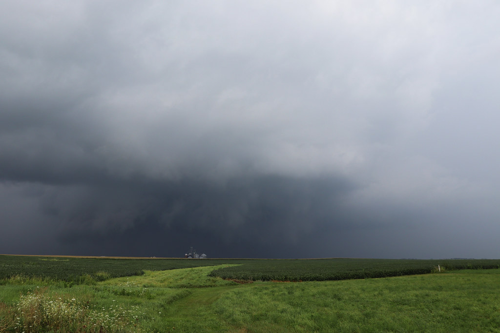
Woke up in Cedar Rapids, Iowa after breaking my long-running Iowa curse the day before. Feeling pretty satisfied with my trip (which included the Omaha supercell two nights earlier and the Iowa tornado the day before), I woke up contemplating a westward target to get me closer to home (I never had any real intention of going as far as Illinois on this trip). But alas, morning data gave me enough of a shove to opt to drive myself another few hours away from home. Certainly nothing that morning screamed "tornado outbreak" at me, but I decided to make the play.

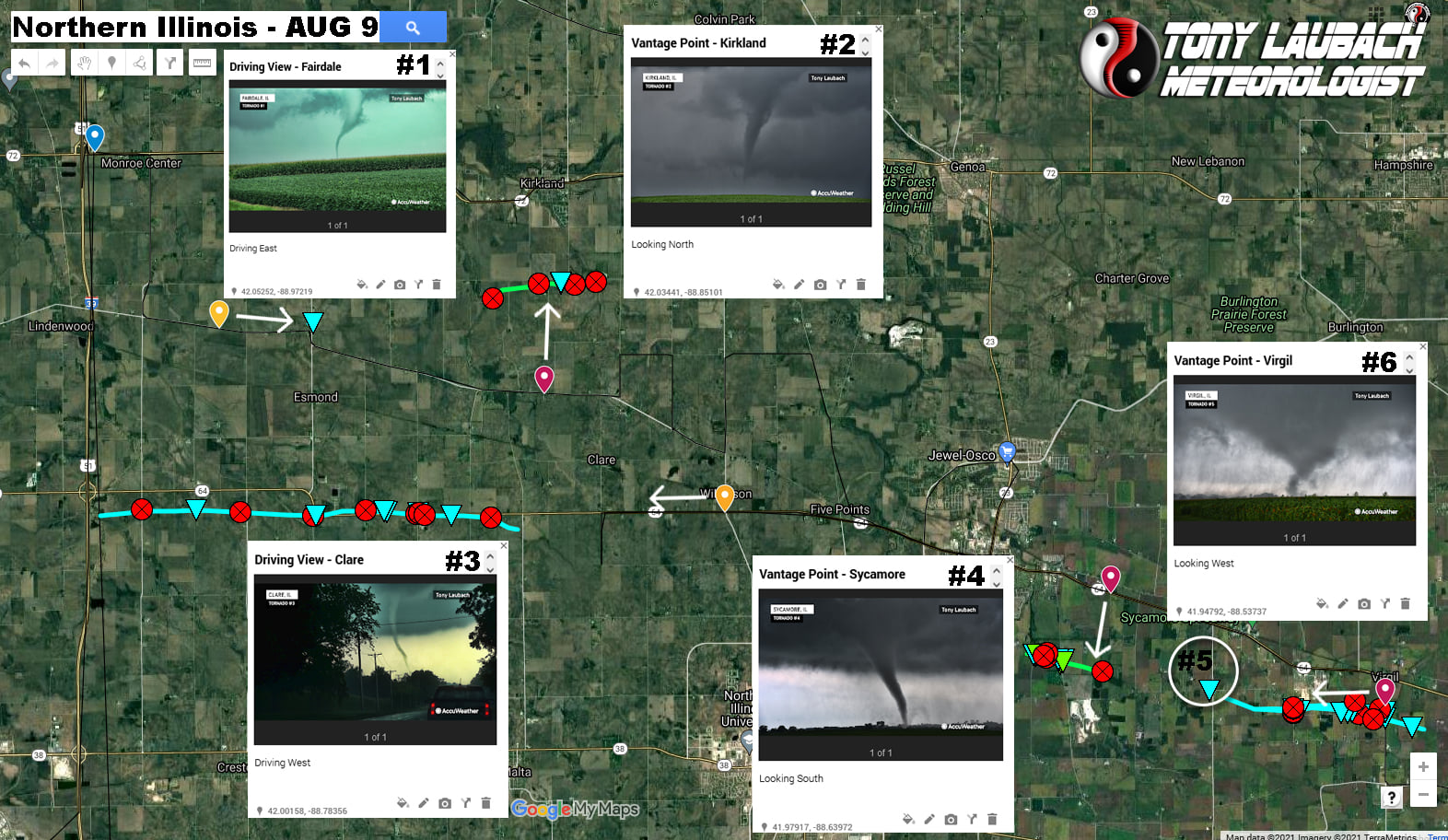
I rolled into Rochelle, then north on I-39, making my final fuel top-off stop at Monroe Center, about that time, the Rockford storm got severe warned. I headed east to get in front of the southeast moving cell, which would get tornado-warned on the southeast side of Rockford. I doubled-back, taking a series of northwest routed roads only to find myself buried in rain with no evident rotation to speak of.

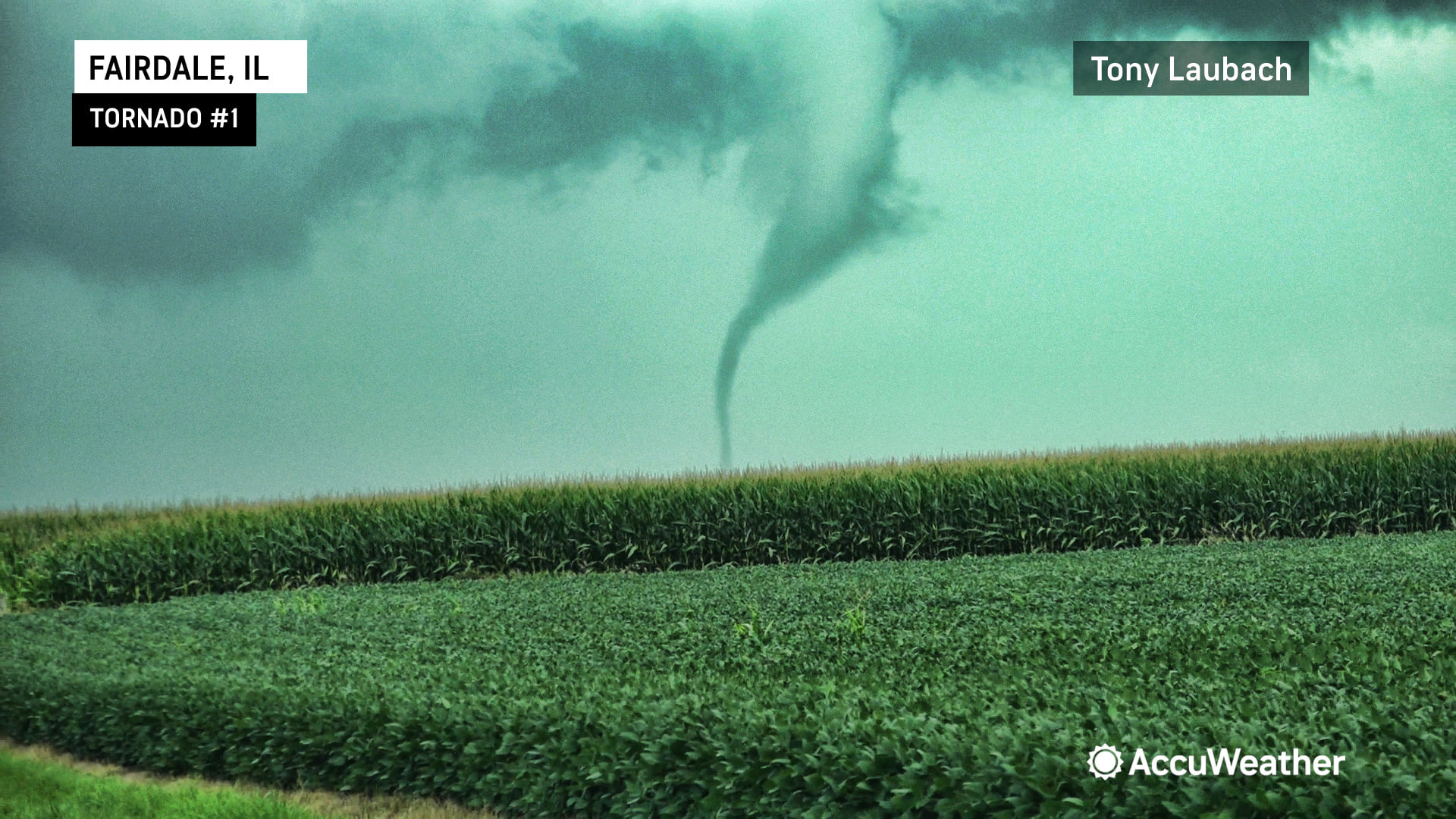
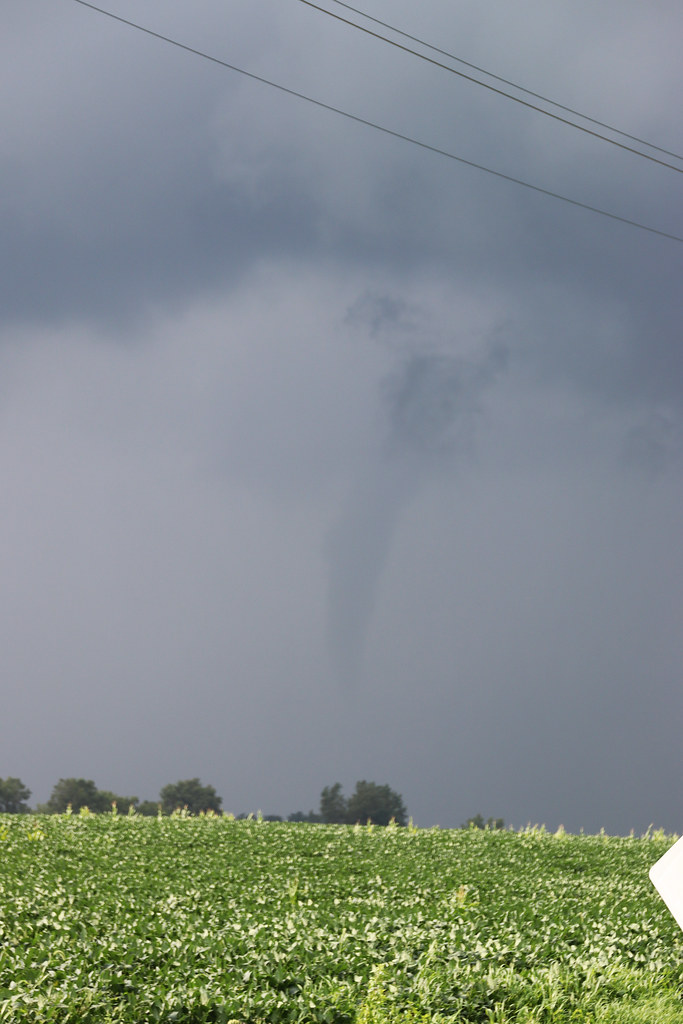
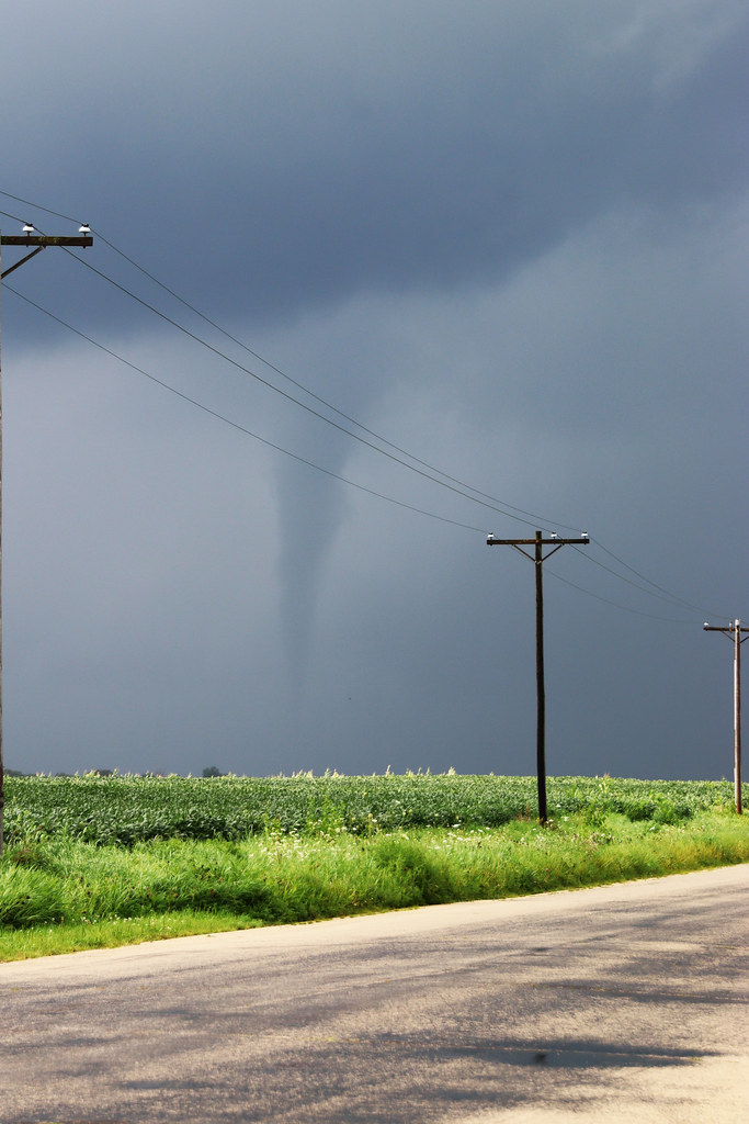
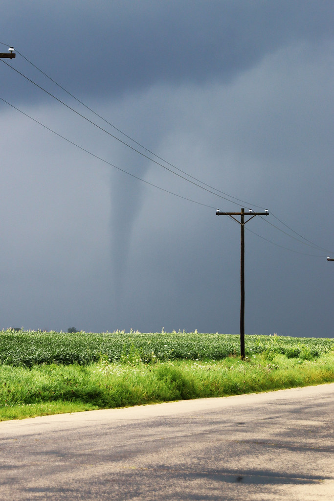
I saw the cells developing to the southwest, so I worked my way through Rockford and south on I-39, ending up back at Monroe Center, but this time, I dropped south on Mulford Road to get on the south side of the cell. I made a mini core-punch on the storm, turning east on Lindenwood Road just in time to see a gorgeous white funnel touch down in the corn fields to my immediate east.

230537912_381160023385325_357283295327809103_n.jpg


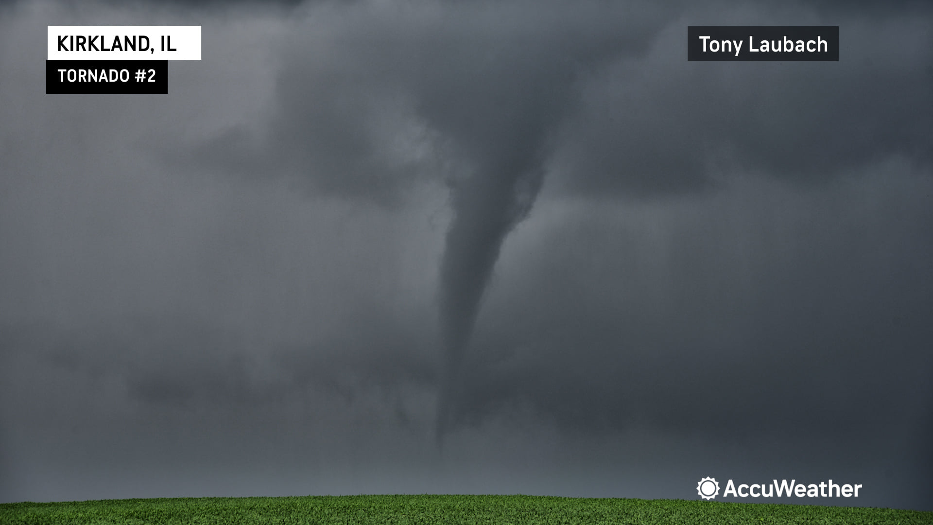
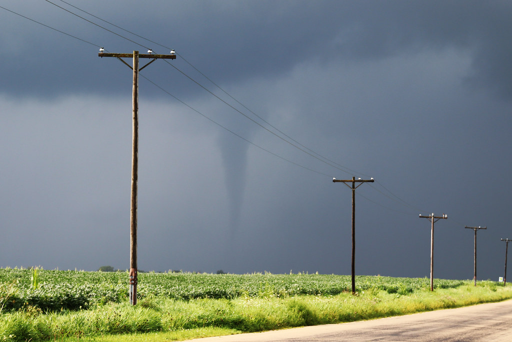
This tornado was brief, but it was pretty. It wouldn't be long before the next one came down. I got lucky and found a pull off from the road and witnessed this tornado from a driveway along Old State Road, looking north. The funnel was visible for several minutes before the tornado touched down, slowly vanishing in the rain. I was approximately 2 miles south of this twister.

234918180_381159913385336_6741817205668339752_n.jpg


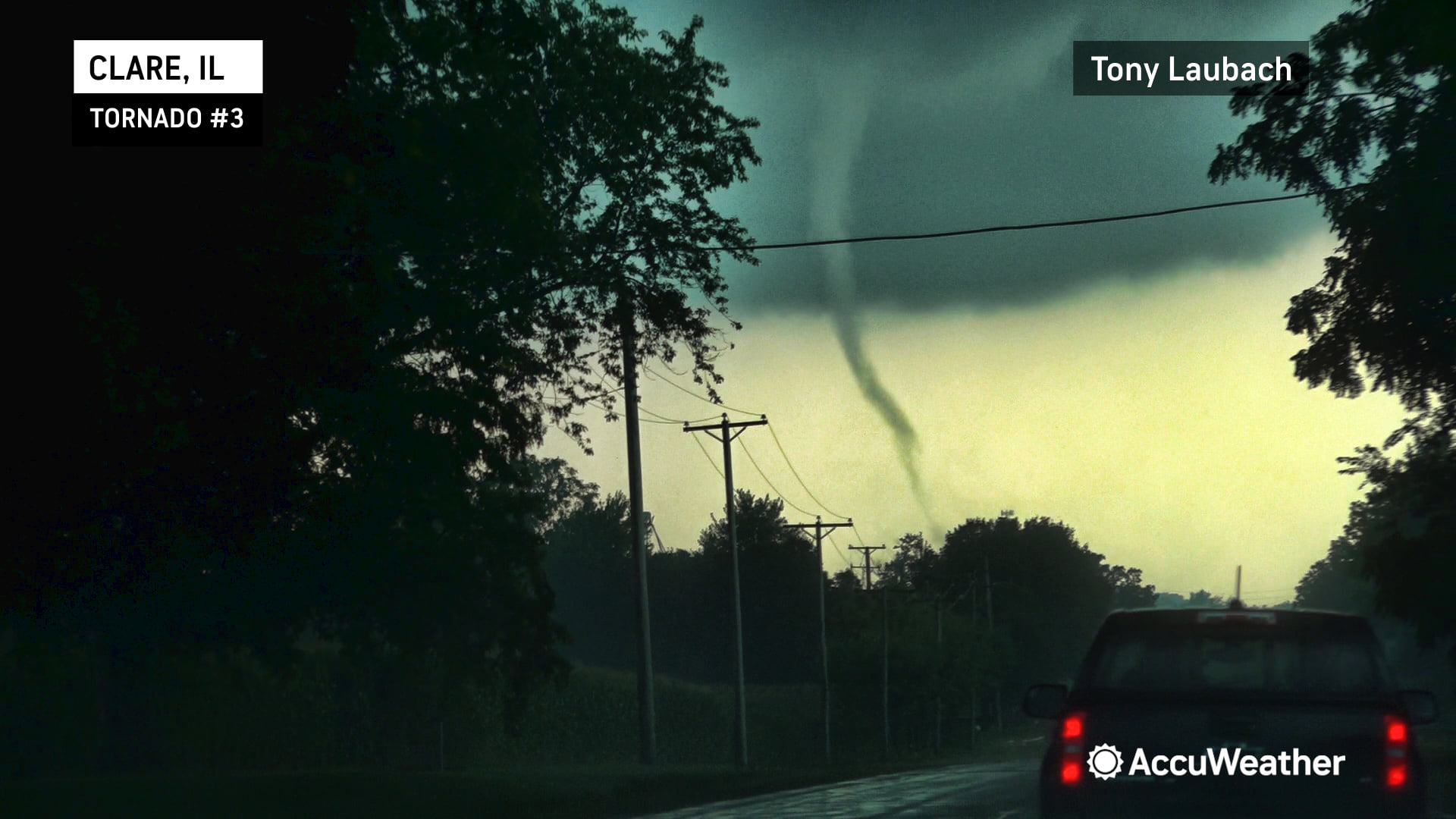
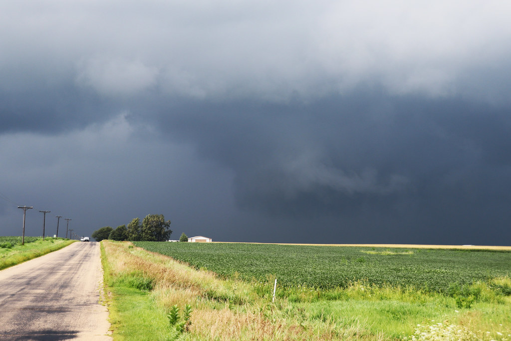
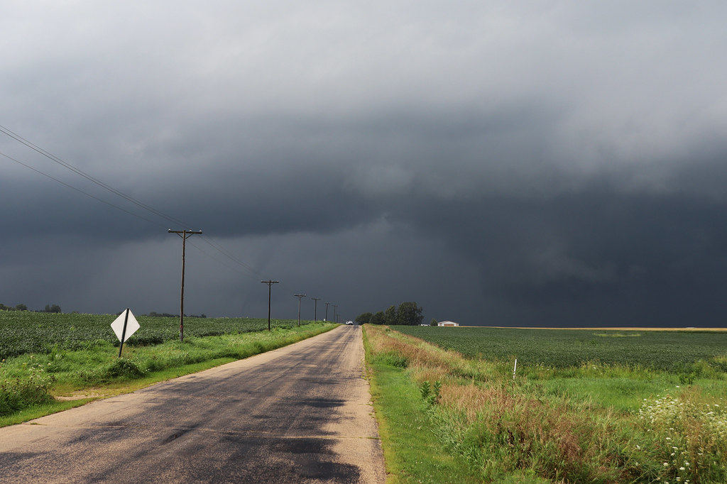
I followed this storm a little longer than I should, eventually wonkily getting into Sycamore. I was cut off by precip and approaching the more populated western suburbs of Chicago, so I cut my losses on this storm and retreated west for the next sup along the line. I was dealing with the most traffic I had come across on the day along my westward job along IL-64, but along the way, I spotted my third tornado of the day.

I was approaching Clare when I saw this tornado. My view was hampered by trees along my drive, but my dash camera was able to collect imagery of this tornado as I attempted to close the gap despite being stuck in a line of vehicles (mix of chasers and locals). I never got within 2 miles of this tornado, even as we were converging along the highway.

234803157_381159993385328_5427553548882964986_n.jpg


With this new storm actively producing, I flipped myself BACK around toward Sycamore, watching significant cloud-based rotation as both the storm and I neared the town. By this point, the rotation was now south of 64, so I felt lucky not to be buried in the core.

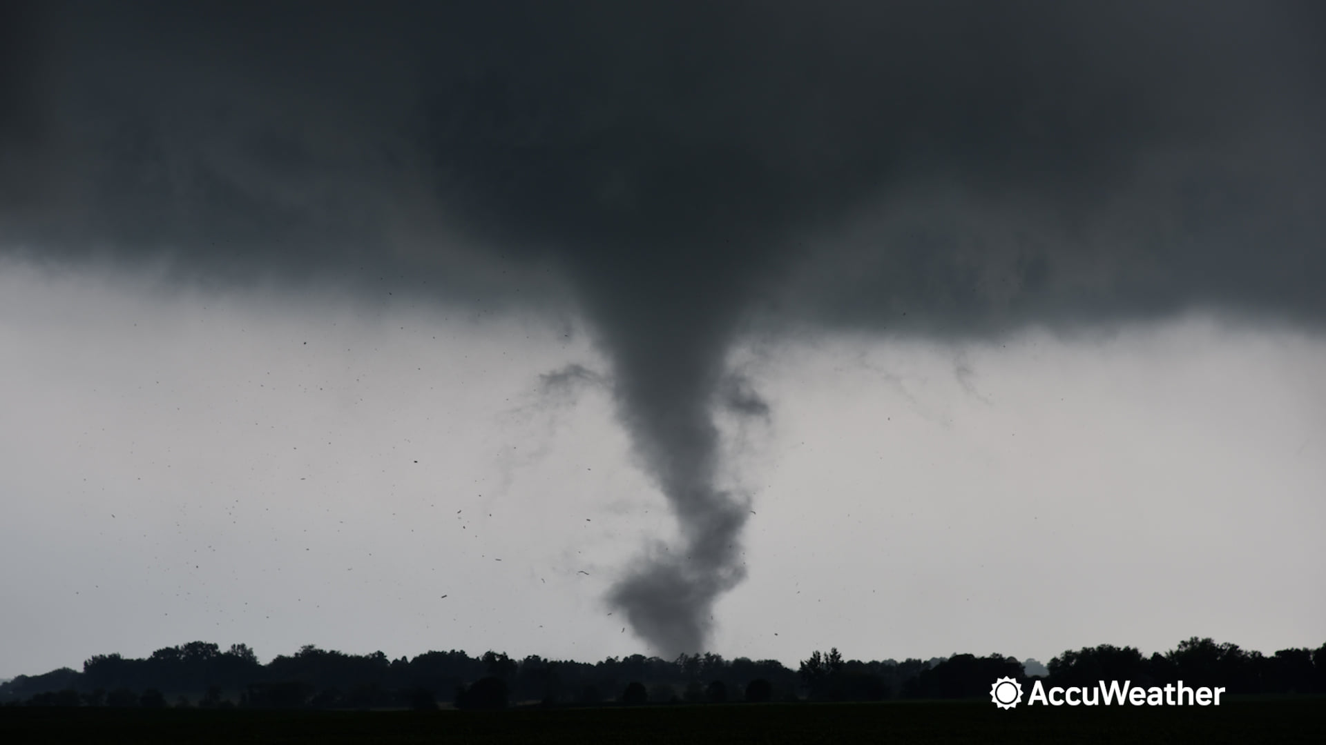
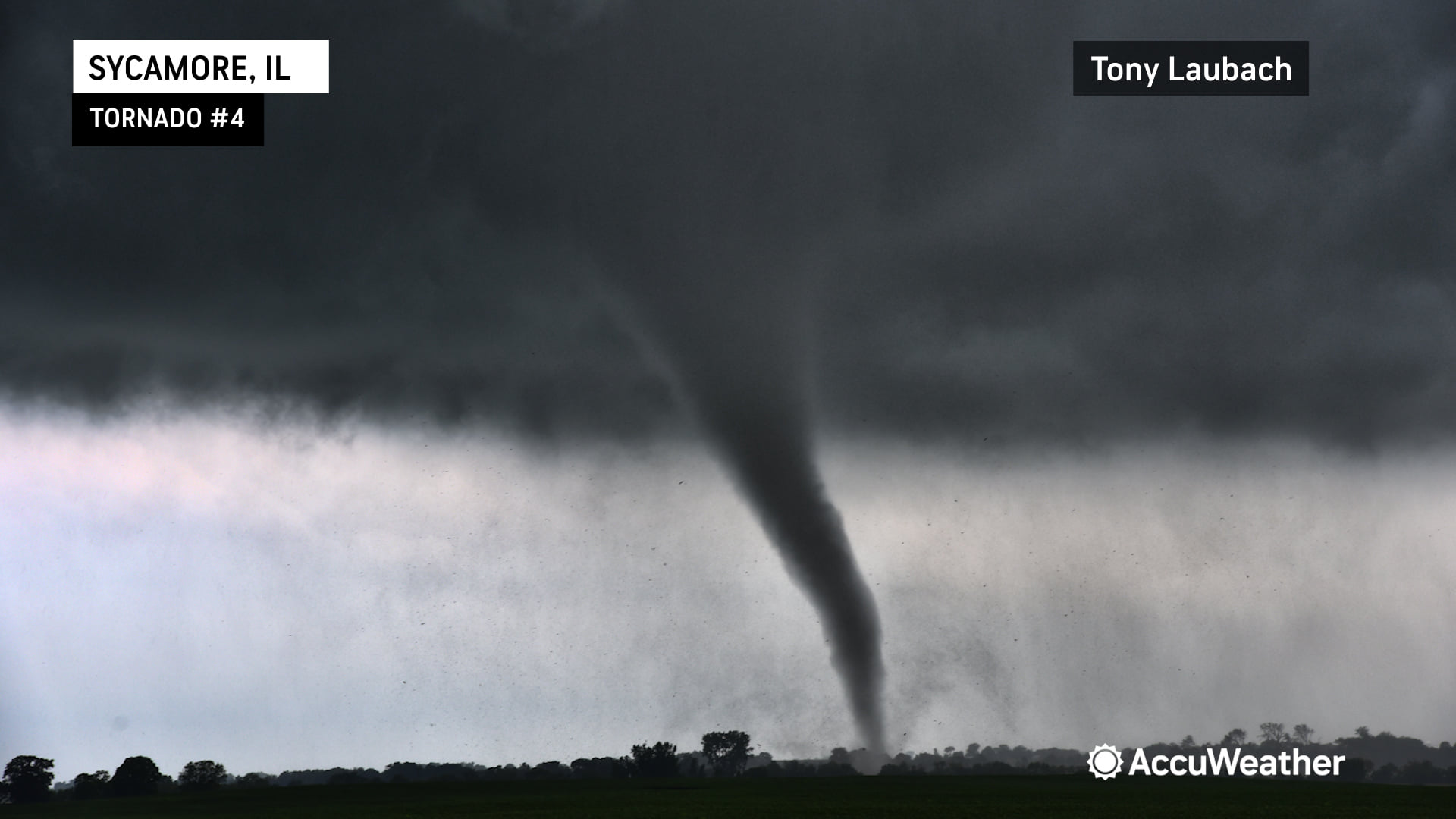
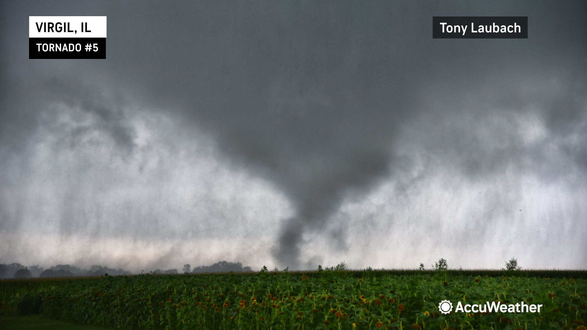
After clearing the town of Sycamore eastbound on IL-64, I observed a well-established funnel poking from the clouds to my south/southwest. I was once again able to find a great pull-off and point my vehicle south, documenting the entire lifecycle of what was the most dramatic looking tornado of the day on multiple cameras.

235181690_381014440066550_3065855516814051743_n.jpg


This tornado was approximately 1.5 miles to my south, crossing west-to-east across my field of view before lifting. This tornado came down and immediately started tossing large trees and other debris. This went on for several minutes as this tornado took on a very classic looking shape, thick and black and basically reminded me of what I grew up seeing in textbooks.

235361559_381159923385335_7503439153657644631_n.jpg


Once that tornado lifted, I was now northwest of the business area of the storm. I proceeded east on 64 with a great view of the sweet spot. I caught up with it quickly, was due north of the the rotation when I saw a brief touchdown moving toward Virgil. The touchdown was to my due south, out of view of my cameras. This was initially thought to be part of the Sycamore EF-1, but was determined to be a separate tornado. I logged this in my initial report as a separate tornado as it was several minutes after the Sycamore tornado lifted. No imagery of this tornado unfortunately.

My final tornado of the day was next. I had paralelled the storm along 64, and was once again watching a funnel get going. I got into Virgil and turned south out of town on Meredith Road. The tornado touched down as I worked my way out of town. Once again, I found a prestine viewing spot in a driveway where I documented this looking west south of the town as the tornado approached my location. This multi-vortex tornado was the twister I put live on AccuWeather as it was organizing. I abandoned my view for a safe escape to the south as the tornado got within 3/4 mile of me. Once clear of the path, I stopped and turned as the tornado crossed my road to my north, heavily shrouded in the rain.

231672929_381159960051998_7337354175490878308_n.jpg


I let this storm go, similarly to the first one as it was making its way into the western suburbs of Chicago and due to safety, I opted to NOT pursue those storms into heavily populated areas. I attempted to intercept a couple more storms to my southwest between Aurora and Utica, but the event was winding down by this point. I hit I-39 at Troy Grove where I called it a chase, returning to Rockford where I bunked down for the night.

239779391_389856952515632_8658548156423414413_n.jpg


In summary, I saw a total of six tornadoes on two different supercells, two on the first and four on the second. This chase was easily my top Illinois chase (surpassing every chase I had while living there for 5 years) and will take the top spot for best chase east of the Mississippi River. It may find its way sneaking into the #10 spot in my top ten tornado chases largely due to the picturesque nature of all the tornadoes I saw, the relative ease of the chase including being able to stop and document most of the tornadoes I saw from a stationary, great viewing area. Unlike many tornado chases, I was able to get both video AND photos of these tornadoes, which has become a HUGE goal of mine on chases (mainly photographing more). The Sycamore tornado video was likely some of my best stuff, and again, having it shot on multiple cameras. I also add a few brownie points for getting the Virgil tornado live on my network just a few months after starting my work with them, so adding a little professional work to the mix adds to this incredible chase.


Apologies for the necro, but I realized I never posted my account of what I term the "IL-64 Outbreak" of August 9, 2021 on here, even though it featured what I consider my first "official" tornado intercept (I had glimpsed a few others before, but wasn't sure I was looking at one in real time and/or a tornado cannot be confirmed from my imagery alone due to ground contact obscured by tree line, funnel not fully condensed, rain-wrapped, etc) in the form of the Clare/Kirkland EF1.

My chase was similar to @Tony Laubach's, at least the first part of it, only from much further away. I started out by killing the early afternoon in Rochelle shooting trains at the railroad park (which I also did on May 27, 2019 prior to intercepting the Yorktown-Paw Paw supercell - missing the brief tornado near the latter town - and which I REALLY wish I'd done on April 9, 2015).

Like Tony, I jumped on the initial severe-warned cells in the Rockford to Davis Junction vicinity, but wasn't impressed by them and before long realized it was the sucker play and doubled back to new development to the southwest, which quickly became apparent as the real deal.

A compact wall cloud developed just north of IL-64 and just east of the intersection with 251, reminding me again of my blunder on 4/9/15 as the monster EF4 had crossed that intersection, destroying the Grubsteaker's Restaurant located there (they rebuilt and reopened).


Like Tony, I realized the storm had a southward component of motion, but overestimated it and drove all the way south to the next major E-W highway, IL-38 which runs from Rochelle past Creston to DeKalb. Realizing my mistake, I began driving north again but was quite far away when the first tornado (beautifully captured by Tony) occurred, visible in this zoomed-in grab from the video off my dash-mounted phone:

080921EsmondKirklandILTornadoes.00_00_35_00.Still002.jpg

This EF0 tornado lasted only one minute per NWS Chicago's survey, from 4:35-4:36 PM. When I finally reached IL-64 again on Esmond Road at 4:36 (per timestamp on my DSLR), this remnant funnel was all that was left:


Pacing the storm east on 64, I turned north again, stopping to set up just after passing through the unincorporated community of Clare as another narrow elephant's trunk funnel began to reach out of the storm. Per Tony's description, it appeared to hang there for a minute or two before definitively touching down, and then slowly vanished into the rain; I never actually saw it dissipate.


The storm began to cycle to the east-southeast, with a new rotating wall cloud forming east of the road, while the narrow Kirkland tornado continued to its west. This was the first time I'd visually observed the cyclic supercell process.


I played with this new lowering for just a few minutes before deciding it was too murky and rain-wrapped. It was here that I made my most significant mistake of the day. Tired from working 3AM-noon that day, with another 2:15 AM alarm set for the next day, satisfied with what I'd already seen and expecting my storm would have worked over the atmosphere and not allow for another supercell to take almost the exact same path less than an hour later, producing the much more dramatic/photogenic Creston/"second Esmond" (which crossed almost right over the intersection where I took the photo of what was left of the first/north Esmond tornado) and Sycamore-Virgil-Lily Lake tornadoes, I left the area and started for home. My first encounter with a photogenic, intense and relatively close tornado would have to wait until March 31 of last year at Keota, IA.

Lesson learned: It can't be assumed that smallish-to-mini supercells associated with summer mesolow setups will sap the environment in the same way that a more classic, large tornadic supercell that sucks massive amounts of inflow and leaves a large, rain and hail-cooled wake would. A very similar localized outbreak occurred in almost the same area on July 12th of last year, and although not playing that day perfectly either I was able to get at least a minute or so's glimpse of the concurrent tornadoes that occurred just northeast of Lily Lake.
 
Back
Top