Began the day getting to the low/boundary near Springfield Colorado in good time for initiation off the higher terrain. Spent about three hours watching a stationary supercell flounder and then strengthen quickly as it finally got a small push from a shortwave and the low shifted. The storm moved from near Kim, CO. and began tracking east very slowly, and then cutting almost due south before returning to southeast before eventually dying near Boise City.
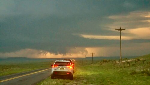
I was in a convoy escorting friends on dry dirt roads in their sedan, and also had forgotten to load my OK roads in GRlevel3, so did not pursue thru the Canyon on the more sandy dirt road from Colo. to Boise City. I did drop back to Campo and hit pavement to get south, and the structure was not that great anymore when I got down to Boise City.
Decided not to stay out and chase tomorrow as I saw a great tornado series Wednesday in NE, and I could use a break. Home is only 4.5 hours from Boise City and seemed reasonable at the time. Unfortunately, I went thru La Junta on the way home, and they had bad flooding with a foot of water in some streets. Got trapped in a bad MCS with small hail and torrential rain for almost 2 hours, made the return exhausting. Colorado also has some of the most dangerous, pathetic road construction zones with incredibly narrow lanes and some of the roughest car destroying roads in the country. Other states seem to warn for uncomfortable bumps. In Colorado you are lucky to get a warning sign for a cliff or car destroying feature.
Sadly, I must report that imbecile behavior of the average chaser is continuing to get worse. I witnessed an idiot with a loud diesel truck leave it running so no one could enjoy the nature and thunder sounds. His convoy of four vehicles all parked sideways on the dirt road, not leaving the road, all for their convenience and annoying to locals and others trying to get by. The group were a bunch of loudmouths and some twit crashed his drone into power lines after annoying everyone with it for several minutes. If this was any of you, please consider in the future that others may like to enjoy the storm without all that noise and clutter, and locals may appreciate your not blocking half the road.
Had several occassions of fools who were out of position going dangerously fast on the dirt network and passing unsafely or not courteously. Noticed zero courtesy for people on the dirt network, people seemed to revel in blasting others with dust- is it no longer common manners to slow down some on dirt when passing others out of their vehicles? If those few seconds of slowing are too much for your chase, maybe you are already behind the decision curve... The average chaser these days acts like they are missing something epic when nothing at all is going on, the desparation and selfishness is beyond me. Seen so many people going crazy even on outlfow dominant decaying garbage just because it was tornado warned; they have no idea what they are doing or how to read the current situation. Today had someone pull out right in front of me (50 yards or less) onto the highway in a 65MPH zone doing 20MPH. A guy last week passed me in no passing zone on a blind hill and then swung his car at me deliberately and aggresively. In short, there is a significant increase in the me crowd and the mentally ill who are a large swath of chasers; this is why I am happy to know so few people in the community. Seems the majority of people acting like this are the lesser skilled and have more attention getting junk on their vehicles as a trend. Not much to do about but buy dash cams and report it, put up with it, or find a new hobby; the wrong kind of people are truly everywhere.
Anyway enough of my rant but it was a part of the experience today, here are a few photos of a not too bad chase:
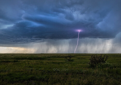
Some good positive bolts for the first hour as the storm tried to organize.
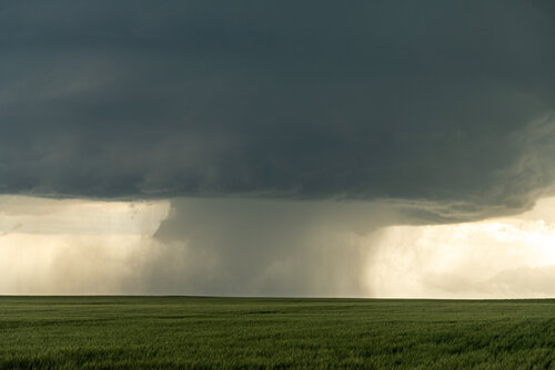
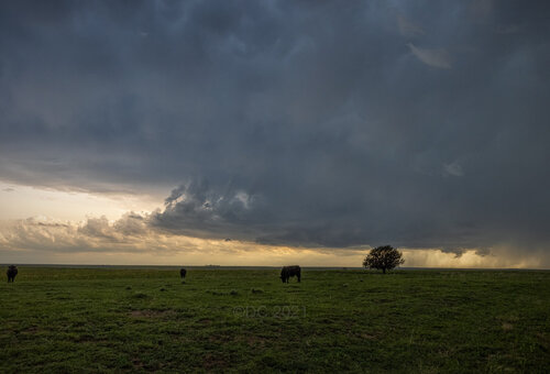
Storm starting to rapidly get a meso and move south.
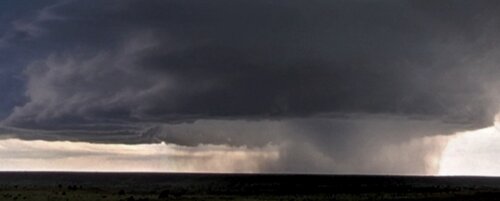
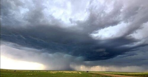
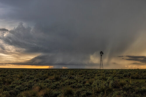
The structure became quite decent. It really looked like there was a large wall cloud or possible large cone wrapped in rain for a few minutes. I was not able to get a photo at the optimal time this feature could be seen due to hills, and driving in a group of vehicles on dirt. Perhaps someone else has photo verification of the tor report.
I was in a convoy escorting friends on dry dirt roads in their sedan, and also had forgotten to load my OK roads in GRlevel3, so did not pursue thru the Canyon on the more sandy dirt road from Colo. to Boise City. I did drop back to Campo and hit pavement to get south, and the structure was not that great anymore when I got down to Boise City.
Decided not to stay out and chase tomorrow as I saw a great tornado series Wednesday in NE, and I could use a break. Home is only 4.5 hours from Boise City and seemed reasonable at the time. Unfortunately, I went thru La Junta on the way home, and they had bad flooding with a foot of water in some streets. Got trapped in a bad MCS with small hail and torrential rain for almost 2 hours, made the return exhausting. Colorado also has some of the most dangerous, pathetic road construction zones with incredibly narrow lanes and some of the roughest car destroying roads in the country. Other states seem to warn for uncomfortable bumps. In Colorado you are lucky to get a warning sign for a cliff or car destroying feature.
Sadly, I must report that imbecile behavior of the average chaser is continuing to get worse. I witnessed an idiot with a loud diesel truck leave it running so no one could enjoy the nature and thunder sounds. His convoy of four vehicles all parked sideways on the dirt road, not leaving the road, all for their convenience and annoying to locals and others trying to get by. The group were a bunch of loudmouths and some twit crashed his drone into power lines after annoying everyone with it for several minutes. If this was any of you, please consider in the future that others may like to enjoy the storm without all that noise and clutter, and locals may appreciate your not blocking half the road.
Had several occassions of fools who were out of position going dangerously fast on the dirt network and passing unsafely or not courteously. Noticed zero courtesy for people on the dirt network, people seemed to revel in blasting others with dust- is it no longer common manners to slow down some on dirt when passing others out of their vehicles? If those few seconds of slowing are too much for your chase, maybe you are already behind the decision curve... The average chaser these days acts like they are missing something epic when nothing at all is going on, the desparation and selfishness is beyond me. Seen so many people going crazy even on outlfow dominant decaying garbage just because it was tornado warned; they have no idea what they are doing or how to read the current situation. Today had someone pull out right in front of me (50 yards or less) onto the highway in a 65MPH zone doing 20MPH. A guy last week passed me in no passing zone on a blind hill and then swung his car at me deliberately and aggresively. In short, there is a significant increase in the me crowd and the mentally ill who are a large swath of chasers; this is why I am happy to know so few people in the community. Seems the majority of people acting like this are the lesser skilled and have more attention getting junk on their vehicles as a trend. Not much to do about but buy dash cams and report it, put up with it, or find a new hobby; the wrong kind of people are truly everywhere.
Anyway enough of my rant but it was a part of the experience today, here are a few photos of a not too bad chase:
Some good positive bolts for the first hour as the storm tried to organize.

Storm starting to rapidly get a meso and move south.

The structure became quite decent. It really looked like there was a large wall cloud or possible large cone wrapped in rain for a few minutes. I was not able to get a photo at the optimal time this feature could be seen due to hills, and driving in a group of vehicles on dirt. Perhaps someone else has photo verification of the tor report.

Last edited:

