Ethan Schisler
EF5
Little bit of an underwhelming chase yesterday but still came away with some good stuff at the last minute. I targeted the nose of the moisture plume in Western Kansas near Scott City around mid-day. I don't think this was the actual dry line but instead a pre-frontal confluence feature as obs showed the actual dry line back in Colorado (90s over 20s). We sat there through mid-day while large tornadoes occurred around lunch-time to our east near Hays (wtf?). We coulda made that storm, but I didn't want to get out of our position on that bulge in Western Kansas and honestly most of the chase community was there. We followed a blip from Leoit northward where it eventually died and then shot north after the storm in SW Nebraska arriving around 6:30pm. Saw a distant view of a possible tornado, but I had no service and couldn't see radar so I've no idea if it was. It was SE of McCook, NE.
Dropped back into Kansas and played several supercells near sunset that were ingesting air in the low 60s, but one managed to spit out a bird-fart tornado S of Hill City, KS shortly after 9pm that we pretty much drove through. It was super weak though....and I wouldn't believe it was a tornado except several notable chasers had reported it including Jeff P. Overall a disappointing chase, but I've had worse. You can't win if you don't play.
The only thing I'd done differently is gone after those mid-day storms near Hays, but then again I didn't know the evening show would be pretty much non-existent lol. Here are some pics:

Storm near McCook, NE looking north.

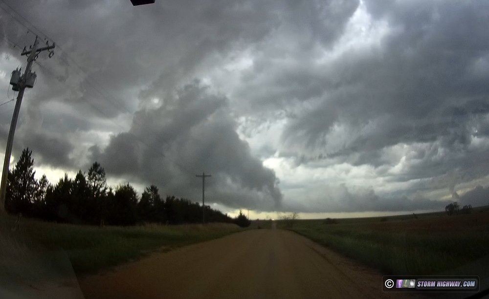
Long lived supercell in Southwest Nebraska with wall cloud and pretty green foreground

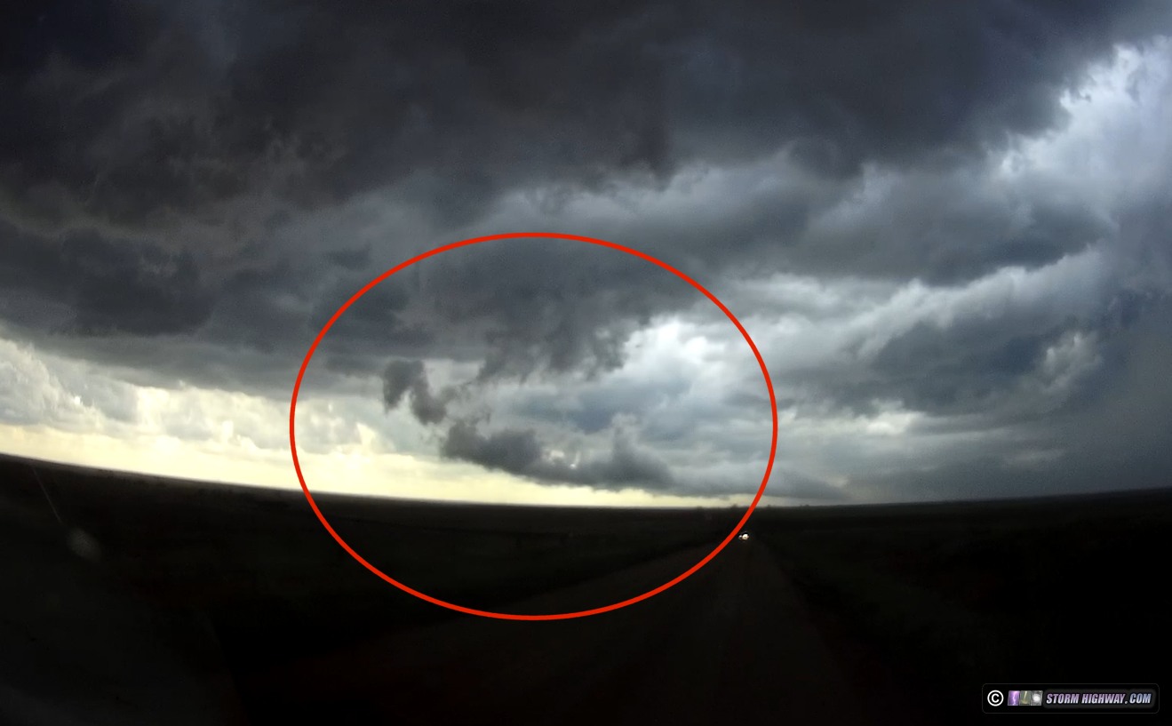
Suspicious area SE of McCook, NE around 6:30pm. I didn't have radar for a long time, so no idea if this was a tornado, but the meso that came out of it crossed in front of me and was violently rotating. I thought we were about to get a huge tornado there for a bit.

Supercell thunderstorm in North Central Kansas at sunset

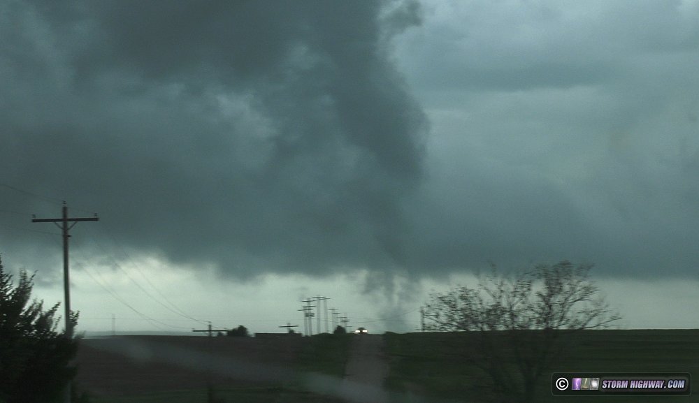
Another supercell thunderstorm near Lenora, KS at sunset

Supercell coming over me near Lenora, KS. I didn't get photos of the Hill City storm but I did get about 20 minutes of tripoded video of a large wall cloud SE of Hill City with spiraling rain curtains and some suspicious looking activity under it around 9:30pm. Will have to view that later. Onward and southward...
Dropped back into Kansas and played several supercells near sunset that were ingesting air in the low 60s, but one managed to spit out a bird-fart tornado S of Hill City, KS shortly after 9pm that we pretty much drove through. It was super weak though....and I wouldn't believe it was a tornado except several notable chasers had reported it including Jeff P. Overall a disappointing chase, but I've had worse. You can't win if you don't play.
The only thing I'd done differently is gone after those mid-day storms near Hays, but then again I didn't know the evening show would be pretty much non-existent lol. Here are some pics:
Storm near McCook, NE looking north.
Long lived supercell in Southwest Nebraska with wall cloud and pretty green foreground
Suspicious area SE of McCook, NE around 6:30pm. I didn't have radar for a long time, so no idea if this was a tornado, but the meso that came out of it crossed in front of me and was violently rotating. I thought we were about to get a huge tornado there for a bit.
Supercell thunderstorm in North Central Kansas at sunset
Another supercell thunderstorm near Lenora, KS at sunset
Supercell coming over me near Lenora, KS. I didn't get photos of the Hill City storm but I did get about 20 minutes of tripoded video of a large wall cloud SE of Hill City with spiraling rain curtains and some suspicious looking activity under it around 9:30pm. Will have to view that later. Onward and southward...