2019-05-24 REPORTS: IA/IL/KS/MN/MO/ND/OK/TX

Joined
Jun 16, 2015
Messages
476
Location
Oklahoma City, OK
Not a lot to say here, so I'll keep it brief. I targeted West Texas, knowing that it was kind of a muddled setup. I left Shamrock, TX to head toward Lubbock and storms started firing just after lunch. I knew that wasn't a good sign.

I got down to Ralls and noticed that two relatively discrete storms were starting to throw out an outflow boundary to the south. I stopped and waited. There were a few times in which it looked like the cells were trying to become rooted on the boundary, but I'm not sure it ever happened. After some time, one of the storms showed some increased low-level rotation around Roaring Springs. I'm not sure if there was a tornado, but John Sirlin reported a tornado, while Jim Tang thought that he narrowly avoided one. I was a few miles away and as it's been most of the week with smoke, unless you were up close and personal, you probably couldn't tell the difference between a possible tornado and a sloppy mess.

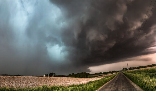
Without a great road network and an expectation for storms to quickly grow upscale, I decided to go east and try to get out in front of the storms. Best case, maybe catch a few photos in front of an approaching squall line. Worst case, head right back home to Oklahoma City and make it in time for a late dinner. Well, I did briefly stop at Eldorado for a few photos, but visibility was limited and the shelf cloud was not exactly the highest contrast one I've witnessed.
pano_190524.jpg
Hopefully this image isn't too big. It's also the first and only time I've tried to create a panoramic image with photos merged using the A7iii. I know I'll want to practice with this more to get it right in the future, but the window of time I had between too-low-contrast and storm moving overhead was very short.

I started the chase in the Lubbock CWA and made it home right around sunset, fittingly, just as an MCS was about to move through.

Today's chase wasn't a total letdown, as I didn't have the highest expectations in the first place.

P.S.
I was seriously considering the I-10 target today, but didn't want a long drive for tomorrow and kind of needed to get back to Oklahoma City tonight, anyway. Even though a particularly intense supercell did develop down there, with it being south of I-10, the road network is pretty awful. I probably didn't miss too much, but I'd be very curious to see if anyone on here was on that storm.

Oh yeah, and Iowa...
 
I managed to get in the notch of the HP supercell south of Matador, despite strong broad rotation i didn't see it really tighten up at anytime and saw nothing I would classify as a funnel. The biggest headache of the day was driving back to my motel room in Lubbuck through the new lake that has been formed to the east, saw a lot of homes flooded.

 
Started in Plainview. Made it to Lubbock and was on the storm just after noon that had a nice wall cloud with strongly-rising scud tags near the ground. That was the best thing I saw all day. I dropped south to the next cell, which became the dominant one as it moved over the city. However, it and the previous storm had already sent outflow far ahead of the updrafts, so tornado potential was near zero until something could get ahead of that.

Finally a storm fired down near Post that had a shot before moving across the boundary, but it could not root. I tried getting back ahead of the mess again, but encountered field-to-field flooded roads south of Crosbyton with dry spots on the road closing up fast. I wanted none of that, and turned around, which was essentially a decision to abandon that cluster of storms. I'd have a 2-hour drive to get back ahead to Paducah to the only storm that seemed to not be hopelessly undercut, and it didn't seem worth it.

I went back to the dryline/outflow boundary intersection at Brownfield hoping for a strong updraft to go up on it and at least spin up a landspout before crossing. This almost happened, as a storm went up right at the intersection near Levelland but quickly sent outflow racing south and west, killing any hope of that.

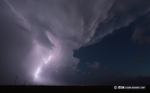
I waited for the storm to cross, then headed north to flank the storm to the west to avoid flooding in Lubbock and New Deal. During this time, there was some nice lightning and sunset colors, which provided some scenes worth stopping to shoot. Ended the day at my hotel in Plainview for the 2nd night in a row.

may2419a.jpg
 
Last edited:
I had the Iowa target today, and it was a bit of a ride to be sure.

Today was a rather challenging forecast, at least for me. What made it difficult was that the warm front had similar parameters from Kankakee all the way towards the East Central Iowa triple point. I had originally targeted Rock Island as models had honed in on initiation along the MS river this morning, and had generally held on to that idea through the early afternoon, so off I went to the Quad Cities, after stumbling around there for a few hours, and winding up in some shadier areas of Rock Island. It became evident by ~3PM that the Quad Cities was no longer the place to be and that the triple point in East Central Iowa was looking increasingly favored over IL, particularly noting the extreme levels of 0-3km CAPE(200-250 J/kg), rich mid 70s dewpoints and the fact that it had been sunny in Iowa the whole day, whereas IL had a late morning MCS and midday supercell. Not to mention that a fairly robust patch of cumulus was evident on visible satellite out in Iowa. After seeing that Iowa was clearly becoming the favored target area, I turned back the way I came, minus one tank of gas lol.

Eventually posted up in Williamsburg and watched several towers to the south struggle. After about an hour and a half of watching towers go up and back down on themselves, I became increasingly concerned with the possibility of a cap bust, as subsidence was really putting a hamper on these updrafts, and seemingly winning for the time being.

9ab258d084acfdc3c2ce5103482b910e.png


A lone storm finally became established at about 5:45pm and slowly began to acquire supercell characteristics. Core punched through perhaps the lamest core ever(heavy rain and pea size hail -- zzzzzz) but was greeted with a nice, broadly rotating wall cloud, but updraft base was still pretty anemic otherwise. This storm was fighting for its life during its entire existence.

6922ec124d2aa92b9f84f55611360e1f.png


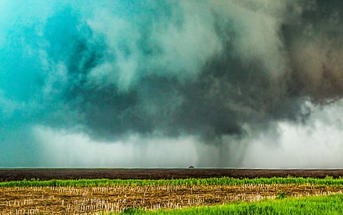
his wall cloud would persist and evolve with several RFD pushes failing to get the job done. I continued to follow the storm east, and the low-level rotation was getting more and more defined with each successive RFD push, but still had a long ways to go. As this supercell approached the warm front, it rapidly got its act together and picked up a tornado warning. Not 10 minutes later, a barrel-shaped tornado dropped below the world's most anemic base, which allowed for some spectacular lighting, to be fair. I'm almost certain that the extra vorticity on the warm front and 225 J/kg of 0-3km CAPE are reasons this storm was able to produce such a formidable tornado despite the storm struggling to maintain a consistently strong updraft.

77372d11fb6ac13d7562103bbbc8670e.png


37ad8040e3d33e055ba8f439673b2fb5.png


(Music is because I totally botched the real audio -- with radio, some tornado tourettes and talking to other chasers, so I just canned and replaced it with some music.)

After this tornado occluded over Iowa City, the storm slowly started to succumb to the subsidence as it never regained anything really resembling a healthy updraft base after this tornado. I followed it towards West Branch before letting it go and heading back to Cedar Rapids. This storm went up, produced a significant tornado and died in under 2 hours, that is the part that surprises me. This wasn't a dominant, robust supercell, this was a supercell that did nothing but fight to stay alive as long as it could, which happened to be just long enough that it was able to produce the most impressive single tornado that I've seen so far. What a fantastic way to start off my 2019 chase season!

b645dfb608261f4d6c665822f7db4923.png
 
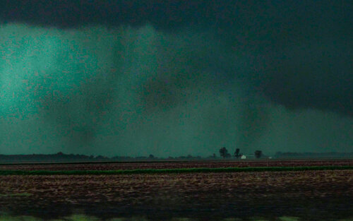
Had a successful and unsuccessful chase yesterday. I woke up and as I was eating breakfast, my weather radio went off for a tornado warning for McDonough County. I headed southwest toward Macomb intercepting the storm east of Industry noting a cone tornado to my SW. Coordinating with a friend of mine who is a met at WFO DVN, we determined this was one of the EF1 tornadoes that produced 110 mph winds around 12:35-12:45pm. There is another possible suspicious feature in the back, and at one point the storm did indeed sport 2 couplets.

18344

I headed east and between Table Grove and Adair, I documented a small needle tornado under a rapidly rotating wall cloud around 12:50pm. I thought for sure a strong tornado was going to form, but I quickly got overtaken by 70 mph winds and debris. I followed the storm to west of Lewistown before I gave up. It sported some of the better HP structure I've seen in Illinois.

18345

18346

Then I made the really really dumb decision of staying in IL on the warm front instead of going to Eastern Iowa because I thought the updrafts forming in Western IL would mature as they crossed the front and produce tornadoes. The sig tor over Galesburg was estimated at 5.6 on the RAP, so in my mind, I'd not change a thing again. Still very annoyed though that such a beautiful tornado missed me by what is a 90 minute drive. Oh well. Slice of humble pie is good every now and then, although I seem to be getting the whole pie lately. I didn't even take any photos of the evening storms. I'm not sure whether to call this a success or not since I did indeed see a tornado, just not the one I was after...
 
Started the day in Lubbock and already being in the general target area hung around there all morning. When the severe thunderstorm came through around noon, I felt it was too early and did not even go after it. It was coming right for our hotel but I can never catch a break, the storm split as it approached and the hail core split such that a portion went to one side of us and a portion to the other, I ended up right in the middle of the goal posts. The same thing happens at home, the line always develops a break in it just as it approaches my house.

Anyway, we just watched on radar as a training line of storms formed moving east of Lubbock. We were ambivalent about chasing at all, there was no real isolated storm to go after. Had some immediate regret when we saw the TOR warning on the eastern end of the line near Matador so that finally motivated us to get out in the field. We drove east, there was so much road flooding as @Dan Robinson noted above, the terrain and roads get worse as you get east of Crosbyton, there was no cell service, no clear target, so we just bailed and decided to head to AMA to set up for the next day. It was a pretty high impact weather event for the local area so it was still interesting to be “on the ground” to experience it.


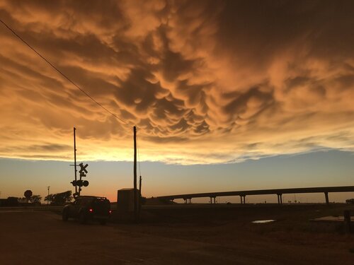
Had a little excitement driving through storms north out of Lubbock. Had to race a hail core before it encroached on I-27. Experienced some very strong winds and whiteout rain but had to keep going to avoid the hail. Had that brief feeling of “maybe we shouldn’t have done this...” On the service road, people were stopped under the overpass, blocking traffic! We made it through and stopped later to photograph a full (but low contrast) rainbow and sunlit mammatus. The picture here is just from my iPhone but I have some hopefully better ones I’ll get off my DSLR later.


8622E1FD-6C33-45BD-8449-9C9D12F8655D.jpeg
 
Hello! Long-time lurker of this forum. Figured I would jump in with my chase this day.

I am a meteorologist for the CBS affiliate, KGAN, in Cedar Rapids and I was chasing for the station this day. This is a video recap of our coverage and my chase that day.

Overall, being confined to a viewing area it made this chase quite easy. We were worried about morning cloud cover as well as convection firing farther south cutting off moisture, however the storms ended up forming farther east in Illinois allowing moisture to come into the area unit erupted. By the afternoon, a warm front began pushing into the area pushing north of I-80.

What we watched south of the warm front was a dramatic change in low-level instability. 0-3 CAPE surpasses 150j/kg.


One storm took over in Keokuk County, and we jumped on it right away knowing sunset was closing in and we would lose the only thing we had going for us - low-level CAPE.

Veering surface winds dramatically helped the low-level shear. SIGTORs jumped to more than two. Looking good at that time.


The storm quickly became surface based and formed a stout wall cloud. We sent this to the NWS via NWS Chat and a tornado warning was issued.


Then touchdown. Tornado went through the whole process of needle, to stovepipe to a pretty significant cone.


Overall, a fairly easy chase given the fact we were confined to an area. Lieowa prevails.
 
Back
Top