Daniel Reese
Enthusiast
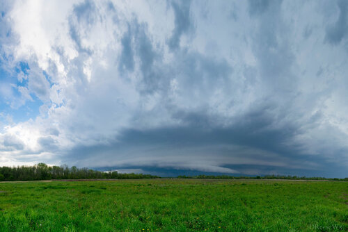
Had a surprisingly good chase on a tornado warned supercell near Syracuse, NY, with great structure relative to Northeast US standards, so I figured this was worth a reports thread. Left Albany early afternoon and headed west towards the western end of the Mohawk Valley, where the hope was backed southeasterly flow in the valley would help boost the modest background shear. Caught several clustered cells near Rome, with some marginal supercell characteristics including a nicely structured LP cell. Deep layer and low level shear both began increasing around this time, so storms continued to organize. The storm just west of Syracuse then caught our eye, and it went tornado warned just as we started making our way down I-90 toward it. Caught our first view of it about 10 miles east of town.

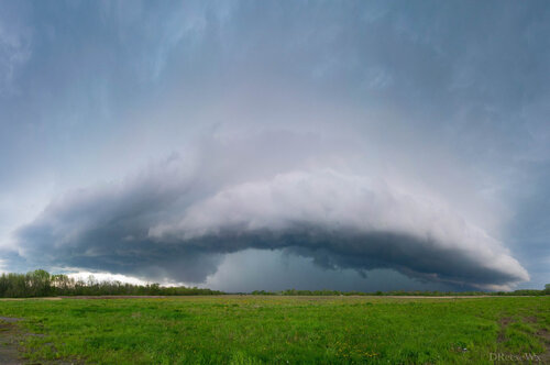
It seemed mainly outflow dominant from the moment we arrived, though there was a decaying wall cloud behind the shelf cloud for a few minutes. After a bit it turned fully outflow dominant, developing the shelf cloud even further.

Couldn't get back around it until after it had significantly weakened, so we called it a day after this. But overall, great chase day. Missing the Plains this year, but this was some of the best supercell structure I've seen in the Northeast.

It seemed mainly outflow dominant from the moment we arrived, though there was a decaying wall cloud behind the shelf cloud for a few minutes. After a bit it turned fully outflow dominant, developing the shelf cloud even further.

Couldn't get back around it until after it had significantly weakened, so we called it a day after this. But overall, great chase day. Missing the Plains this year, but this was some of the best supercell structure I've seen in the Northeast.
