• While Stormtrack has discontinued its hosting of SpotterNetwork support on the forums, keep in mind that support for SpotterNetwork issues is available by emailing [email protected].

2017-07-11 REPORTS: ND/SD/MN/IA

Joined
Aug 9, 2012
Messages
586
Location
Macomb, IL
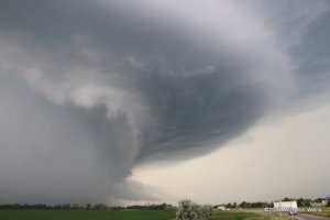
I'm going to make this short as I plan on chasing this afternoon as well. I had been eyeballing Eastern Iowa all day on Tuesday but was not sure whether we would have the forcing for storms to fire. The environment was excellent as far as CAPE/shear combinations go, but the forcing was lacking and the 18z DVN sounding showed a decent capping inversion. Well a storm formed right around 5pm and I took off from home, it didn't take long for the storm to go tornadic and produce a photogenic tornado near Iowa City. I arrived on the scene about an hour after the tornado, no thanks to a traffic jam on I-80. I documented some classic supercell structure and quarter size hail and followed the storm for a while southeast until it died eventually. Besides for missing the tornado, it was a pretty good chase given what I had expected. Here is my main image for the day.

8ae5e4c78a43c8d610b9ae04aa8177b0._.jpg
Iowa City Classic Tornadic Supercell July 11, 2017
 
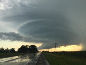
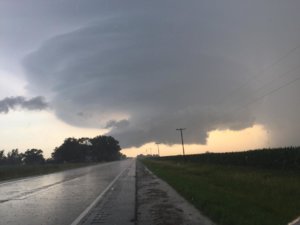
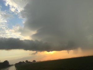
While I had been aware of the warm front and the parameters along it, I largely chose to ignore them, not expecting the cap to break(DVN and most CAM runs agreed). As such wasn't at all paying attention to storms. I spent most of the day in North Liberty(5 miles N of Iowa City), watched that storm go up, and also watched it struggle for a good 15-20 minutes, before going back home. When I got there I saw a 55kft supercell with a TOG, so I checked mesoanalysis and turned around. I missed the tornado by 15 minutes, decided it would be easiest to go straight through Iowa City to get a vantage point further east as going south and around was a bit of a gamble. I will now be avoiding municipalities with pop. greater than 50,000. I did eventually get ahead of it and got some fantastic structure, especially for Iowa. I'll take that as my consolation prize for being late to a party I could've and should've easily been there for, still bummed about that bit at least.

cb720573a11a4acb1134f2669f9697ef.jpg

17c1ceb0f7f4e0ae423b88b3fea718b1.jpg

46ec47422e999434b6ee011520170673.jpg
 
Last edited:
Although it's far from nearly everywhere, North Dakota is one of my favorite places to chase. I caught much of the life cycle of the Mayville, ND supercell, but I was unable to get near the nice multivortex tornado that this HP storm produced in its core. Still, this Northern Plains beast put on quite a show, and it was an enjoyable chase.

After having lunch in Fargo, I drove a bit further north on I-29 to my initial target of Hillsboro, ND, where I spent a couple of hours waiting for storms to fire in the warm sector. After a set of towers went up northwest of Grand Forks, I headed towards them, eventually getting in front of a line of several rapidly maturing cells strung out along and northeast of US 2. I feared that these storms would quickly congeal into a MCS, but to my surprise, the southern-most cell in particular remained discrete until well into the evening. Two of the storms to my northeast were soon tornado-warned, and for a few miles I was drawn in their direction, but I eventually came to my senses, turned around, and stayed with the southern-most cell while it slowly matured near Larimore, ND. I stayed east of it as it began to organize and show its potential, rumbling constantly. This shot looks west at the storm from ND-15 about five miles east of Northwood, ND:
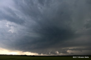
099.JPG

I stayed ahead of the storm as it continued to move east. I eventually got back to I-29 near the town of Reynolds, ND, headed south for a couple of miles, and then got off at the Cummings, ND exit. The storm rapidly became better organized as it approached the warm front, which appeared to be draped more or less parallel to the interstate at this point. Here's what the storm looked like as it began to take a hard right turn and dive toward me:
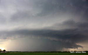
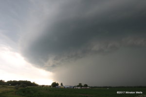
359.JPG 121.JPG 144.JPG

Reports suggested that the storm was producing a nice tornado in its precip core, but I had no chance of seeing it. Here's the storm's impressive radar presentation at this point:
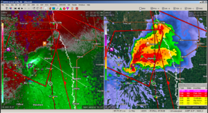
2017-07-11nd#10interstateMayvilleexit.png

I then continued to move further south on I-29 and began thinking about my road options east into Minnesota, which were somewhat limited by the Red River that separates the two states. Here's the storm over my initial target of Hillsboro, ND from a few miles south on ND-200:
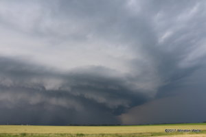
192.JPG

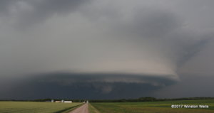
I eventually crossed with the storm into Minnesota. It was still cranking away, but the cell's tornadic potential seemed pretty well over by this point. This last shot looks north from County Road 39 a few miles west of Borup, MN:
242.JPG

I then called it a day and headed a few more miles south to the many reasonably priced hotels of Moorhead, MN. There were certainly no problems with crowds on this day, although I did see a fair number of other chasers as the storm began to squeeze us together between the interstate and the river.
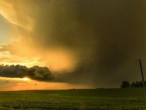
 
This was a local chase for me 30 miles from home, didn't expect I would end up staring down a multivortex tornado. Once storms fired I messed around with the cells north of US 2 for a bit but the soon to be storm of the days left split moved up into these storms and really wreaked havoc. I core punched the southern storm, didn't get any big hail, and came out under the updraft. At this point nothing appeared imminent as the wall cloud was very stretched out, more like a shelf cloud ahead of the RFD. After moving SE with the storm it hit its sweet spot west of Buxton, ND. A huge rain filled RFD surge moved around the wall cloud and a multi-vortex tornado rapidly formed right in front of me, this tornado intensified and expanded lightning fast and before I knew it I was in the bears cage. I kept filming a little longer but I was not in a safe position and gunned it out of there. While escaping the storm south I took the full brunt of the RFD at Hillsboro, ND, 100 mph winds ravaged the town and I witnessed a grain bin rip off and decapitate a tree right in front of me! Scariest chase day in my career thus far but it was a blast.

 
Mods: Please add SD if needed.

I chased this day as well. My initial plan was to head up to the ND/SD/MN border area and then see what happened. After getting close to that area, I continued north though to the south side of Fargo. My "issue" for the day was how far would I go to chase? I was wanting to stay as close to home as possible to prevent a really late night of driving back to Omaha as I had to work at 8 the next morning. In my head I kept thinking of what time I would get home if I chased until.... and then had to drive x amount of hours home. Fargo is about 5.5 hours from Omaha which I figured was about as far as I wanted to be. Sorry to bore you with the mundane details, but this led me to what happened on this chase.
I was in West Fargo when the first cells formed a ways west of Grand Forks around 5p. I thought, I don't want to go another 1.5 hours away though. However, there were towers forming to my west down the front that were much closer so I went after those that were about 30 miles away down the interstate.
As I approached the towers, they died. Then some more attempted to form, but died too. Meanwhile the storm to my north was slowly growing and eventually had a tornado warning. I still couldn't pull the trigger and head back north, thinking I was too far away anyway. Eventually that storm turned south and I could have met it sooner than I thought, but don't think I still would have seen much other than an HP storm.
I started meandering my way back towards home/northeast SoDak, where some stronger storms were. Wasn't much hope for a tornado but thought maybe some pretty structure.
I made it to Watertown to see the backside of a severe warned storm, but it was rapidly weakening so I continued on south down I-29. It was after 8 now, so I expected the weakening trend of the storms in the area to continue. There was a new cell that formed to my southwest though and it continued to strengthen. It started to throw down some pretty frequent positive CG strikes as well, but my view of the base was obscured by the precip I was driving through.
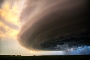
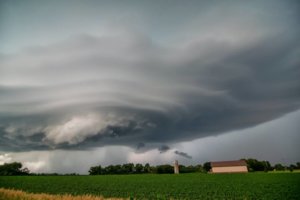
I exited at the Bruce exit north of Brookings and headed west and immediately came into view of a nice wall cloud a ways off to my west. It had some rapidly rising scud and showed some visible rotation. At times it looked like small funnels were trying to form, and there was blowing dust visible from a strong RFD wrapping around it.
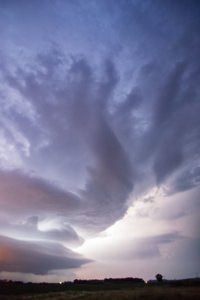
The storm was creeping along and the structure became amazing. Eventually the NWS put out a tornado warning, but I never saw anything close to producing again. The storm persisted past dark and kept it's great structure and had a continuous lightning show. More cells eventually merged with it so I continued on home.
I was glad with the way things worked out in the end as I ended up with beautiful structure on a tornado warned storm, even if I didn't see the rain wrapped tornado from the "storm of the day".

brookings.jpg

Brookings farm.jpg

Brookings lightning.jpg
 
Back
Top