• While Stormtrack has discontinued its hosting of SpotterNetwork support on the forums, keep in mind that support for SpotterNetwork issues is available by emailing [email protected].

2017-05-27 EVENT: AR/KS/MO/OK/TX

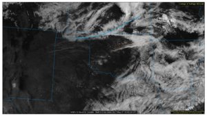
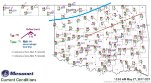
I'd say that's more likely an undular bore created by outflow that didn't make it very far away from last night's convection itself. There isn't any thermodynamic gradient associated with it, but there is a pressure rise, which resembles the structure of a bore. I wouldn't put any hopes in this feature initiating convection today because it's going to keep moving south at a pretty steady pace and be well under the stronger cap before peak heating.

The synoptic cold front can be seen right now about 100 km behind the leading edge of the bore, though.
srnplains_02_20170527150218.jpg
OKMeso_current.gif.gif
 
That outflow boundary is intriguing and is currently working its way to I-40 corridor. Models are all over the place on exact location on southern play initiation. HRRRx and HRRR have storms developing in south central OK around 6pm. Also, some of the WRFs are showing this as well. With the OFB headed that way, I am inclined to like the southern play today. Will be watching satellite come 3 pm.

CODNEXLAB-GOES16-Visible-15:12Z-20170527_440-464-10-100.gif
 
Looking at the GFS, the NAM and the 3k it would seem to me we should be convecting by mid afternoon, yet the NAM and the HRRR don't break out anything until closer to 7pm. CINH becomes minimal by mid afternoon and its hard to see things not going up and we'll have a good 500mb jet streak right over the warm sector.

Is that an outflow boundary surging south or a gravity wave? I was thinking the boundary would move slower and stall out in s tulsa county, that thing is booking to the south ...

Any thoughts on CI today? Are the primary models, the 3k and HRRR under doing the CI for some reason or am I missing something significant? Trying to figure out lake plans plus chase plans and I'm pretty well stumped. I think the warm sector should go in spots by 5pm if not sooner.
 
Is that an outflow boundary surging south or a gravity wave? I was thinking the boundary would move slower and stall out in s tulsa county, that thing is booking to the south ...

It's a gravity wave of some type...whether undular bore, soliton, or otherwise, I'm not sure which. But it's definitely not an outflow boundary. Outflow boundaries will be accompanied by a wind shift and a temperature gradient. Neither of those is true with that feature.
 
Back
Top