Devin Pitts
EF2
I chased in Indiana but I know there were some supercells in Texas too, so this thread will be for both.
I targeted Rantoul, IL as a good place to chill while I waited for convective initiation to happen. Saw towering Cumulus go up to my East, but it struggled for a good while before finally kicking off. Storm took several cycles before finally producing, alternating between both HP and classic with each cycle. Had a few large wall clouds that I was sure were going to put down tornadoes but no luck. Then finally I saw a funnel drop from the updraft base with no wall cloud which completely caught me off guard. Tornado was on the ground for a good 5-6 minutes. I've heard there were other tornadoes associated with this supercell, but I fell behind the storm due to a bad road choice and got caught on the wrong side of I-65. All in all, an excellent chase especially given the marginal conditions present.
Struggling at initiation:
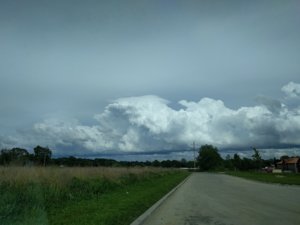
Storm finally starts taking on supercellular characteristics.
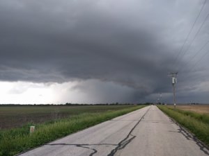
Super scuddy low hanging wall cloud
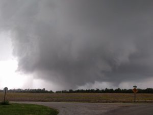
And finally, the tornado
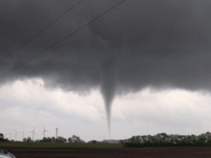
And video of the tornado
I targeted Rantoul, IL as a good place to chill while I waited for convective initiation to happen. Saw towering Cumulus go up to my East, but it struggled for a good while before finally kicking off. Storm took several cycles before finally producing, alternating between both HP and classic with each cycle. Had a few large wall clouds that I was sure were going to put down tornadoes but no luck. Then finally I saw a funnel drop from the updraft base with no wall cloud which completely caught me off guard. Tornado was on the ground for a good 5-6 minutes. I've heard there were other tornadoes associated with this supercell, but I fell behind the storm due to a bad road choice and got caught on the wrong side of I-65. All in all, an excellent chase especially given the marginal conditions present.
Struggling at initiation:

Storm finally starts taking on supercellular characteristics.

Super scuddy low hanging wall cloud

And finally, the tornado

And video of the tornado
Last edited:
