2017-05-10 REPORTS: IL/IA/TX/OK/KS

Joined
Aug 9, 2012
Messages
585
Location
Macomb, IL
Today was a pretty decent chase day across Southeast Iowa and West Central Illinois. My chase group and I managed to "score" 2 tornadoes, however there was a lack of satisfaction as we didn't get much photographical evidence of either. Anyway here is the story....

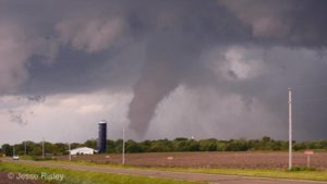
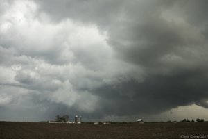
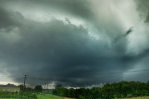
We started the day off eating lunch in Galesburg, I noticed an outflow boundary bisecting most of West Central Illinois. By 1:30pm updrafts were already starting to get established in Warren County, IL where this boundary was located. Temperatures on the north side of the boundary were a solid 10-15 degrees cooler than the south side, so I knew this is where we needed to be. We played with the Warren County storm for about 5 minutes and noticed it was trash. We piddled around on the back roads making it back to 34 and then west of Burlington towards a beast that had developed outside Birmingham, Iowa. This road network issue is probably what cost us a closer view of the "Salem, IA tornado". Anyway we made it almost to Mount Pleasant up Highway 34 when we got a view of the storm's base from about 10-12 miles out. It was a classic supercell initially with very little precipitation obstructing my view. We could see a cone/stovepipe tornado off to our southwest, however by the time we pulled over, the tornado had either roped out or became totally rainwrapped/occluded. I took this right around the 3:00 oclock time-frame...
d3fc118674e6a1482f539182d2e39526.jpg

I'm thinking this was about the time the tornado lifted or so. It was a shame that we couldn't get up there sooner for a more quality shot, but I guess a tornado is a tornado. My friend and fellow chaser Jesse Risley got some excellent footage of this particular vortex. Hopefully he posts his report here, not to speak for him!

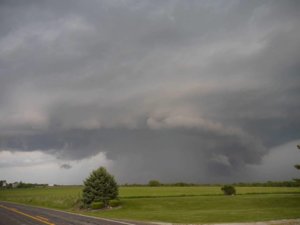
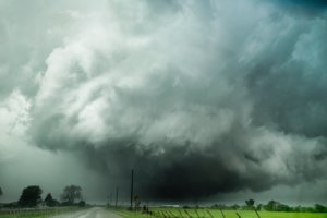
Anyway, I followed the storm further east, through a couple more cycles and it wasn't really producing. We would get these large RFD surges and then precipitation overtakes us and then a new cycle. The most impressive photo of the day was just outside of Mount Pleasant, Iowa. We came in on the back side of the storm's mesocyclone and got an incredible view of a carved out meso, something you would except to see a wedge under. I couldn't verify a tornado under this, but it wouldn't have surprised me at all. It even had the "ghost train"/RFD inflow jet ahead of it that you would expect. So cool to see, so close to home.
73616a0fbfb466dbedf4da1373dec97c.jpg

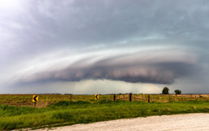
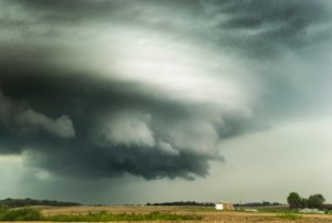
We gave the storm a little more chance, but unfortunately our road network wasn't working well so we got back to highway 34 and crossed back into Illinois at Burlington, Iowa. We headed north to intercept the tornado warned storm one last time near Keithsburg where it exhibited dramatic supercell structure.
988b8c0832a8426e73923e2b165bcad5.jpg

It was at this point that the storms were starting to congeal together and form a line, so we decided to head back towards home and get a few shelf cloud shots along the way. Mother Nature had other plans....

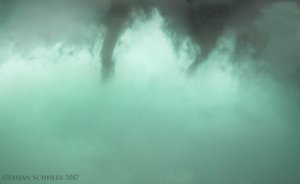
Going back through Monmouth on Highway 34, we noticed that rotation was starting to increase on the leading edge of the squall line. So we decided to divert south and east and eventually ended up between Galesburg and Abingdon in Knox County. This is where I looked out my drivers side window and saw TWO funnel clouds at the same exact time basically rotating around each other.
ce4815f61f434cabf661229b7b3bf620.jpg

These eventually congealed together and moved east, I thought they dissipated.....however about 2 miles up the road and to the right off highway 10, we noticed an incredible surge of wind (probably close to 70 miles-per-hour) and then shifting directions, I looked out the window and saw the funnel briefly touchdown in the field next to me to my north and was throwing small pieces of debris. I submitted a report to SN and continued east, abandoning the chase near Knoxville, IL.


While some may scoff and say, you got plenty to show for today's chase.....yes I did get some awesome photographs, however I failed to document the two tornadoes that we did see. The second one I can't really blame myself because it was so quick and I didn't expect that, I thought the storm was undercut, but obviously not. The first one, it was so far away I was skeptical and that got the best of me, until I realized it was a tornado based on other chasers that were closer.
31e41e1343c8ebfa6ba551bb01b1dd6f.jpg

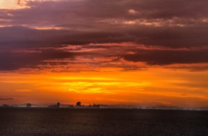
And to top it off, no good chase day is complete without a great sunset. I like the fog on the ground from the recent rainfall and the warm front being in the area.
 
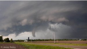
I ended up catching a nice tornado on the cell that popped up west of Keosauqua, Iowa. I had been eyeing southeast Iowa and west central Illinois after morning convection had laid down some boundaries prior to afternoon destabilization. As the frontal boundary lifted northward, it oriented itself proximal to US Highway 34. There was enough destabilization south of the frontal boundary to sustain severe convection as the mid-level perturbation and associated region of surface low pressure moved into the region by early afternoon. The cell that formed down near Keosauqua worked northeastward at a moderate pace, only traveling approximately 30 mph as it headed towards Mt. Pleasant. I headed over towards Burlington, Iowa and dropped south from Middletown, getting a great view of the notch as the storm ramped up as I worked west of Lowell. Once I got to Highway 218, I could tell a tornado was likely on the ground, but I didn't get a good view until I got west of Highway 218 just east of Salem. I was able to film a slender cone as it eventually roped out, for a good 3-4 minutes. It appeared that the tornado lifted just prior to affecting parts of Salem.

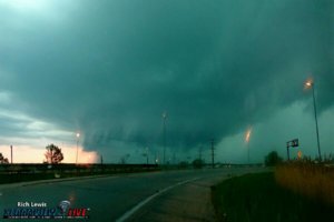
As I worked back east, the storm occluded and interacted with a new cell that formed between Houghton and Lowell. I'm not sure if the storms' interactions produced another brief tornado or not, but it maintained an impressive RFD cut with copious inflow bands to the east. I didn't get another good view until I got back north to US 34 near Danville, where I took the bottom photograph as the storm began getting a quasi 'mothership' sculpture.

As the storm worked back to the east, flirting with the boundary, it eventually congealed into the cells forming a QLCS to its rear. Although it maintained occasionally modest velocity signatures on radar as it approached the Mississippi River, it was never able to reinvigorated itself to produce any observably substantive tornadogenesis. Nevertheless, I followed the line all the way to Galesburg, IL, where it went on to produce occasional funnels on the leading edge of the main QLCS, once of which apparently produced a brief mesovortex tornado that other chasers witnessed near Monmouth, Illinois.

tor 1.jpg tor 2.jpg tor 3.jpg
 
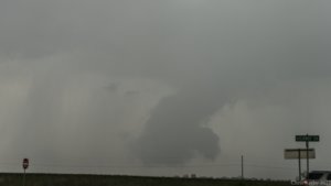
I witnessed my 1st tornado today near Salem Iowa at close range. I can confirm there was weak ground circulation very close to the west side of Salem. The road network near Salem was not ideal so I was stuck on a road with no shoulder, tons of trees, & couldn't find any place to pull off. I thought about using my dslr while driving but seeing a state trooper in my rearview quickly made me change my mind. Due to me waking up late & not being prepared my gopro was dead & was of little use being on the charger and not on the windshield at this point. About 10-15 minutes after the tornado lifted and I made it to the east side of Salem I took this 1st pic.(not the greatest angle due to my aversion to powerlines)
fb564.jpg
I then made my way to US 34 and took this pic of something that I almost didn't even notice in the rain. I thought it might just be scud but appeared to be slowly rotating before I completely couldn't see it anymore (major contrast & clarity added on this)
fb565.jpg
Overall I'm fine with how the day went as I don't care about social media glory. Now if I had saw the perfect photographic opportunity like say an old structure to put in the foreground, then I would probably despise the day for a long time.
 
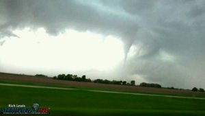
Where about on Highway 10 were you? I was traveling south on 41 from 34 just before meeting the intersection to highway 10 and saw this funnel. I couldn't make out any ground contact at the time due to some precip bands in front if it begining to wrap around , but it was over halfway down. Here is a video still. I gave Matt and James from ILX a detailed account in correlation to your report. They were going to go back through radar imagery today. f4ca6ccd96713655a8255561975003b7.jpg

Sent from my HTC One_M8 using Stormtrack mobile app
 
Where about on Highway 10 were you? I was traveling south on 41 from 34 just before meeting the intersection to highway 10 and saw this funnel. I couldn't make out any ground contact at the time due to some precip bands in front if it begining to wrap around , but it was over halfway down. Here is a video still. I gave Matt and James from ILX a detailed account in correlation to your report. They were going to go back through radar imagery today. View attachment 15705

Sent from my HTC One_M8 using Stormtrack mobile app

I was right behind Ethan, as I was in contact with their vehicle on VHF amateur radio. We were literally crossing the BNSF railroad yard on the overpass when the rain bands started to wrap in horizontally just to the north, and there was some tree debris being yanked off of nearby trees as what appeared to be a vortex momentarily appeared in the field to the north. We definitely saw the funnel, but it was much more obscure, although it all happened so fast I wasn't personally comfortable confirming a tornado. I was driving by myself, so admittedly I was trying to watch the road more than I was beneath the base of the funnel, and everything became immediately rain wrapped by the time it got to Knox Co. Hwy 25.
 
From the message that I got from Matt (ILX), they sounded fairly convinced it was a brief meso-vortex tornado....there was another east of Peoria too that damaged some outbuildings. I think its going to be entered into the May 2017 STORM DATA as an EF-0 Tornado I do believe
 
Wow heck of a shot Rich, I didn't notice that. We were practically under the thing with 60 mph winds and wrapping rain curtains. I saw a couple whiffs of condensation and some small debris off the ground to my left in the field and then it was over, so not on the ground too long. But with as many vantage points as we had here, it shouldn't be too difficult to confirm.
 
Yeah I talked to James Auten who took your report Ethan. The reported tornado near Peoria has been taken out. It's been labeled a gustnado now. The damage was from a strong downburst...which caused the gustnado, which is what was reported as a tornado. I gave both James and Matt my video when I documented the funnel almost all the way down. You just can't see any circulation on the ground however from my vantage point due to those darn rain curtains wrapping in. But I swore it was down myself. I saw the report and knew I was in the same location. I talked to James on the phone yesterday in hopes to validate your report further. My location was just to the north of the railroad yard on 41. As of now they still haven't confirmed. They went over radar imagery again today and were looking for any video from anyone else that might have been in the area that clearly showed it was or could have been on the ground. Without that though, it sounds like they will not confirm it or enter it in. James said they might mention it as a "possible" but probably won't go any further than that unless they find more concrete evidence. Another likely IL tornado that slips through the cracks. The tornado warning in Macon county earlier that night near Oreana did produce but won't go as confirmed either. Heavily rain wrapped and no evidence of its occurance even though there was a clear debris signature. QLCS spinups are extremely hard to validate unfortunately.

Sent from my HTC One_M8 using Stormtrack mobile app
 
Time to get some TX and OK storms in this thread. It was long day in NW TX and SW OK, but well worth it as we saw 2 tornados. For a change I drove and give my chase partner, Chadwick Stelzl, a break. I didn't get as many pics as a result, but he is kind enough to let me share some he took.

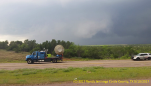
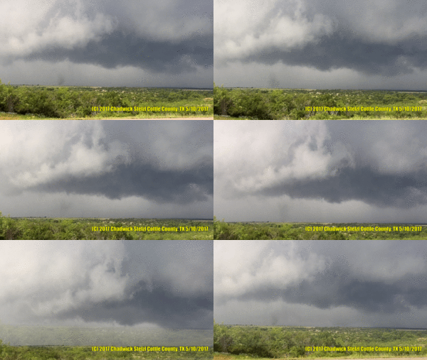
We left DFW around 9:30 AM and drove to Vernon, TX and had lunch at Braum's where we talked briefly with @James Langford and several others. By the time we left storms had already started to fire back to the southwest near Matador. We took US 70 and ended up in Paducah. We took US 62 north towards Childress, but stopped at a rest stop on the east side of the road that was elevated and had an good view of a rotating wall cloud to the west/northwest that quickly became TOR warned. As we where watching @Tim Marshall passed by going south around 3:30 PM (talk about making you rethink your position). Not far behind him was the rest of the TWIRL team including a DOW. Tim went on, but the rest of the team pulled off the road just south of us. They barely had it in park before they had the DOW scanning and a tornado was on the ground. Here is a pic of the DOW I took and a animation of the tornado from several pics that Chadwick took.

dow.png

IMG_3316-ANIMATION-wm.gif

A army of chasers showed up, we started getting mild RFD winds, and had no good road network to our northeast so we head back south towards Paducah and then went northeast on 104 towards Quanah. The storm was still TOR warned by the time we got back on it, but was just a rotating wall cloud at this point. We went north on 6 from Quanah and took a few pics, then once again having no road network to stay on the storm without punching it and ending up on the left flank, we went back to Quanah then went southeast on US 287 to Chillicothe and then used 91 and 2379 to get northeast to Odell where we cut over to US 283 where we went north and crossed into Oklahoma. We stopped at the General Store in Elmer to get gas, along with tons of other chasers, which was flustering because the card readers didn't work at the pumps and the line inside was long. There was quite a dust storm caused by outflow. We went east on 5 to Tipton where we gave up on that storm and went back to Elmer and crossed the Red River back into TX to get on a storm to our southwest. We went west on 91 and stopped short of Odell to look at a wall cloud to the southwest and meet up with Daniel Shaw and a couple of other chasers.

20170510_185319_small.jpg

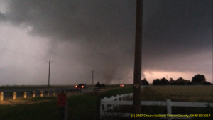
We went back to US 283 and went south to Vernon. Then we went east on US 183/287 to Oklaunion then went north on US 183 to Davidson, OK. We then took US 70 east to Grandfield. The storm became TOR warned and we went north on 36. Chadwick got this shot of the tornado about 8:38 PM.

IMG_3635.PNG

We chased this storm all the way to Duncan OK and then Davis OK, but never saw anything else exciting. Along the way we meet @Travis Cruz and his StormCruzzer at a gas station in Comanche. We gave up and turned south on I-35 at Davis and headed home arriving around 1:30 AM.

Miles driven: 759
Hrs: 16 hrs
Chaser Traffic: Given the small SPC moderate risk area, there where a lot of chasers in a small area. Limited road options and river crossings also caused congestion. Lots of best pull offs where taken and it did take several minutes sometimes to pull back into traffic. There where a few groups of college kids that stood in the roads, and several folks who drove way under the speed limit. But most chasers where fine. There was a van and another vehicle with New York plates (not together) that almost caused several accidents. We had several times where the same yahoos came late to the party down a dirt road at a high rate of speed kicking up a dust storm and blocking our views of the storms. Sure, they have just as much right to be there as we did, but it was frustrating.
 
Targeted SW OK and drove to Altus, where we gassed up, grabbed lunch, and waited. Sat patiently watching the early cell SW of Childress on radar, not wanting to pull the trigger for fear of getting out of position for possible new storms closer and to our west. That plan ended up failing big time, as the only tornadoes that storm produced were early on. By the time we started to move on it, the show was over and we were greeted by a huge whale's mouth "I'm not doing anymore tornadoes" type of storm. Stayed in front of it anyway, east on OK5 through Tipton and Manitou, where we turned north on 183. By this time the storm was obviously never going to recover, so we dropped it, and decided to head SW back down into NW TX to get on a fledgling storm near Quanah. That proved to be the move of the day, as we got right up next to it as it began to get interesting. Retreated east and south in short intervals as the storm began to get wound up, and then as we came into Davidson things really got interesting. We went east on US70, as a huge dust foot (normally associated with outflow/RFD blasts) began to form. However, another huge dust foot was moving from south to north, and the two were converging in a way that looked like a huge, slowly rotating debris cloud. About (6-8?) miles east of Davidson, a brief tornado developed as a concentrated dust whirl under rapid cloud base rotation. Stopped and reported it, then took off again as it only lasted maybe a minute (the best of which was before I got my vidcam on it). Missed the other tornadoes due to stopping in Grandfield for gas, and the fact we really couldn't tell visually what was going on at that point due to impending darkness. Video of the tornado is below....

 
Back
Top