Quincy Vagell
EF4
A slightly more amped up setup than the day before in the southern High Plains, I once again targeted eastern New Mexico, at least to start.
It was clear by early afternoon that I wanted to target the NM/TX border area, as dew-points were generally much more favorable to the east, with only 40s to lower 50s over New Mexico. If anything discrete went up in West Texas or could survive the journey into Texas, it would have a strong possibility of becoming an intense supercell.
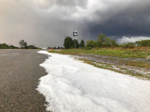
I watched a storm initiate by Lovington, NM and it initially struggled, but as it moved north-northeast toward the Texas border, it was finally starting to turn into a supercell. As I crossed into Texas, I drove through Bledsoe and saw some hail "drifts" on the side of the road:
I stayed with the storm and although structure was nowhere near as well-defined as the storm I chased the day before, there was still at least some hope that better low-level moisture could help increase the tornado threat.
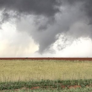
Just to the southwest of Morton, I observed a few occasional funnels, with the most conclusive one below:
I continued north and low-level rotation was really struggling, so I decided to see what I could find for hail. It wasn't long that I found myself driving through inches (at least 2-4") of hail, just to the south of Enochs. Things got tough in Enochs, as the storm was cycling and had the potential to produce again, especially since it was getting later, T/Td spreads were narrowing and the low-level jet was increasing, so I had to punch back through the storm. The alternative was to drive through increasingly flooded/foggy roadways and I was not thrilled by that prospect.
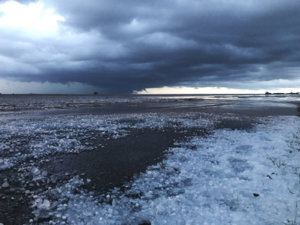
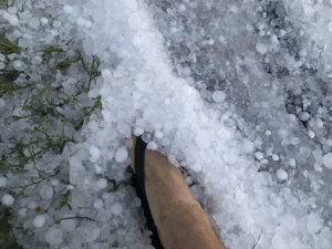
I went east from Enochs and the roads were slushy and became more and more flooded as I pushed forward. At first, a few inches of water/slush wasn't a big deal, but it turned into what could have been a really bad situation. I stopped and took advantage of the situation to capture some video and a few quick photos.
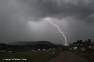
The last photo was taken near sunset, as the storm was cycling again and some chasers reported seeing a funnel cloud. I was focused on getting myself out of the slushy situation and called the chase off a short time later.

It was clear by early afternoon that I wanted to target the NM/TX border area, as dew-points were generally much more favorable to the east, with only 40s to lower 50s over New Mexico. If anything discrete went up in West Texas or could survive the journey into Texas, it would have a strong possibility of becoming an intense supercell.
I watched a storm initiate by Lovington, NM and it initially struggled, but as it moved north-northeast toward the Texas border, it was finally starting to turn into a supercell. As I crossed into Texas, I drove through Bledsoe and saw some hail "drifts" on the side of the road:

I stayed with the storm and although structure was nowhere near as well-defined as the storm I chased the day before, there was still at least some hope that better low-level moisture could help increase the tornado threat.
Just to the southwest of Morton, I observed a few occasional funnels, with the most conclusive one below:

I continued north and low-level rotation was really struggling, so I decided to see what I could find for hail. It wasn't long that I found myself driving through inches (at least 2-4") of hail, just to the south of Enochs. Things got tough in Enochs, as the storm was cycling and had the potential to produce again, especially since it was getting later, T/Td spreads were narrowing and the low-level jet was increasing, so I had to punch back through the storm. The alternative was to drive through increasingly flooded/foggy roadways and I was not thrilled by that prospect.
I went east from Enochs and the roads were slushy and became more and more flooded as I pushed forward. At first, a few inches of water/slush wasn't a big deal, but it turned into what could have been a really bad situation. I stopped and took advantage of the situation to capture some video and a few quick photos.

The last photo was taken near sunset, as the storm was cycling again and some chasers reported seeing a funnel cloud. I was focused on getting myself out of the slushy situation and called the chase off a short time later.
