Ethan Schisler
EF5
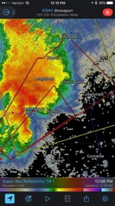
As I discussed in the event thread I planned on chasing this day. I targeted the Louisiana/Texas border for an early initiation of supercells ahead of an ongoing MCS in Northeast Texas. The area was already primed when I south of Mansfield, LA which was on the warm front. Instability, shear, and moisture were all off the charts for this early in the season and of course SPC went with a rare high risk of severe weather. I chased a couple tornado warned storms early on (first one around 9am) and the second being around 11:30-12PM just outside of Center, TX.

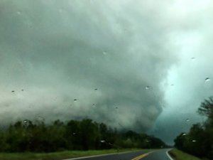
Being right on the warm front, the visibility was so awful that I literally had to get within a mile of the updraft base of the storm to even view it. I saw what was possibly a tornado outside of Center, TX shortly before noon, but I can't confirm because of bad terrain and low visibility. There was an ominous low level mesocyclone to my NE by maybe a mile when I crossed the MS river with a possible ground circulation, but once again because of bad visibility and rain-wrapped I can't confirm this. I followed the supercell to my northeast where it crossed the warm front and died. Also as I mention below, I was the driver, navigator, and forecaster for this chase (basically solo), so I didn't have time to get video or photos of the storm because things were moving so fast, my road options were awful, and the visibility was even worse than the roads.
I intercepted another storm further SW once again in the Logansport, LA area that was tornado warned, however it failed to do much. I was chasing with limited data most of the day because of poor Verizon coverage in this area. So because of that, I failed to get further east in time to view the Alexandria, LA cyclic supercell which was the only storm of the day in my eyes that really was worthy of chasing. Everything else just kind of went up at once. I called the chase around 3 oclock and headed for home arriving at my door-step around 5:30 this morning. Oh did I forget to mention, i was the driver, navigator, and all that stuff for this chase too? Definitely one of my more frustrating chases, one I would certainly consider a bust.....Here are a couple photos I shot on the way home in Louisiana.

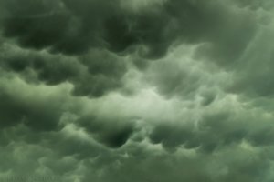
Mammatus clouds behind the squall line outside of Shreveport, LA around 4 oclock

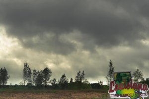
My first and hopefully last time chasing the bayou state. The Louisiana sign showcases the awful terrain behind it, near Mansfield, LA. It doesn't show the terrible cell reception here, which was the deal breaker for me.
Anyway that is the wrap on that. I look forward to everyone else's reports that braved to chase the jungle yesterday lol.

Being right on the warm front, the visibility was so awful that I literally had to get within a mile of the updraft base of the storm to even view it. I saw what was possibly a tornado outside of Center, TX shortly before noon, but I can't confirm because of bad terrain and low visibility. There was an ominous low level mesocyclone to my NE by maybe a mile when I crossed the MS river with a possible ground circulation, but once again because of bad visibility and rain-wrapped I can't confirm this. I followed the supercell to my northeast where it crossed the warm front and died. Also as I mention below, I was the driver, navigator, and forecaster for this chase (basically solo), so I didn't have time to get video or photos of the storm because things were moving so fast, my road options were awful, and the visibility was even worse than the roads.
I intercepted another storm further SW once again in the Logansport, LA area that was tornado warned, however it failed to do much. I was chasing with limited data most of the day because of poor Verizon coverage in this area. So because of that, I failed to get further east in time to view the Alexandria, LA cyclic supercell which was the only storm of the day in my eyes that really was worthy of chasing. Everything else just kind of went up at once. I called the chase around 3 oclock and headed for home arriving at my door-step around 5:30 this morning. Oh did I forget to mention, i was the driver, navigator, and all that stuff for this chase too? Definitely one of my more frustrating chases, one I would certainly consider a bust.....Here are a couple photos I shot on the way home in Louisiana.

Mammatus clouds behind the squall line outside of Shreveport, LA around 4 oclock

My first and hopefully last time chasing the bayou state. The Louisiana sign showcases the awful terrain behind it, near Mansfield, LA. It doesn't show the terrible cell reception here, which was the deal breaker for me.
Anyway that is the wrap on that. I look forward to everyone else's reports that braved to chase the jungle yesterday lol.

