Jesse Risley
Staff member
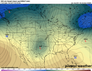
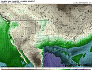
It's still a bit tucked away at the rear of the forest, so no need to hyperaccentuate what will most likely be changing placement of certain dynamics, but both the GFS and the ECMWF are showing a 500 mb disturbance approaching the region late TUE (03/28) - late WED (03/29), as another upper-level system takes on a more negative tilt as it moves east of the MS valley by the end of the week. It looks like the GFS is indicating much better moisture return, especially south of the Red River valley, though a narrow ribbon of instability on last night's 00z run would be concerning if it were much more proximal to the event.
Low-level shear profiles look decent, at least on the last few runs, and the ECMWF has been a bit more generous with the depth and organization of the surface low, which weakens and then strengthens again by THUR as the system takes on more of a negative tilt. There's a decent perturbation at 500 mb juxtaposed with favorable dryline and surface low placement to keep an eye on (especially) eastern or NE TX, probably near and east of I-35, late WED afternoon IF ample instability materializes. H85 jet enhancement and propagation of key surface features looks to put at least parts of SE OK, SW AR and possibly NW LA into the crosshairs by late evening and into overnight, possible with more of an MCS or linear congealment of initial surface convection. It's definitely worth watching as the system comes into range of the short-term convective models over the next 24-48 hrs (e.g., today's 06z NAM run was just a tad more progressive than the 06z GFS with 84 hr H5 placement of the upper-level energy). The ensemble GEFS run is depicting the more ambient instability shunted further to the south, so it will be interesting to see how this evolves and whether or not it becomes something more noteworthy to watch.


Low-level shear profiles look decent, at least on the last few runs, and the ECMWF has been a bit more generous with the depth and organization of the surface low, which weakens and then strengthens again by THUR as the system takes on more of a negative tilt. There's a decent perturbation at 500 mb juxtaposed with favorable dryline and surface low placement to keep an eye on (especially) eastern or NE TX, probably near and east of I-35, late WED afternoon IF ample instability materializes. H85 jet enhancement and propagation of key surface features looks to put at least parts of SE OK, SW AR and possibly NW LA into the crosshairs by late evening and into overnight, possible with more of an MCS or linear congealment of initial surface convection. It's definitely worth watching as the system comes into range of the short-term convective models over the next 24-48 hrs (e.g., today's 06z NAM run was just a tad more progressive than the 06z GFS with 84 hr H5 placement of the upper-level energy). The ensemble GEFS run is depicting the more ambient instability shunted further to the south, so it will be interesting to see how this evolves and whether or not it becomes something more noteworthy to watch.


