I struggled with where to target on Tuesday... I woke up at 6 a.m., knowing I would have to haul non-stop to Illinois if I was going to choose to chase there. Given the time crunch, the possibility that I could show up too late and the fact that I had to work in Oklahoma City the next day, I opted to stay south. Then the question became, Arkansas or Missouri, with both targets having glaring terrain obstacles.
I drove northeast on I-44, initially focusing on southern Missouri. That area had the best parameter space, with moderate instability and strong shear expected. However, once I got to the Joplin area, I kept thinking back to April 27th, 2014, when I had the same internal battle between southern Missouri and Arkansas and chose the latter, at the last minute. Despite driving several hours out of the way, I dove south on I-49 and decided to head toward Little Rock.
The backstory is that in 2014, I had a defining moment in my chasing career. At the time, I was relatively new to chasing in tornado alley and nearly got too close to a violent tornado in Mayflower, AR. I often daydreamed back to how I screwed up that chase, but I digress from Tuesday...
Even though the terrain and road networks in central Arkansas are only marginally better than southern Missouri, I was hoping that a "tail end charlie" type storm might take advantage of unseasonably large CAPE on the southern edge of the risk zone. Also, central Arkansas is a mini hotspot when it comes to tornadoes. as wind channeling in the valley seemingly regularly leads to supercells becoming tornado warned between Conway and Little Rock.
I almost turned back when convection (that went on to become a long-lived supercell) fired in far northwestern Arkansas, but was mildly intrigued by new convection trying to pop in central Arkansas. As I approached Little Rock, this convection became severe, but I also noticed major traffic backups in Little Rock, likely a combination of rush hour and newly issued tornado warnings to the northwest. Luckily wind shear in the lowest 1km was weaker than in 2014, or this could have been an especially bad scenario with nearly gridlocked traffic.
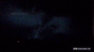
I turned back on I-40 toward Mayflower, as the lead supercell in a cluster became better organized on radar. It was eerily similar to 2014, when junky cells developed near Hot Springs, only to rapidly organize as they moved into the Mayflower area. Just south of Mayflower, traffic slowed and I could see a clearly rotating mesocyclone with a well-defined inflow band. I inched closer and closer, but as the cell moved nearly directly overhead, there was nothing but a ragged looking low cloud base. I turned around in Mayflower and went back for an intercept of the second cell, but the environment was worked over and this storm was less impressive than the first.
The video footage and quality aren't great, but it was a case of deja vu, as a tornado warned supercell passed through Mayflower, AR.
(
video replaced below as requested)
I stayed with the storms to about Searcy, AR, before bailing back west, in hopes for a second round. If it wasn't dark, I would have pushed forward, as the terrain gets much better with northeast extent in Arkansas. I couldn't get to southeastern Kansas in time for their tornado warned storms, but I did experience quarter sized hail in southwestern Missouri.
Even though the chase as a whole was not particularly well-planned or executed on my part, I'm very encouraged by how active 2017 has been so far. We've had several chaseable events already and one of the busiest starts to a year in terms of tornadoes since 2008.

EDIT: There was an error in my video and I had to re-upload.