Carl Jones
Enthusiast
Some models are suggesting a tasty enviroment in the central/eastern Dakotas, particularly around their neighboring border.
Synoptics:
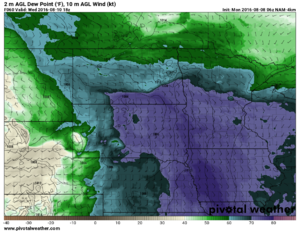
Most models agree on a decent, compact s/w moving out of the northern US Rockies into E MT. In response, cyclogenesis maximized around the W Dakotas will promote favorable wind profiles over the Northern Plains. This response also allows an EML to overspread Northern Plains. Sufficient surface moisture advects (noted by dwpts lower-mid 70s) into the E Dakotas with ample insolation south of a warm front draped E/W just north of the ND/SD border between ~BIS and FAR. Oh and the dryline should be oriented N/S within central SD near or west of the MO River.
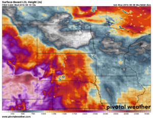
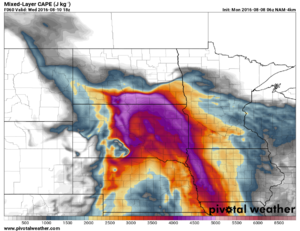
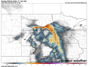
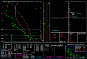
Some models disagree on how stout the EML is this far out, but most agree on enough CIN to get moderate to extreme CAPE within the warm sector. CAPE values are maximized along or just south of warm front due to moisture convergence. 0-1 km hodographs are wide/curving with helicity values near the warm front ~250-350 m2/s2 per 06Z NAM 4km. Juxaposition of these two parameters provide best enviroment for meso development. Not to mention LCL heights will be more favorable for tornado development.
Things to look out for:
- Overnight MCS starting in western SD could eat up available moisture/CAPE lessening severe potential significantly, particularly if atmos cannot rebound from cloud debris. Even if MCS produces a lingering OFB for the afternoon convection to ride on, I am afraid it may be too far south away from better dynamics/forcing.
- NAM4km eliminates CIN within extreme CAPE around 18Z which could set things off early. Could be good: long lived supercell if cell pops deeper within the warm sector or right turns onto WF. Could be bad: multiple single cells pop early merging earlier.
- Model consistency lacking, although higher res models are just starting to glimpse into Wed afternoon. After all it is still 48+ hrs out.
- Best case tornado scenario: supercell right turns onto warm front.
