Dan Ross
EF0
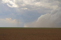
Headed out the door initially targeting Burlington, CO since cold outflow from overnight/morning convection in Nebraska was pushing about that far south. Cells started to pop about around 1:00pm, with the most robust updraft near the KS border. It assumed supercell structure right away and was feeding on 60+ dew points advecting from the east at 10-15 knots. I struggled to get into position for a bit, having positioned myself a bit far north. Outflow was stirring up a lot of dirt out there near Cheyenne Wells, CO. A dissipating dust devil can be seen just ahead of the gust front:
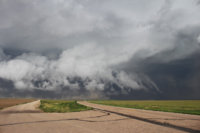
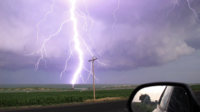
By 3:00pm MDT a new cell was exploding right on the KS border north of Holly, CO. It would go tornado warned as I approached it from the west. Preceding the tornado that touched down WNW of Syracuse, KS was an intense bout of CG strikes in the vicinity of the updraft:
Not long after, I observed some intense sinking motion to my northeast as the RFD began to wrap. I viewed the tornado from within the hook, letting it cross Hwy 50/400 to my east. A satellite formed briefly, as well:
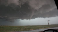
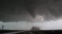
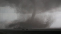
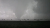
It grew larger as it moved off to the south, with more precip obscuring my view. Didn't see too many other chasers out there, everyone was on the east side looking west, probably being safer than myself. I don't usually position myself in the hook like this, but once it was forming I opted to "weather" the RFD rather than cut in front of the tornado.
Here's a link to my video from that day:


By 3:00pm MDT a new cell was exploding right on the KS border north of Holly, CO. It would go tornado warned as I approached it from the west. Preceding the tornado that touched down WNW of Syracuse, KS was an intense bout of CG strikes in the vicinity of the updraft:

Not long after, I observed some intense sinking motion to my northeast as the RFD began to wrap. I viewed the tornado from within the hook, letting it cross Hwy 50/400 to my east. A satellite formed briefly, as well:


It grew larger as it moved off to the south, with more precip obscuring my view. Didn't see too many other chasers out there, everyone was on the east side looking west, probably being safer than myself. I don't usually position myself in the hook like this, but once it was forming I opted to "weather" the RFD rather than cut in front of the tornado.
Here's a link to my video from that day:
