Dan Rupnow
EF1
- Joined
- Jan 17, 2008
- Messages
- 78
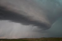
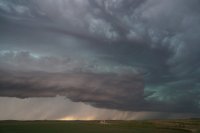
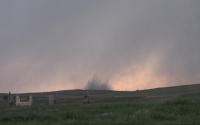
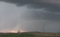
Started the day in Jamestown, ND, with a general target of Glendive, MT. It was a hot, sunny day, so I stopped at the Beach! Beach, ND that is, for fuel and a data check, and noted that models were showing convection initiating in far SE MT, and then moving northward into my target area. I waited in Beach for a couple hours, then once storms fired, I moved down to Baker, MT to let them slowly come to me, hoping one of them would go dominant. A storm did go dominant near Miles City, but I didn't like its left moving characteristics, so I stuck to my guns in Baker. This turned out to be a good decision, as the cell near Baker finally started intensifying, and I noticed an area of interest with rotation just south of town. A slender tornado soon spun up, and unfortunately did damage in the city of Baker.
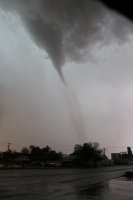
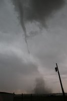
It was a pretty helpless feeling to watch this tornado plow into Baker, and I later saw some significant damage in town. It could've been even worse though, as the tornado thankfully dissipated before cutting through the entire city. Bittersweet day, as I documented my first MT tornado, but hated seeing the destruction!


It was a pretty helpless feeling to watch this tornado plow into Baker, and I later saw some significant damage in town. It could've been even worse though, as the tornado thankfully dissipated before cutting through the entire city. Bittersweet day, as I documented my first MT tornado, but hated seeing the destruction!

