• While Stormtrack has discontinued its hosting of SpotterNetwork support on the forums, keep in mind that support for SpotterNetwork issues is available by emailing [email protected].

2016-05-26 REPORTS: KS

MFPalmer

EF0
Joined
Mar 27, 2015
Messages
15
Location
Topeka
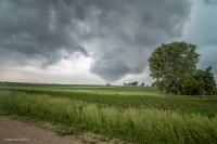
I'd like to say my adept forecasting brought me to the right place, but I ended up leaving Topeka late and was on I70 about 45 minutes west when the storm approaching Wamego became warned. I tried to get into position south and slightly east of the storm but couldn't because of the road network, so I ended up east and slightly north of it as it went by. I saw it touch down briefly a few times but nothing crazy.
b3b3c6caed4106b88aad7924d7ba06d7.jpg
 
After not being able to get out all week to chase, I got out this day targetting Salina-Hays, KS. On paper it looked great, actually in my opinion the best out of the week (on paper ha!). Well as things go, on paper isn't always the greatest, ended up being probably one of my least fruitful storm chases to date (a lot of those this year). To top it all off, I drove right under the cell near Topeka about an hour before it went tornado warned. I don't know why it never occurred to me to pull over and check it out, I guess because it didn't really look that great at the time, so I wanted to keep going to my target area...

....Bottom line is, target area busted with too many storms going up at once, never took my camera out of the bag once...headed for home after driving through some of the most torrential rain I've seen in a long time, getting back into my bed around 5am (think this is one of the latest arrival home times I've had in a few years lol).

Lessons learned on this chase: Don't blow off storms going up at noon while driving to the target area, they may become a fairly legit tornadic supercell later on (which in this case it did).....

Overall while an amazing week for many of my friends, its one that I'd rather forget personally.
 
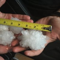
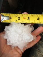
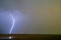
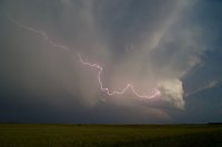
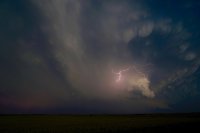
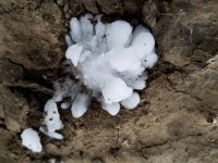
After chasing Saturday 21st thru Tuesday 24th, I had to get back to Houston for work on Wednesday 25th. Of course missed the I-70 show in Kansas on Wednesday so decided to fly up for Thursday's event thinking it at least had to be a tornado day. Played around with the grunge in Kansas most of the afternoon and eventually dropped into Oklahoma late. Did measure many 2-3" hail stones north of Sitka including one that measure 4" due to some nice spikes on each side.

IMG_2526.jpg IMG_2532.JPG IMG_2552.JPG
 
Started the day in Salina. Didn't need to go anywhere - the primary boundary was hanging out right along I-70, so I expected to just wait around for storms to come up from the south and hopefully grab it long enough to produce. This only ended up happening to the east, out of reach. Outflow as far as the eye could see for the rest of the day. I semi-called the chase early and started heading east toward home, hoping for something to get established south of the outflow. I made it home by 2AM, so the fact the day busted at least prevented the need for another overnight stay.

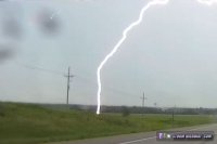
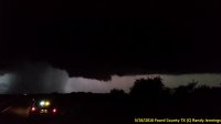
I saw this close lightning strike near Ellsworth (dashcam shot) and a few interesting shelf clouds near Council Grove, but that's it.

may2616a.jpg
 
This day transpired pretty much as I expected. A bunch of messy junk along the warm front, a few cells north and northwest of the surface low, and some isolated storms south along the dryline with weak tornado potential. I was never too thrilled with the setup, and I thought it was being over-hyped by most others, including the SPC. In looking at the HRRR that morning, it dropped dewpoints significantly, and per SPC I guess this was a result of downward transport of dry air as a result of overnight convection. It also showed a huge mess of storms; no real supercells. Really not even multicell clusters... just junk. I even contemplated just staying home, but after missing the Solomon wedge the day before, I decided I'd rather go and bust than not go and miss another wedge.

I had 5 potential targets: NW Kansas and possibly into Colorado, N Central KS, NW Oklahoma/SW Kansas in the same general area as Tue, SW Oklahoma, or west Texas. I decided to head to NW Oklahoma and play the dryline close to the surface low with the hopes of more isolated cells. I got on a storm early near Arnett, but it was high-based. Got into some quarter hail, followed it for a bit, then let it go. At that time it looked like storms were about to fire in the TX panhandle, so I headed to Shattuck and sat for a while as I watched the cell near Canadian, TX die. I decided to gun it north to the cell crossing into Kansas, and caught up with it in Englewood. Another high-based hailer. Went through some good hail, then got out in front of the storm. It did have some nice structure.

617a07dacaa9b600de6796fa9c37459e.jpg

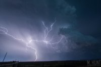
I ended up following this storm north of Coldwater when, ironically, COLD outflow was evident. The storm was done. It had a tornado warning on it for a while, but I never saw anything close to being tornadic. I hung around the area for a while into the night shooting lightning, and came away with some good shots. I had a really great anvil crawler, but unfortunately I had forgotten to re-focus after changing focal lengths. D'OH!

6791c76e5b7ea63c34eed56e0eaf6bf0.jpg
 
Mods: Please add TX.

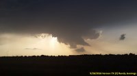
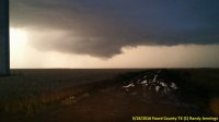
Today was about a 500 mile chase that for a while had us worried about a bust, but turned out to not be too bad. I made my target forecast around lunch time. We couldn’t get out of work early enough to make it to KS, so I didn’t even look that far north. Based largely on the HRRR, my initial target was Clay County TX around 7 PM and we planned to leave Plano TX about 3 PM. Neither of us could get out of work as planned, so it was more like 4 PM before we left. As we started to drive that way we started to become worried that we would clear sky bust, as nothing much was firing. Storms finally started to fire to the west of Wichita Falls, so we made a new target of Vernon TX and kept going on US 287. We enjoyed some nice back lit structure as we drove northwest. By the time we got to Vernon, there was one cell already in OK, and another cell to the south. We watched a LP cell with a very high base and very low top pass to the west of Vernon. By this time a storm near Abilene, TX was starting to look good and we debated about trying to drive to get in front of it, but there was no way we could make it so we sat and watched the cell we were on dissipate thinking we drove a long way for very little reward. Then another cell started to fire to our southwest to the west of Crowell, TX. We decided to take a couple more pics and then head that way. I took this picture looking northnorthwest from Vernon towards the original cell we were on, right as the cell to our southwest became severe warned.

20160526_194747_small.jpg

We took US 70 southwest from Vernon with a new target of Crowell, TX. Not wanting to core punch it, we turned south on FM 267 to try to get out of the rain and get into the right flank. Once we got out of the rain, we could see a well defined wall cloud to our west. We turned around and went back north with the wall cloud just to our northwest the whole time. We got back to US 70 and I took this picture at the intersection of US 70, FM 267, and County Road 229 (the dirt road in front of us) at 8:42 PM.

20160526_204238_small.jpg

There was another wall cloud to our southwest by this time and the one to our northnorthwest was disputing. So we went back south on FM 267. The whole time we could see a well defined wall cloud to our west. At 8:48 OUN issued a tornado warning for the cell to our west. Around 8:59 we turned west on FM 2877 and went a little ways and met up with another chaser and watched a well defined rotating wall cloud to our west that was nicely backlit and had a visible hail shaft on one side of it. I took this picture at 9:02.

20160526_210220_small.jpg

We went north on FM 267 again and followed along behind it slowly. Once the wall cloud crossed over the road we went up to US 70 and slowly followed the cell back to Vernon. At 9:15 OUN let the tornado warning expire. As we drove back towards Vernon we got a good lighting show and the cell looked like an upside down T on radar with the reflectivity spinning cyclonically on the right and anti-cyclonically on the left. We had to hold up a little in Vernon until the hail core crossed north of US 287 so we can head back to the metroplex. Once we got out of the rain near Wichita Falls, we enjoyed a great lighting show in front of us as a MCS was approaching the metroplex. The storm never produced a tornado, but we got some great backlit shots.
 
glad somebody got the wamego tornado. I was on the wall cloud and funnel south of St. George, Kansas and got into the trees along the Kansas River right as it was about to drop. guess what.. police Pottawatomie county sheriff road block rightin a tree filled ravine couldnt see shit and missed it. tornado 10 miles from my house!!! I'll post what I got when I can my computer is not reading my SD card for some reason right now.....
 
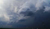
Started out near Salina, made my way down towards Greensburg and hit the Tornado warned cell right there in town. Realized that we just had a nuclear bomb go off in the warm sector and got out of there immediately. Headed West to the CO/KS border and watched a cell building in the distance, which like every other cell I was on this chase, went tornado warned. It had great structure, and it put out a funnel that come so close to being an epic landspout. I cant complain about it however since I was lucky enough to be on every other big play this week. But boy would it have been the Cherry on top!

20160526_184725.jpg DSC02636edit3.jpg DSC02734edit2.jpg 2016052695183019.jpg
 
Back
Top