• While Stormtrack has discontinued its hosting of SpotterNetwork support on the forums, keep in mind that support for SpotterNetwork issues is available by emailing [email protected].

2016-05-25 REPORTS: KS/OK

Joined
Jan 14, 2011
Messages
3,535
Location
St. Louis
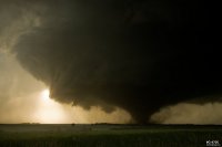
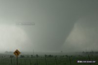
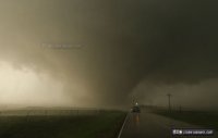
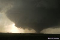
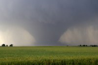
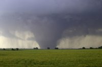
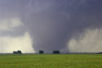
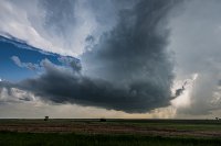
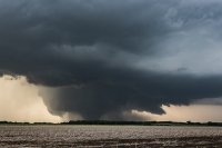
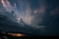
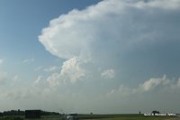
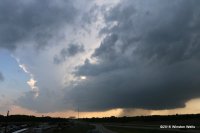
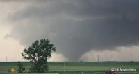
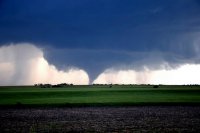
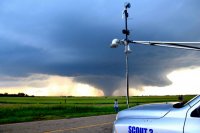
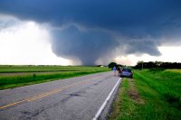
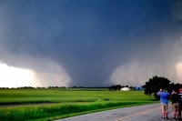
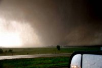
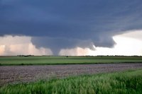
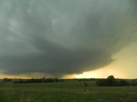
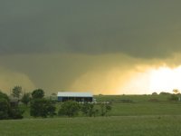
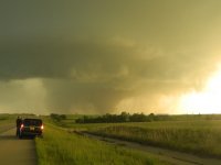
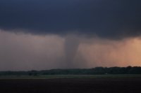
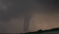
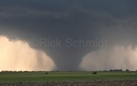
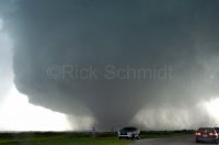
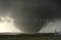
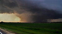
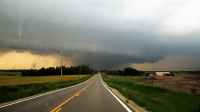
Targeted Mcpherson, KS, the halfway point between two targets. Eventually became clear the northern target was the favored one, and arrived on the storm at Bennington just in time to see it produce its first small tornado west of Highway 81. Followed the storm east and was right on it for the genesis of a violent, long-track tornado that stayed on the ground from near Solomon all the way past Chapman. I was able to get two close passes of the tornado, once north of Solomon and the second north of Abilene. The roar north of Solomon was the loudest and deepest I've heard.

Unfortunately, it was obvious this was going to a bad situation. I witnessed several structures being hit north of Abilene. I went up to the damage path to check on the residents, but thankfully all of the homes were largely intact, though some had significant damage.

Chase account with stills and full video is here:
http://stormhighway.com/may252016.php

a619e1c1e9743300b0e11b6affac51f0.jpg

0a6e1e400e84fe1d22f8147f93e1f7cc.jpg

dd53ca07e23563ae355a8b50ea0e6b66.jpg
 

Attachments

  • may2516a.jpg
    may2516a.jpg
    32.4 KB · Views: 303
  • may2516b.jpg
    may2516b.jpg
    33.6 KB · Views: 292
  • may2516c.jpg
    may2516c.jpg
    31 KB · Views: 270
Last edited:
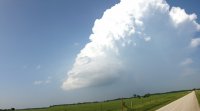
Started the day in Dodge City, and I was originally targeting the OFB/triple point near Salina. Changed my mind upon arrival at McPherson when I saw towering CU to my south, and none to my north. This was enough to start suckering me to the southern target. Thankfully, I stopped at Newton to reevaluate things again, and by that time, I could see some towering CU had formed in the northern target, and radar was showing a cell just starting to fire there as well. I booked it back north, and arrived on the storm just as it was producing a brief tornado in almost the same spot as where I saw the Bennington tornado back in 2013. The storm took a while to get its act together, but once it got started, it simply did not want to stop. I'm absolutely amazed at the duration of time that this tornado was on the ground!594211b7bee9417823599f8a9e0a018c.jpg 707331baf447505e445ab0288d7480ab.jpg 254de523c883543bb03321e57f99e222.jpg
 
We too started in McPherson and headed north at the sight of towers going up. We caught the storm in its early stages northwest of Bennington where we watched it produce the first tornado. We then tracked with it but much further south on the old US40 after realising the farm road we were on didn't intersect with the I70 east. We stayed with it until just past Chapman where we decided to hang back and get some behind the storm lightning shots.

first.jpg

start of cell.jpg pano.jpg tornado.jpg lightning 2.jpg
 
I too managed to catch the Abilene-Chapman tornado. It was certainly one of the best of my career, made even more remarkable by the fact that as late as midday I was relaxing in my hotel room in Woodward, OK and planning on taking a down day. Around 1 p.m., though, I suddenly changed my mind, quickly packed, checked out, and started the three-hour drive to Hutchinson, KS to try the triple point play. Never have I been more grateful for a stout cap! After arriving in Hutchison I opted to move east to Newton but I got caught in two frustrating construction/pilot car delays on U.S. 50. I then decided to blast north on I-135 toward a set of towers that were going up off of the dryline. One was a storm that was already orphaning west of Lindsborg, KS, so I continued north toward the much more impressive looking storm to my northwest. This first picture looks northwest from northbound I-135 south of Salina at the storm, which was then roughly over the Minneapolis, KS area:

IMG_5727.JPG

I missed the cell's first brief tornado, but I arrived under the base just as the storm appeared to be weakening over the hallowed (and still familiar) ground just west of Bennington, KS. I moved a bit east with the storm and saw a few small midlevel shear funnels before turning south on old highway 81. Once in Salina I decided to get ahead of the storm by hauling east on I-70, and this turned out to be a good move. I got off of the interstate at the Solomon Road exit, set up my tripod, and waited as the storm - now much better organized - moved closer from the northwest:

IMG_5771.JPG

A tornado soon lowered from a beefy wall cloud beneath the storm's base, and I knew we were in business. This picture looks northwest from the I-70 Solomon Road exit:

IMG_5775.JPG

I managed to get about 15 minutes of video from this location as the storm moved slowly to the east just north of my location. The tornado also began to fatten up nicely. The next shot shows the storm's overall structure at this point:

IMG_5413.JPG

I then gradually lost sight of the tornado as it became rain-wrapped to my northeast. So I continued east on 1-70, eventually stopping at the Jeep Road exit just east of Abilene. Once again I was able to tripod and capture another 15 minutes or so of the tornado, now fully visible and wedge-like after briefly thinning out into a straight pipe. The next two pictures and video look north from this exit ramp:

IMG_5469.JPG

IMG_5507.JPG


I then cautiously moved a bit further east on I-70, took some small hail, and let this beast move across the interstate in front of me. I made a half-hearted attempt to keep up with it on the backroads south of the interstate near the small town of Chapman, KS, but it was soon out of reach. As daylight faded I headed back to my hotel in Salina.
 
I began this day doing a damage survey with Tim Marshall and Brandon Molyneaux of TWIRL after the Dodge City tornadoes. We had just finished locating the deployed pod locations when we got an email from Karen Kosiba to race northeast and get to the dryline. We where about 100 miles south of the storm when it was first tornado warned, and we had just gotten there in time to witness the strongest tornado I've ever seen. We watched it from North of Solomon to as it passed south of Chapman, and for a while I was incredibly nervous for the town of Chapman. This was an absolutely unbelievable tornado the day after getting over a dozen tornadoes in Dodge City. Overall my week in the plains consisted of about 20 tornadoes. This was the last one, and what a tornado it was. Here's my full video:
Just a few of the pictures: 49ad5d3880db99c47f8904fe1336ef15.jpg3383a1d82859e4097b45110589f37d4b.jpgdcfad10aadcd03dd3a45cdfb2111bd06.jpg2aa894d53dd7486b345e783f5a042580.jpg78d50c3d7858183735dc6a5b69b8d979.jpg546199dc0f871ab90a51584fccb76773.jpg

Sent from my SM-N920V using Stormtrack mobile app
 
Targeted the southern outflow boundary, and ended up waiting for storms to fire in Newton KS. On the drive out there I noticed a boundary to the North as well and said to myself reminds me of the Bennington setup. Towers went up well to my North and just to my South at about the same time. I stuck to the southern target t0o long (first picture), booked it north when the storm failed to maintain itself and I saw the beast on radar as well as on the horizon with an overshooting top. I was well late to the show but still got to see the finale after an hour hail marry drive up to Junction City KS.

IMG_0353.JPG Tor Edit one.jpg Tornado 5-25-16.PNG
 
I finally got these ready for posting. Like most everyone else, I was able to change position 4 times to get in front of this beast. I only had 1 encounter with the law, which was a road block on the road to Talmage, I believe. One of the most exiting and satisfying chases I have done, with nearly minimal effort. I wasn't even going to go, but checked the radar after mowing the yard, and figured I might be able to catch up with it. I have missed so many significant tornadoes by 15 to 30 minutes, so this one makes up for the goofs.
 

Attachments

  • Abilene fat cone.jpg
    Abilene fat cone.jpg
    515 KB · Views: 216
  • wedge and edge of meso.jpg
    wedge and edge of meso.jpg
    468.4 KB · Views: 200
  • Solomon tornado 5 25 16.jpg
    Solomon tornado 5 25 16.jpg
    366.7 KB · Views: 240
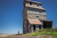
We started the day out in Dodge City where we had experienced tornado overload the day before. As we made our way east on Hwy 50, we stopped at a couple abandoned buildings east of Spearville, at a spot on the map called Ardell. We had passed these the day before while shooting some sunset pics after the Dodge City storm. My daughter is a bit of an explorer and spent a lot of time checking things out, including peeking into a window where she was hissed at by a huge, cranky gopher snake that had wound itself around some pipes dangling over an inky abyss.
29715ddcb15398a13b6bd3bcc3665858.jpg
Exploring a towering abandoned building in Ardell.

As we got further east, a long arc of clouds bordering hazy skies announced the dryline bulge. It was extremely cool to see it stretched out like that visually without even needing satellite. Although the satellite view was pretty impressive too, showing both the arc of the dryline and a boundary further east. Towers were trying to build on this eastern boundary, while others were brewing to our north near the triple (quadruple?) point. We gradually made our way eastward shooting landscapes along the way, watching the boundaries percolate, trying to decide between east or north.

By the time we reached Hutchinson around 2145Z, convection was gushing anvils to our north near Claflin while the Wichita towers appeared to still be working on the cap, so we headed northwest for the ongoing convection. When we got to a few miles southeast of Lyons by 2215Z, those anvils had gone orphan while a Wichita storm was finally taking off and looked like it had a nice, muscular updraft going. More self doubt followed as we drifted eastward and a new growing tower between Minneapolis and Lincoln to our north got going. I watched these two towers compete for attention north and southeast until Rt 61 a few miles southwest of McPherson when a final decision had to be made. I opted north, thinking that storm’s convection looked sturdier, had a backsheared anvil, overshooting top, hopefully the benefit of a boundary and better backed inflow to work with, and an easier intercept by this point.

e75fd6d963997b3064f57d14d84318fa.jpg
By 2254Z, southwest of McPherson, the choice of storm target was clear. (Left: storm northwest of Salina—check! / Right: storm east of Wichita—adios)

As we got further north on I-135, the storm was looking pretty impressive as it approached the north side of Salina. I wondered if Bennington would see a repeat 2013 performance—I appreciated seeing Cammie's photo of that first touchdown above.

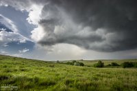
We headed off onto the grid about 4 miles north of I-70 and had our first look at the base. It was working on an RFD notch, but didn’t look too impressive at the moment.
0f94ef80575099c4279cadad511ad640.jpg
A corkscrew in the updraft west of Bennington [2349Z]

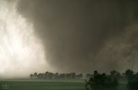
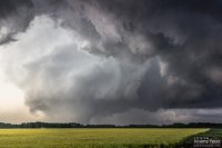
We got a little behind for a few minutes, but worked some very nice dirt road grid to catch up. After heading west another 5 miles, the storm really pulled together and we caught sight of a hazy, dark, cone tornado behind a thin veil of RFD precipitation. The pace of the chase really picked up after that. As we paced and worked to gain ground on the storm, the tornado grew in size while the choppy barrel meso above it took on Bowdle stylings.

e2a31032effd552cbe3c4b84f2b8f59c.jpg
Growing tornado and chaotically detailed meso [0016Z]

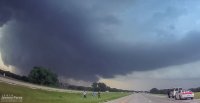
At 240th road, I headed south and got onto I-70 to try and gain some ground on it, snagging blind photos out the window along the way. Just a bit before the Solomon exit, we encountered a sheriff hollering at a tour van operator who was parked on the side of the interstate while his tour group was loping across the median. Yikes.
d72cc0ca35dc97972e6746bf7e03d7c8.jpg
Dashcam view of tour group getting busted for Interstate frolicking [0025Z]

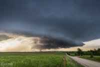
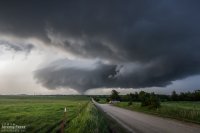
We made our way to the east side of Abilene and Indy Road just north of I-70. It was a perfectly elevated spot to watch the dusty, stovepipe tornado approach and widen into a large cone as it crossed our road a little over 2 miles to the north. It served up the best set of photos and video I’ve ever gotten of a tornado. A couple of locals, a father and I think his teenage daughter pulled up and talked about this being the first they’d seen even though he’d lived in Abilene his entire life.
a374863d614684aeb0126ef085b46413.jpg
View from Indy Rd north of I-70/northeast of Abilene as a stovepipe moves across the landscape [0050Z]
e5d3e25daff971f6d37cc5bd3535ed6e.jpg
Tornado and rippling RFD cut getting ready to cross Indy Rd. a little over 2 miles to the north [0054Z]
21ce05b54dc21daea53953a2769436aa.jpg
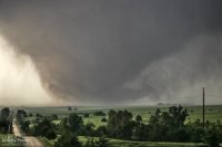
Tight video frame view of tornado base after crossing Indy Rd. [0057Z]

As it passed to the east, RFD shrouded the view and was pretty intent on knocking my tripods over, so we packed up and pulled back east onto Old US 40. Because the storm was nudging increasingly south and we didn’t want to play tag with the approaching tornado, we turned south on Rt 43 at Detroit to get some distance from it. I was concerned that by the time we found a good east-west road we might not catch back up until the river infested, choppy road network south of Junction City. So we lost it at that point and snagged sunset photos of a beautiful trailing cell before heading further south and shooting some nightscape shots with fireflies, stars and receding lightning near Antelope.
144ab585e7467b0b865118a426da66e0.jpg
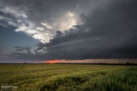
Sunset and striated structure on trailing supercell [0134Z]
a21683de76229120d02670bfbac7d279.jpg
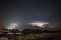
Stars, lightning and headlights reach into the sky near Antelope [0411Z]


Zoomable/interactive chase map


Video highlights from the chase

Full chase report with more/larger photos: Storm Chase - Bennington/Solomon/Abilene, KS || 25 May 2016
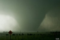
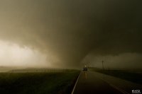
 
Made it to the EF4 Chapman tornado before it crossed I-70
I got to see the huge tornado for about 15 minutes before it went rain wrapped just east of Detroit KS
I lost the video that had a couple decent minutes of the tornado, although the photos still weren't great.
After it got wrapped in rain we hung out further SW and watched some anti-cyclonic rotation and the beast from a distance.
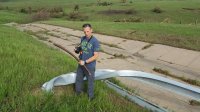
We checked out the damage the morning after.
That picture of me is on I-70, with a sign that had been twisted apart.
Those are the large girders, not the small type, I cant imagine the force it would take to twist one of those big boys like that.

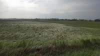
I also found it interesting how it laid down the grass like that just south of Chapman. I haven't seen that before.
FB_IMG_1464279376296.jpg Snapshot_4edit.png Snapshot_2edit.png FB_IMG_1464279418959.jpg
 
I just posted three videos that encompass much of the 45 minutes or so of the long-track EF-4 Abilene, KS tornado that I was lucky enough to capture. The videos show the very beginning of the tornado and some of its middle and end stages. I missed quite a few minutes of the middle of the storm as I was repositioning from the Solomon Road exit off of eastbound I-70 to the Jeep Road exit. I also don't have footage of the tornado as it crossed the interstate in front of me and moved south of Chapman, KS.


I didn't get nearly as close as some did to "Bennington 2.0" as others did, but from a distance we did watch the tornado nearly from start to finish. (Bailed a little early at the end to avoid getting into the hail core) The back to back days were my best pair of chase days, beating out Pilger/Coleridge in my opinion.

Here is a time-lapse of about one hour's worth of tornado footage cut back to just over a minute a half. (some segments were removed where trees/vehicles got in the way and when contrast was too poor to clearly make out the tornado)
 
Back
Top