2016-05-23 Reports: TX/OK/KS/NE/IA

Joined
Feb 22, 2015
Messages
164
Location
Norman, OK
What a day! Saw my first three tornadoes of my life (and chasing career) today with the old man near Woodward, OK. Started the day in Colby after seeing the Scott City tornadic supercell yesterday from a distance. Drove south through Garden City and Dodge City figuring the dryline/outflow boundary intersection would yield supercells with southeasterly near-surface flow in place (and also closer to the shortwave trough). Proceeded to drive to Buffalo, OK with upper 60s/70s dewpoints in place.

Watched several storms just east of town try to develop and get capped, until one updraft (that many others saw) seemed to break it, along with another cell near Coldwater, KS. I headed east on US-64 towards Alva to watch the southern storm develop a nice base with great inflow (>20-25 mph gusts at times), but it eventually began to become strongly sheared and excessively tilted (as did the storm to the north).

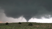
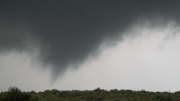
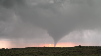
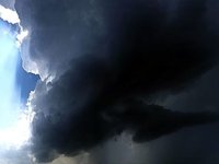
We then met up with Jon Strebler during this time and decided to head south on 34 towards Woodward to catch the rapidly developing supercell to the south (had a very impressive updraft that was far less tilted than the others). Ended up punching through its core (fortunately before it was producing any larger hail) and having a rapidly rotating wall cloud basically right on top of us on the other side. Tracked south to just N/NW of Woodward as the tornado sirens began blaring with inflow in excess of 30 mph. Eventually after a decent period with a rather ragged looking wall cloud, the storm tightened up and produced its first tornado, then proceeded to spawn at least two more. One of them was quite strong with rapid motion evident at its base.

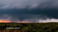
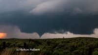
Below are a couple images (taken by the old man since I was taking video) of the first tornado. Unfortunately, the DSLR's battery died (without me knowing it was low of course) so we didn't get many, but I did get video of the whole sequence that hopefully turned out well.
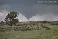
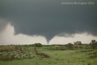
DSC00243.JPG
DSC00237.JPG
 
Stayed in Childress TX last night and decided that the triple point and associated boundaries looked best.

I openly wondered about my decision to stay north when the storm fired West of Childress, however Im getting better at being patient apparently.

The cell that produced the tornadoes got quit a late start, but it didnt take long before it started putting down tornadoes.

Its turning out to be quite the Chasecation....

Snapshot_14.png Snapshot_10.png Snapshot_25.png
 
We enjoyed lunch in Woodward and then watched the sky for several hot hours. While cells went in the Panhandle we stuck to the triple point like feature, but it took all the discipline we have. We also went after the Coldwater cell before coming back to Woodward. Congratulations Andy!

We approached from the east on 412 after swinging wide to avoid the core.
image.jpeg


Super fun chase day. Was able to not give in to the southern storms and wait up in the Woodward area until the north storm fired. Stationary supercell with at lease 4 tornado's. Fun fun. Here is a gopro timelapse
 
I was leaning toward Woodward the night before, but thought the morning's models looked better around Childress, and besides, that was a lot closer to where I was (Tulia). Got on the initial LP supercell near Hedley almost from initiation; watched it quite a while from a rest area along 287 where lots of chasers were watching the storm. Very convenient. Eventually the storm moved enough that I had to move, and I tracked it as far as Quail before it weakened and I turned my attention to the cluster of storms developing southwest of Memphis.

Eventually I got on the Turkey storm and watched it until dark. Really thought it was going to get the job done around 7:50, but it did not quite manage to. Then 2 hours later, well after dark, it did. But being due east of the storm at a point where the road to the west was closed, I was in no position to chase it after dark, particularly with the risk of flooding and roads in some places damaged by the previous night's flooding,

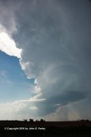
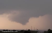
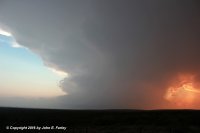
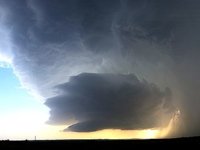
First picture is of the initial LP between Hedley and Quail. Second picture, the Turkey supercell when it looked like it was going to tornado around 7:50. Last picture is of the same storm, later and farther SE, around sunset.Hedley53416-FB.jpg

TurkeyVC2-52316-FB.jpg

Turkey52316-FB.jpg
 
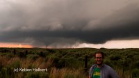
After tailing an LP Supercell into Kansas, we saw the Woodward storm and backtracked south and got under it. The base started wrapping up and managed to get four tornadoes out of it, including one after dark. Got my first sunset tornado!


a3ec14964054b8ceff4bdc9a907a325f.jpgUntitled by keltonhalbert, on Flickr

91637f3b988c3ff1b724442c7836839e.jpgUntitled by keltonhalbert, on Flickr

e3247da4dac474332efb87e38d54a905.jpgUntitled by keltonhalbert, on Flickr
 
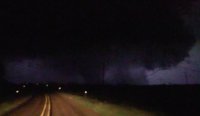
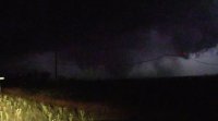
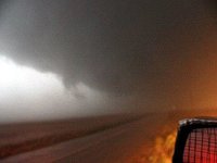
I caught the late tornado southeast of Turkey, TX (north of Northfield). Was on the storm from initiation when it rolled off the caprock and tracked east. Had pretty much given up on it about 9pm since I had to drive back to Houston that night. Was pretty far east when the first tornado touched down so I blasted back west. Caught some glimpses of the tornado north of county rd 656. Here are some bad quality video grabs.
IMG_2564.JPG IMG_2565.JPG IMG_2566.JPG IMG_2567.JPG
 

Daniel Betten and I started out in Elk City after lunch, but quickly decided to hedge more north toward the dryline-OFB intersection on the OK/KS border. After meandering up toward Shattuck, we endured a couple agonizing hours baking in the sun as Cu failed to deepen much; all the while, a full-fledged supercell was ongoing well to the S near Clarendon. Eventually, a couple updrafts developed along the OFB to our NE, which sent us off in that direction. While they dissipated in short order, an explosive new updraft over WWR became our next target, and ultimately proved fruitful.

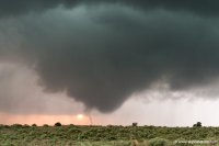
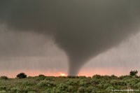
We watched the WWR storm from S of town for awhile early on. It's common for chasers (including myself) to overuse the "LP" monkier these days; this was one of those textbook cases where it really applied, though, at least for its first hour or so. Eventually, the tornado risk appeared to be ramping up visually, so we closed in on the base. We spent much of the first cycle darting back and forth through the main intersection, unsure whether to set up shop E or N of town. Thankfully, this first cycle was not close to producing, or we might've really blown it. When the second cycle began in earnest, we had finally figured out that the storm was drifting N, so we headed up that way and stopped on OK-34 a few miles N of town for the show. The main daytime tornado appeared to last 10-15 minutes, but was only intermittently condensed as a cone for a minute or so at a time. This would have been decent enough on its own, but finally getting the fabled "sun behind tornado" shot I've dreamt of year after year really augmented the experience.

f73decb69870c4d4d2a73875124462d1.jpg

81e810f3f63a60110a35bdbf12535631.jpg

Our only regret was failing to recognize that a paved E-W road was available a couple miles N of where we stopped on OK-34, which probably would have led us right up to the funnel. Still, with rain wrapping in the immediate vicinity of the tornado, positioning there might well have had its own downsides. A very solid chase day that would soon be overshadowed by its successor, but we went home more than content, regardless!
 
Started this day in Erick, OK. Made my way over to Wellington, TX, then headed east for the Quail/Hedley storm that ended up dying a slow death. I spent a lot of time hanging out near Quail, waffling about whether to go for the I-40 or Quitaque/Turkey storms. Finally, I'd had enough with the struggling storms up north and headed down to Turkey at the last possible minute. As I arrived, the base lowered and an RFD cut sliced in, and I thought we'd have our first tornado, but it didn't happen. I made it under the base on FM 656 and stayed there until dark, watching several occlusions take place, but nothing could get it done. Once it got dark and I lost visual, I decided I'd had enough and bailed east. Direct result of El Reno making me not want to tangle with a situation I didn't feel 100% confident in, plus there was only one road in this area - limited escape options. I could not find a pull-off to the east that had a view, so I missed the after-dark tornadoes happening just a few miles away.

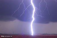
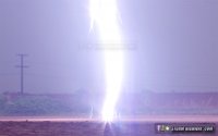
The day was still a success, as I bagged this great close lightning bolt before sunset between Northfield and Turkey. I had my 50mm (narrow view) lens on trying to get more distant CGs, which makes it remarkable that this bolt was so nicely framed! There are upward leaders visible coming up from the ground:

g-4359.jpg
g-4359crop.jpg

Here is my full chase account with more images:
http://stormhighway.com/may232016.php

I also posted my 4-way dashcam timelapse from this day here:
 
Last edited:
Good day all,

This is my reports from the Texas panhandle area starting near Shamrock, Texas with a chaser convergence there, then to near Hedley, Texas, and finally with tornadoes after dark near Turkey, Texas.

m17chc3.jpg

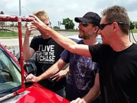
Above: Chaser "convergence" in Shamrock, Texas near I-40 before a great chase day on May 23. From left to right: Mark Robinson, Jason Persoff, and George Kouranis. These folks were checking out my hail grills on my vehicle.

m17dows.jpg

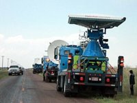
Above: Doppler on wheels (DOW) vehicles associated with the TWIRL project along highway 203 near Hedley, Texas. Tim Marshall and Josh Wurman is in this group of researchers as well.

1). May 23, 4:30 PM - Interception and penetration of a very severe thunderstorm to the north of Hedley, Texas in Donely County to the northwest of Highways 287 and 203. This storm was an LP supercell storm. Large hail to golfball sized, 30 MPH winds, frequent lightning, and light rain was observed with this storm. The storm undergone downscale development and dissipated after a few hours. Conditions causing the storms were surface heating, a low pressure trough, dryline, and upper trough. A 2009 Ford Escape SUV was used to chase the storms. Documentation was digital stills and HD video. A tornado watch was in effect for the area until 10 PM CDT.

m17lp4.jpg

Above: A view of the anvil and main updraft of the LP supercell near Hedley before undergoing downscale development on May 23. This storm was producing golfball sized hail.

2). May 23, 9:00 PM - Interception and penetration of an extremely severe and tornadic thunderstorm to the southeast of Turkey, Texas in Hall County and east of Highway 70 along county road 656. The storm was an HP / classic supercell storm. This supercell had a striking visual appearance, and multiple funnels were produced. The storm back-built to the northwest after dark, and intensified significantly. A large tornado was observed south of my location on 656 at about 9:30 CDT. This was a multivortex / cone tornado, mainly lightning illuminated. This tornado moved southeast, then turned north, and moved northwest! Winds gusting from 80 to 100 MPH with torrential sideways rain and hail to tennis ball sized were encountered at this time. The tornado evolved to a wedge tornado, then crossed the road to my east, then a large cone tornado to my north before lifting. Frequent lightning with close hits was also observed with this storm. The storm also caused flash flooding, but the tornado remained over open country. Conditions causing the storms were surface heating, a low pressure trough, dryline, and upper trough. A 2009 Ford Escape SUV was used to chase the storms. Documentation was digital stills and HD video. A tornado watch was in effect for the area until 10 PM CDT.

m17sc17.jpg

Above: Tail end "Charley" classic supercell storm to the north of Turkey, Texas in Hall County late in the afternoon on May 23, 2016. This storm would eventually produce tornadoes after dark east of town!

m17tor35.jpg

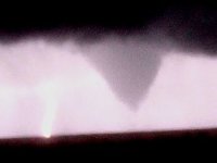
Above: Lightning illuminated cone tornado (with lightning strike to its left) well after dark to the southeast of Turkey, Texas on May 23.

m17tor38.jpg

Above: Tornado continuing to move NW, crossing the road where I was a few minutes earlier in its multivortex stage. This view is looking east on County-Road 656. Tornado is lightning illuminated, and is centered pretty much over the road and to the right of the center of the picture.

m17tor40.jpg

Above: View of large cone / wedge tornado to my north after backing off earlier and returning east on County-Road 656. The view is due north and I am in near calm winds now. A loud roaring sound could be heard as I took this picture. This tornado lifted a few minutes later.
 
Back
Top