• While Stormtrack has discontinued its hosting of SpotterNetwork support on the forums, keep in mind that support for SpotterNetwork issues is available by emailing [email protected].

2016-05-22 EVENT: TX/OK/KS/CO/NE/ND/SD

Mike Marz

EF3
Joined
Mar 11, 2014
Messages
209
Location
Minneapolis, Minnesota
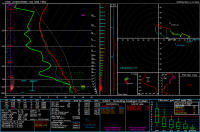
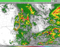
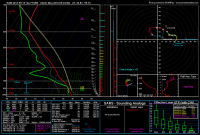
Sunday is looking like it has decent chase potential anywhere from the Northern Plains down through the Southern Plains. All of the models have been forecasting some degree of troughing to begin impinging upon an increasingly warm/moist sector all the way from Texas up through the Dakotas. The NAM is now in range of Sunday evening and it is showing a sharp dryline setting up anywhere from west/central Kansas down through the Oklahoma and Texas panhandles. 850mb flow is looking to be anywhere from 30-45 knots all across the warm sector and it is backed. The problem I can see in Sunday is that the 500mb and upper levels are quite weak in some areas that have the highest instability. Along much of the Kansas dryline where as much as 3-4000 MLCAPE is forecast to develop, the 500mb flow barely pushes 30 knots... Down in Texas however, it looks like possibly 45-50 knot 500mb flow could intersect the DL. Obviously, as always, things will continue to change, blah blah. Just thought I would get this thread started and see what people are thinking. As of right now, If I chase, I would favor the Texas part of the dryline. Here is a nice cherry picked sounding from Texas.
0a2ef6a50c07b11aa356055305d43593.png
 
Last edited:
Just looked at both the NAM and GFS as it came out for this day - Holy smokes, great split flow coming out. I would tend to agree, the southern end in the extremely rich and deep moisture would be favored, but there is enough to get it done up north around Oakley too.

Here's a full resolution BUFR sounding from down near Abilene. There's not much to dislike here, that's for sure!

956232347c67734afefad7e45820ee43.png
 
I noted the better upper levels in TX on the 12Z NAM also. Even if DPs are overdone by NAM, it still looks like instability would be good. If 10-20kt storm motions pan out that's also a bonus. Storm relative anvil winds and > 1.5-inch PW would seem borderline for HP storms in that area though. A learning opportunity for me will be to see what effect the split in H5 flow would have on storms if it does indeed occur over that area. Plan B in my case may also be triple point based. Less moisture there could mitigate HP frustrations and maybe more photogenic storms.

[Edit: Just saw the forecast sounding Ben posted. I hadn't checked GFS. It nudges slightly better 250mb winds over the TX dryline area—maybe enough to help with storm mode if that pans out.]
 
Last edited:
Something I'll be keeping an eye on—NAM (and now including 4KM) move an MCS South/Southeast from SW Oklahoma into N Texas Sunday morning. The outflow boundary may be worth watching if it lays down early enough to undergo some modification and if it's close enough to the dryline for storms to interact with before the evening cap pinches them off.
Screen Shot 2016-05-20 at 8.35.36 AM.png
 
Yes that outflow boundary OFB, assuming OK morning rain, will be a huge influence in final target selection Sunday. No OFB and I would have to say triple point up north. Up there all levels are backed, but not VBV, so they still shape a good hodo just turned about 30 degrees.

However I believe an OFB will be present in Oklahoma or even the Texas Panhandle. Such an OFB would set up the low levels with locally backed winds. Upstairs is looking great per the soundings posted above or just a quick look at latest NWP. If indeed the OFB materiazlies I would favor the southern target.

Keep in mind such mesoscale forecasts shift around. If the hi-res NWP shifts the cells, look for a reason. Perhaps NWP is shifting the OFB. Better yet follow the OFB on surface and visible satellite. Good luck and chase safely.


"Keep in mind mesoscale forecasts shift around". Is that why there are usually uncertainties even on the day of the event because I noticed that the mesoscale factors are usually why? For example, whether or not there is still cloud debris, how fast AM convection clears up and like you said, if there's an OFB.
 
Right now I am favoring Texas. 60's dews on the cap rock with that veering profile is enough to have me interested. If we have an OFB set up just right that could make the difference between a really good supercell event to a great tornado event. There has been a trend this season for morning convection to clear out early to allow for airmass recovery.
 
A bit of a tough decision for tomorrow, and probably won't lock down a target until the morning, but I'm leaning toward somewhere between Lubbock and Midland. The NAM4KM and WRF are both breaking out a little MCS junk in the panhandle in the late morning hours, so I wonder if the atmosphere further north will be able to recover in time. Perhaps this will put down an outflow boundary, however. Visible satellite will probably play a large role in my decision making tomorrow. Otherwise, it looks like a crapshoot anywhere along the dryline.
 
As others have noted, largely a crapshoot today. In GCK right now and will see how things shape up in the next couple hours. Thinking similar region to yesterday (southwestern KS) or down into the TX panhandle. NAM and HRRR flow at 700mb and 850mb are better in NEB/KS, but 300mb is somewhat more directionally favorable in TX as noted in the 13Z SPC outlook. HRRR breaks out cells in both areas of interest. NEB is also interesting but I am partial to the southern target due to proximity as well as setup for tomorrow. Noted also that 13Z SPC dropped the 5% tornado risk to the southern portion of the slight risk area, whereas it had previously extended north/south almost as much as the entire slight risk.
 
Given the somewhat large area of so-so meso-driven tornado potential late in the day, will likely focus on surface (including outflow boundaries) to determine target area. With high capes, steep low and-and-mid level lapse rates / little cap and most importantly, outflow boundaries, would not be surprised to see a few landspouts with initial development, so will lean towards western edge of outlook in regions with best road networks. Happy chasing!
 
I'm calling North Platte, NE. Folks talk about 8 O'Clock magic in Pratt KS, I think N Platte is a hidden gem too, tornadoes dropping without a 2% risk and when least expected. Let me put down my rabbit's foot and look at the models for a minute:

Currently 67 over 62 with SE winds, winds progged to back further as the Low in CO moves NE and draws in moisture a little west to the cold front which is currently visible on sate;llite with a defined line NNE from Ogallalala. Looks like the start of a cu field south of Ogallala. Earlier cloud cover is burning off as seen in vis loop, so surface heating shoul increase to 75-80F. HRRR has storms breaking out after 20-21Z.

Addition: I believe N Platte is it slight elevation so dew points of 55F+ are ample there
 
Last edited:
"Keep in mind mesoscale forecasts shift around". Is that why there are usually uncertainties even on the day of the event because I noticed that the mesoscale factors are usually why? For example, whether or not there is still cloud debris, how fast AM convection clears up and like you said, if there's an OFB.
Yes you got it. Sorry for the late reply. Sunday was tough with multiple boundaries in the southern target alone. HP beasts went on the US-287 boundary I'm calling it. Northern Panhandle was more photogenic on another subtle differential heating boundary. Much of the week will depend on boundaries. Chase safely and good luck to all!
 
Back
Top