• While Stormtrack has discontinued its hosting of SpotterNetwork support on the forums, keep in mind that support for SpotterNetwork issues is available by emailing [email protected].

2016-05-16 REPORTS: OK/TX

Joined
Dec 8, 2003
Messages
1,419
Location
Southeast CO
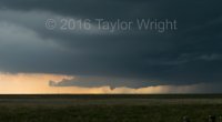
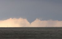
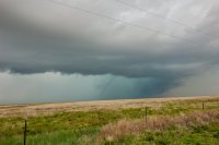
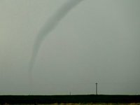
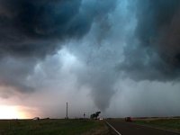
I met with friends and chase partners Bill and Chris Robertson in Boise City. There was a storm just off to our west in New Mexico, so we drove to it, then positioned ourselves between the storm and Clayton, since it was moving just about due south at the time. It dumped a lot of precip and at the time I thought it might be done, but we headed back toward Boise City as the storm turned to the ESE. Here's a short vid of the tornado that developed near Felt:


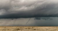
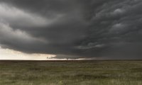
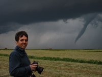
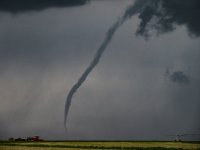
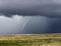
Bill and Chris have been chasing for quite a few years, and they have had worse luck than anyone else in history. This was actually, kinda sorta their first ever tornado, and we followed it up by seeing the one north of Dalhart nearly an hour later, though from a long way away on 287 SSE of Boise City. Here is a still image of that:
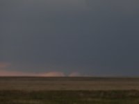
DSC00104.JPG

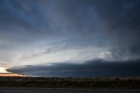
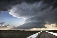
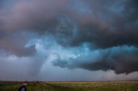
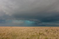
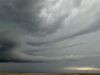
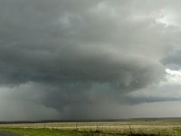
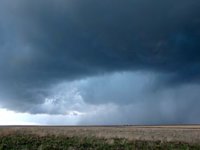
I must also note that there was some jaw-dropping, incredible structure out there today. A taste:
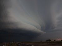
DSC00105.JPG

It's kind of a relief to finally get SOMETHING after missing everything else so far this year, including Wray, which pretty much initiated right over my head, but I was busy with other stuff that day. Hey, I'm ahead of last year, when my tornado count was 0 the morning of May 27.
 
Last edited:
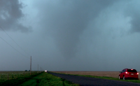
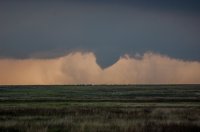
I was on that same storm up in the NE corner of New Mexico, but I thought it was looking less organized and rather messy, so I let it go and went after the next one to the SW. That would be 20 or 30 minutes before it dropped the first tornado. )-: However, it turned out OK, as I got this nicely backlit funnel near the TX/NM state line southwest of Texline on the next storm down. All in all a very nice day with 3 different supercells, all with their photogenic moments. Will post full report as time permits.

funnel51616-fb.jpg
 
I targeted Woodward yesterday, with the intent of moving west or south, on the lookout for something on the dry line near the warm/cold front. When I got there, it was way too cold and socked in with clouds, so I moved on to Canadian. By the time I arrived, subsidence was killing every last cloud in the eastern Panhandle, and the storm in the northwest corner had gotten its act together. Since it was a little too far to try making it before dark, I figured I'd cut my losses and wait for it to come to me around nightfall, in the hopes of getting some good lightning photos. There wasn't a good lightning show to be had, but the presentation it made when it did arrive was pretty outstanding.

IMG_0050.jpg

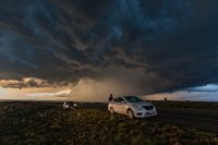
I got this shot from about 5-6 miles north of town. This is looking just south of west. Really cool structure. At the time, there was good strong inflow at my back. In about 20 minutes, it was a lot closer, and things shifted to very cool outflow. Radar presentation had weakened a little bit at that time, with the really high dbz values falling off, and lessening of hail reports, so I figured I could head back to my hotel in Canadian. That...was not a very good idea. I made it about a mile in before getting blasted with what I would guess was pretty close to hurricane force wind and 1-2" hail. After 12 years of chasing I finally waded into a major hail core by accident for the first time, and the passenger side of my car paid the price. :P So I sat for about 15 minutes while it passed through, in zero visibility, with it sounding like my car was in an exploding fireworks factory. The passenger side has more dents than the roof.

Thankfully, the windows held up. I attribute that partly to the tints, which offer some additional security. One of my taillights cracked a little as well. But all in all, the car survived. There were 3 tornado reports very close to my position, that I'm a little skeptical of. While the storm did have a very broad area of rotation, the winds at the surface were blowing out, and more than strong enough to do the reported damage, all the way from the time when I packed it up.

Heck of a day.
 
I had a similar chase as @Bob Schafer did. I missed the storm as it initiated but I wasn't too far off and met up with it north of Stratford, TX. There weren't many road options so I also viewed that tornado from a distance. I agree on the structure, the storm was very beautiful at times.

71042e3dc504f1c504951ebd99b9d280.jpg

<iframe width="560" height="315" src="
" frameborder="0" allowfullscreen></iframe>
 
I left Dallas around 8am with a target of Stratford, TX. I figured storms would fire further west and make their way slowly to the east while gaining intensity. The first cell went up before I even got to Amarillo, but luckily I got to it before it did anything. I was barely able to see the first Felt, OK tornado form behind the rain, then it became more visible, but the condensation funnel was not in contact with the ground. On Reed Timmer's video, however, you can see that there were some small vortices on the ground at that time. The storm formed a wall cloud to the east of that tornado, which started rotating really rapidly, then got obscured by the rain. I went east out of Felt until I could see the inflow, then turned around and saw the 2nd tornado behind me. After that one I dropped south through the RFD with the intention of following this storm east, but the road I was going to take was not paved, and I wanted to stick with paved roads. I had not had data in a while, so I had no idea what other storms were around, but just happened to look west and saw a funnel halfway to the ground. Confirmed this morning that this one was also in contact with the ground. Definitely my best chase so far this season!

Here is my video:
 
I really enjoyed this chase. The setup looked pretty good the day before, then pretty crummy the morning of, then turned out to be pretty damn good realtime! We caught one tornado northwest of Dalhart, unbelievable structure on the storm that passed between Hartley and Channing, and a little baseball-sized hail south of Masterson. Oh, and the Dalhart construction nightmare was a healthy reminder in route planning for safety!

Full log here: http://highwaysandhailstones.com/storm-blog/may-16-2016/

Dalhardt tornado_A2 copy.jpg
Dalhardt supercell copy.jpg
 
Not much to add here. Chased the OK and northern TX panhandles and witnessed 3-4 brief tornadoes, 2" hail, and good structure. Saw the first Felt, OK from a distance with horrible contrast. Finally got in position to see the next brief touchdown SE of Felt. Had a very brief spinup in the rain about 50 yds in front of us on HWY 385 about 1 mile south of the TX/OK border, can see it on video pretty well. Next caught the next brieft 'maybe' touchdown from a distance of the Perico tornado/funnel. Haven't even looked at DSLR pics yet but here are some video grabs. IMG_2433.PNG IMG_2434.JPG
 
Fun first day of a chase-cation! As a guy who only gets out 10-15 days a year its just fun to get out! Started off in Boise City, OK all alone, but that suddenly changed. Awesome day chasing through NM, TX, and OK. Saw 3 tornado's caught 2 on video! Excited for more days ahead!

 
We were near Boise City when the 2 initial cells started to fire. We continued up toward the more northern cell but it was hard to make out any decent structure initially. After realising our road was going to take us too far north, we backtracked and headed west to get back under it again. We watched it roll past but still weren't in a great position to to see any structure, We continued east with it. As out paths grew closer, it started to take shape and look all ominous and beautiful. Through the wall of rain we thought we could make out a funnel. Sure enough as the storm tracked nearer the funnel emerged from the rain and we watched, mesmerised by the rotation near the base of the cloud and watched as it roped out, triggering an applause from us and a handful of other chasers nearby.

After this we caught the funnel north of Dalhart. We found ourselves on a perfect road position wise but when we tried to stop there was always a massive fence in the way, which was a bit annoying so going to have to settle on this cropped 'out the window' fly by shot. We never actually saw the funnel reach the ground but saw it get very close.

We finished the day with some great structure on one of the tail end storms before getting unexpectedly pelted with tennis ball size hail on the US87 south of Dumas. Our car unfortunately has a few roof dents to show for it. For us, one of the best days so far this year.

IMG_1995.jpg IMG_1998.jpg IMG_2015.jpg 610_1206.jpg
 
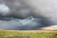
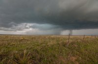
Here are a few more pictures from my chase. The first is from the first of the three supercells I observed, taken north of Clayton, NM along NM route 406:

949663da67238a6b4829c644efb9e0ce.jpg

Here is another picture of the tornado south of Texline, TX:

307f09c0dfc6ecb89fef9623edd7d149.jpg

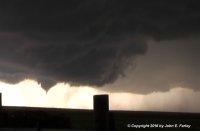
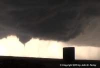
Later, while I was stuck in the construction jam in Dalhart, I saw this:

[Broken External Image]:http://www.johnefarley.com/Dalhart51616.jpg

Edit: Not sure why this says "broken image"; it works if you click on it.

I could not determine rotation with this feature, but it certainly looked like a mid-level funnel to me. I think a lot of chasers may have missed this because they were facing away from it in the construction jam; fortuitously, as it turns out, I had tried unsuccessfully to go around the jam to the east, could find nowhere to cross the railroad tracks, and had to come back west. I saw it while I was stuck facing west trying to turn left back onto 87.

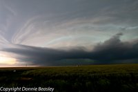
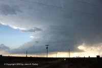
And finally, the gorgeous LP supercell near Channing:

65e82135a6c465fdaf554a1606d339a1.jpg

My full chase report, including video of the tornado, can be found at:

http://www.johnefarley.com/chase51616.htm
 
Last edited:
I had a wonderful chase this day. Thank God as I made the drive from Omaha despite lots of questions with the setup. I really liked the hodographs and hoped enough moisture and clearing would make the setup worth it. The morning of things didn't look too good and I almost thought about driving back home from Dodge City, KS where I had driven too on Sunday. Monday I drove down to Guymon and then towards Boise City as the first storms formed in Southeast Colorado. Eventually met the first cell near the New Mexico border. Initially it didn't look that great, but eventually developed a few short lived wall clouds and a funnel. We dropped south on the best road we could find and ended up heading towards Felt as the storm was to our north. Suddenly we saw the Felt tornado come out of the rain. We stopped and took pics and video for the last 5 minutes of the tornado's life.
From there we dropped south a mile off the main highway with the rest of the chasers and stopped a mile or 2 down an east/west road. Got out of the car to take some pics of the storm when we noticed another tornado back in the rain to the west.
After that we dropped south into Texas and stopped a couple times for pics of the storm and it's beautiful green core. We almost stayed too late at one stop and were blasted for a while with severe winds and heavy rain. We got far enough south out of the storm and were able to see what was the New Mexico cell and was now west of Dalhart. Could see forever to the west and watched a wall cloud form, followed by a funnel and a brief tornado. Pretty sure it touched down anyway!
We watched the storm as it headed towards Dalhart, but it seemed to weaken, at least it's rotation did and facing a 10 hour drive home, we decided to head back to Omaha. Arrived home at 430 in the morning on Tuesday after putting on 1350 miles. My wife thinks I'm crazy or stupid or probably both! Well worth the trip though!

DSC_0061edit.jpg DSC_0070 edit.jpg DSC_0080edit.jpg DSC_0090edit.jpg DSC_0109edit.jpg
 
Good day all,

May 16 was a fun chase day with chase partners Mark Farmer and Derek Sibley from Florida, who met up with me on May 15 near Decatur, Texas and would accompany me for the main chase day, May 16, and return on May 17. Below is my detailed chase log for May 16, 2016.

1). May 16, 5:00 PM - Observation and indirect penetration of an extremely severe and tornadic thunderstorm from near the Oklahoma / New Mexico border north of Highway 412 / 56 in Cimarron County near Wheeless, and east and southeast to near Highway 385 near Boise City and eventually east and southeast towards Stratford, Texas from along Highway 287. The storm was a powerful classic supercell storm that evolved to HP. This cyclic supercell storm produced at least three tornadoes, two of which were observed (one near Felt, Oklahoma and another along Highway 56 / 412 SW of Boise City). The first was a stovepipe that came out of the rain (looking NE from Highway 56 / 412) then evolved to elephant trunk and roped out after 10 minutes. The second was a cone tornado that lasted about 4 minutes southwest of our location during another storm cycle. The third was barely visible and rain wrapped west of Kerrick, Texas as the storm became highly HP. After that, the storm evolved to a bow segment and merged with an MCS (storm cluster) as it neared Stratford. The storm core was not directly penetrated, but had hail to baseball sized. Golfball sized hail was observed from our positions with this storm, which left some dents on the vehicle. The storm also contained torrential rains, 70 MPH wind gusts, and frequent lightning with some close hits. The storm also had a striking visual appearance with many inflow bands and striations. These storms were initiated by upslope wind flow and surface heating. They were sustained by a low pressure area, upper trough, stationary front, and advancing dryline (triple point). Documentation was digital stills, audio, and HD video. A 2016 Toyota Yaris was used to observe the storms. A severe thunderstorm and tornado watch were also in effect for the area until 10 PM CDT.

m17rfd4.jpg

Above: Rapidly wrapping RFD and mesocyclone intensification as the supercell storm continues moving east and southeast west of the OK / NM border in Cimarron County on May 16.

m17band2.jpg

Above: Amazing inflow banding and beavers tail features associated with the intensifying supercell storm west of Cimarron County, Oklahoma on May 16.

m17tor20.jpg

Above: Initial development of the soon to be Felt, Oklahoma tornado, looking northeast from just north of Highway 56 / 412 and east of the OK / NM border on May 16. This feature was seen wrapping up, intensifying, then becoming visually lost in the rain.

m17tor21.jpg

Above: Continuing northeast on Highway 56 / 412 and near Felt, Oklahoma, a large stove pipe tornado emerges from the rain wrap around 5 PM CDT on May 16.

m17tor24.jpg

Above: The Felt, Oklahoma tornado on May 16 beginning to occlude and rope out. Close up shot.

m17tor25.jpg

Above: Second tornado near Felt, Oklahoma southwest of our position, and over Highway 56 / 412. This was from the second "cycle" of this supercell about 15 minutes after the first tornado lifted.

m17cnav1.jpg

Above: Looking northwest of Amarillo, Texas, a supercell storm looms high into the sky late on May 16. Note the airplane and contrail to the left going south of the storm at high altitude. This storm was producing baseball sized hail at the time.
 
Back
Top