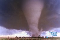
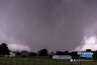
I usually don't post on events that are this old, but today I realized that I never made a formal write-up of this chase on here or even on my own website for that matter. Being the third anniversary, I think it's appropriate to at least give an account of this chase. Back in early 2017, I did record some commentary of this chase and I'll post at the bottom of this.
Anyway, I left Oklahoma City on the morning of May 9th, 2016 for a target near southeastern Oklahoma or adjacent northeast Texas. It was a bad area to be chasing and it wasn't long before I lost cell service, including radar data, in hilly terrain. Once back "on the grid," I quickly realized that supercells were forming along the dryline, well to my west. This was one of the rare Oklahoma chases that I really botched.
My view in the morning was that winds were not going to back "enough" ahead of the dryline, so I favored an area where winds were already out of the SE, in vicinity of a remnant boundary. Well, short-range models in the morning showed southerly winds along the dryline, but they did back to SSE/SE by afternoon. Luckily, I had enough time to turn around, once I realized this, in order to change course and get back west in time to see a tornado.
I set up south of Boswell, OK, just on the Texas side of the Red River. Through fumbling with multiple cameras/video cameras, the "best" footage I managed to get was from a camcorder that I placed on the roof of my car:
It's not the most compelling tornado video ever, but considering my initial target was over 100 miles off, I'm lucky I saw anything at all. For logistical reasons, I couldn't get much closer than I did. I'm also fortunate that I found a partial clearing on the roads I was wandering, as it was a heavily forested area.
Shortly after this video ended, I headed east and eventually north, but I did not witness any more tornadoes. I did, however, catch a vivid sunset just north of the Red River in the same general area. It was a nice end to what started out as a potential chase debacle.

It's a good reminder to not overlook the dryline, especially if there is favorable shear/instability. Even if near-surface wind fields had just stayed southerly, upper level winds were southwesterly with favorable timing of shortwave energy. The end result was a much better wind profile than I had originally expected. Based on OUN soundings, 500mb winds veered back to a more westerly direction by 00z 5/10.

A little more background about the area I was chasing. If you're not too familiar with southeastern Oklahoma, it's probably the worst part of Oklahoma you'd want to be chasing in. Aside from hills and thick forests, some of the roads are very windy and there can be little to no data service for radar access, observational analysis, etc. At one point, I was driving on a paved road that had corners so sharp that the road sign suggested a speed of 10 MPH. This is clearly not ideal for chasing and the area I was in reminded me more of West Virginia than Oklahoma.


