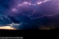
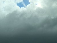
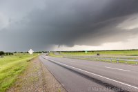
My morning forecast target area was the area between Sulphur Springs and Paris, TX. The NAM and GFS didn’t agree on how fast the dryline was going to mix east, so my chase partner and I didn’t leave Plano, TX until around 3 PM. His headlights quit working, so we had to make a run to an auto parts store to get a new relay. Our new target area was Durant, OK. We saw our first wall cloud to our west/northwest at 4:52 before we even crossed the Red River. I took this picture at 5:05

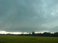
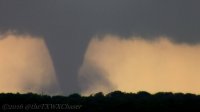
We ended up stopping on the south side of Calera, OK (just south of Durant) and continued to watch the storm try. At 5:09 OUN issued TOR 20 for the storm. At 5:20 we say a funnel start to form and I thought I hit record; instead I took this still pic. Less than a minute later the funnel was gone and I realized my mistake.

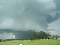
At 5:24, we noticed rising scud into the base, and another rotating wall cloud quickly formed. I started recording this time and at 5:26 got video of another brief funnel (still frame bellow). Before I could hit the dial button to report it, it was over. We measured 15 MPH inflow, which surprisingly is the strongest inflow we measured all day. At 5:34 OUN issued TOR 34 for this storm.

The storm was basically going right down US 70, so we decided to get going and try to stay south of it on OK 70E. The storm continued to cycle up and down and looked like it would produce several times. We watched it produce another wall cloud over a field with some cows and I have never seen cows run that fast. OUN continues TOR 24 at 5:53 and issues TOR 28 for the same storm, now near Blue, at 5:57. OK 70E started to go south for a while and the storm started to pick up speed, so we got behind and couldn’t keep up. At 6:12 TSA issues TOR 30 for western Choctaw county and according to the survey it produced an EF-3 tornado between 6:24 and 6:42 in the Boswell,OK area. As I noted, we were behind and at 6:35 we say a brief funnel for about 2 minutes. I suspect this brief funnel may be behind the tornado that went thru the Boswell area and is not the Boswell tornado. I didn’t take a radar screenshot at this time, so I need to go download and review it.

OK 70E turns and goes north and meets up with US 70, so still trying to stay south of US 70, we took E2210 and despite it looking OK on a map and even being on Google Street View, it turns into a gravel and then dirt road. We’re lucky we where behind the storm at this point, as the Boswell tornado came within less than .5 miles of that road, it was tree lined, very muddy and narrow, and even had water over the road at one point.We reached the pavement again just before OK 109 and some locals told us we just missed the tornado. We took OK 109 into Boswell and crossed the damage path. Before we even got to the main part of town, we noticed a wall cloud starting to form again to the east of Boswell. We turned on US 70 at 7 PM and noticed a huge beaver tail to the east and we stopped just east of Boswell from 7:04 to 7:12 to take pictures including this fantastic picture of a huge beaver tail. I wish I would have shot video, as it was moving towards the main cell extremely fast. You can also see a small wall cloud under it.

Survey says the Hugo, OK EF1 touched down at 7:02 and continued until 7:10. While this beaver tail/wall cloud pic above was taken looking toward Hugo during that time, based on radar snapshot, I believe the Hugo storm is in front on the one we took pictures of. There was 3 areas of rotation in this storm. We got some nice rainbow and wall cloud pics driving towards Hugo.


We drove thru the Hugo damage path and continued on US 70 and enjoyed watching the storms to our south on the Texas side of the Red River. We stopped at the Love’s in Valliant, OK for dinner and took some pictures of the storms to our south in Texas. We took 98 and 37 south across the Red River into Texas. But as soon as we crossed into Texas we had to go west on FM 195 to stay north of the Texas storms. We enjoyed the lighting show on the way home.
I learned or was reminded of a few things on this chase:
- Carry spare headlight relays, having no headlights would be very bad
- There is no APRS digiapeater coverage in SE OK (good thing I beaconed via Spotter Network too).
- Just because it shows up on Google Street View, doesn’t mean the road is good. Avoid E2210 in SE OK.
- Make sure you hit record and not still pic.
- Radar coverage isn’t great in SE OK. Luckily there are 4 to choose from, but the beam height is pretty high on them.


