• While Stormtrack has discontinued its hosting of SpotterNetwork support on the forums, keep in mind that support for SpotterNetwork issues is available by emailing [email protected].

2016-05-07 REPORTS: CO

Joined
Jan 16, 2009
Messages
774
Location
Kansas City
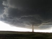
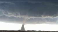
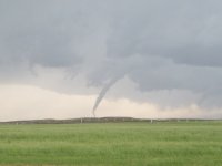
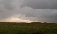
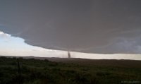
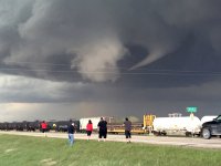
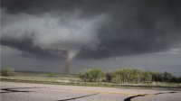
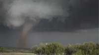
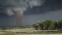
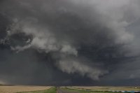
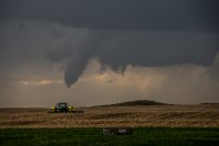
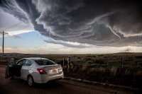
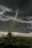
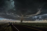
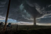
Headed out from KC around 7:30 and got to just East of Fort Morgan when the cells started to fire South of me ... we all know what happened next ... Colorado Magic! Amazing day and I know there will be a lot of great photos on here but here are some quick ones of mine. Congrats everyone that scored ... This was probably my favorite tornado ever.


1.jpg 2.jpg 3.jpg 4.jpg
 
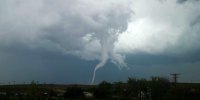
Yeah, it was a fun day today! Here are few shots from the two tornadoes I encountered near Wray, CO. The first was shot was from the first tor warned cell. Was on the ground for a few minutes. The second was a sight to see! Was sorry to hear there were some homes damaged... but also heard there were no injuries. I'm hoping that was the case 'cause some ambulances were in a hurry towards the affected area.
Tornado1_May7_2016 copy.jpg

Tornado2_May7_2016 copy.jpg
 
Glad to see so many people caught the Wray storm. I went out after structure, and while I didn't catch that big supercell I wanted, I did enjoy myself...and had a chasing first:

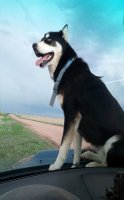
Meet the dog (this is not my dog, random farm dog that came to visit while I was changing batteries on gopro). Yep, that's exactly what it looks like:
07MAY16_CHASE VISITOR.jpg

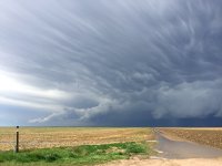
And some structure (Pano from phone):

07MAY16-PANO001.jpg
 
Chased Colorado on Saturday missed the show. Stayed with the junk further west too long then didn't want to dent up my rental car so options to the Wray area storms just weren't there. I get quite used to missing good storms nowadays.IMG_2369.JPG IMG_2370.JPG IMG_2373.JPG
 
We've been coming to the US now for the last 7 years for our chasecation and this has got to be the best day ever, in our favourite state too - and it was only our first proper day chasing! We started out in Brush, CO and headed south. We were torn whether to head in towards the storms nearer Denver but it was starting to look a little messy so we headed east and watched as a couple of more discrete cells headed north. We tracked with these, witnessed the Eckley tornado from a distance but managed to get up close and personal with the Wray beauty. We watched the storm wrap up from a nearby car park area with a bunch of other chasers before we then headed up the road and pulled into a side road where we watched in awe as the tornado formed right in front of our eyes. Absolutely blown away by the entire experience!

610_0435.jpg 20160508-1.jpg 610_0568.jpg 610_0572.jpg 610_0579.jpg
 
Wray Two Tornadoes at Same Time!
Did anyone else get a good video of what the SPC describes below?

"TWO TORNADOES ROUGHLY 7 MILES NORTH OF WRAY. SECOND TORNADO LASTED 2 MINUTES THEN BOTH TORNADOES LIFTED AT SAME TIME"

Here is my video showing the end of the second tornado

 
For us it was a day that featured the highest highs and sobering lows all within minutes of each other.

We started chasing a cell that moved NE from Colorado Springs and actually got tornado warned near Elbert. At one point we were about a mile from the couplet in 46 degree temps – absolutely bizarre. That storm was basically outflow dominant by the time we finally punched ahead of the hail core south of Bennett.

The next cell in line coming up from the south put on a beautiful show along Hwy 36. It tried to take on some supercell structure, but never could fight off the outflow. Still it gave some of my all-time favorite structure timelapse sequences.

Feeling like the day was gonna be a letdown, we proceeded towards the KS/CO border and caught up to the tail end cell on the eastern arc of storms. Bases were sky high and I was worried we were too far from the surface low dynamics – so I felt pretty lackluster as we pulled into Wray for some gas. But then we got the surprise Eckley elephant trunk. And then that main show. Never would I have imagined that we’d be lucky enough to sit in one place for over an hour watching a supercell mature and then having its tornado pass 3/4ths of a mile from us. That may truly be a once in a lifetime experience.

But as high as we felt as the dusty tornado moved passed us up Hwy 385, we were immediately sobered by the realization that a house on the other side of the highway had just been hit. Being the first to pull up, hearing and smelling the propane, not knowing what we were about to find, was easily the scariest moment of my life. The family was just coming out of the basement as I ran up to see if anyone needed help – a surreal experience that in a weird way made me feel like I was intruding on some kind of private moment. Thankfully no one was hurt. But then the heartbreaking realization hit that many of their animals (all with names) had been blown out of the shed next to their house. That especially tore me up. I don’t know who the other chasers were that gave the family a ride to town, and that helped the baby cow wrapped in barb wire, but thank you so so much. Add to that the fact that the mom of the family hugged us and asked us if WE were ok, it was the most humbling thing I think I’ve ever experienced.

I hope the edited video doesn’t come across with an air of triumph. I was going for awe and humility and amazement.
 
Late to the game and there is already a gob of fantastic content out there but wanted to show a summary vid from the day and our 360 output. The key being, we were able to capture the meso in it's infancy South of Wray and stayed with it through its maturity and eventual dissipation.


Couple disclaimers: Our principal video and photo guy could not make the trip so our driver and I did best we could with what we had. Also, please be mindful the sound from the 360 is a little jacked TURN DOWN SPEAKERS so as not to smoke ear drums or equipment =)

[Wray, CO 360 video, original] - there is also a link on the description to the (slightly) higer def version as well. Again: SPEAKER VOLUME

[Wray, CO 360 video, Summary]

Thanks for the time and checking it out
-Mike D


Last edited:
Good day all,

May 7 was a pretty good chase day for me, excepting the fact that I was suckered west away from my primary target (Sterling / Julesburg and points south). I was able to catch some incredible storm structure, plus the Wray tornado from 20-30 miles away, thanks to Colorado's awesome visibility!

Sorry for the late post for this log, but here it is...

1). May 7, 4:30 PM - Observation and penetration of a severe thunderstorm from south of Wiggins and Fort Morgan, Colorado in Morgan and Washington counties from near Highways 34 and 71 and eastward to between Akron and Anton along Highway 63. The storm was a cluster of severe thunderstorms, with a supercell storm on the tail end (southern portion of the storm complex). These storms remained over open country, and produced some brief tornadoes and funnels as well (the tornadoes were not directly observed). Strong winds over 60 MPH, very heavy rains, frequent lightning, and golfball sized hail was also observed with these storms. The supercell storm along the line segment had a striking visual appearance and strong rotation. These storms were caused by upslope wind flow, a low pressure area, upper trough, and surface heating. Documentation was digital stills and HD video. A 2009 Ford Escape was used to observe the storms. A tornado watch was also in effect for portions of the area until 7 PM MDT.
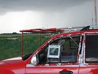
m17car3.jpg

Above: View of the front of my chase vehicle with hail-guards while on a supercell storm near Akron, Colorado on May 7.
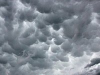
m17mam1.jpg

Above: Mammatus clouds over Akron, Colorado on May 7.
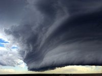
m17sc10.jpg

Above: Tail-end "charley" LP supercell storm (with beautiful sculpted striations) on the southern end of a line segment of severe thunderstorms northwest of Anton, Colorado late in the day on May 7.
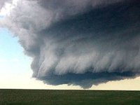
m17fun2.jpg

Above: Rotating portion, and small funnel, of the LP storm (with impressive structure) northwest of Anton, Colorado late on May 7.

2). May 7, 7:00 PM - Observation of an extremely severe and tornadic thunderstorm from near Yuma, Colorado along Highway 34, and into Wray near Morgan County. This storm was observed from a range of 20 to 30 miles at the most intense point, after abandoning the previous storm observed too long above. This was a classic cyclic supercell storm, producing more than 3 tornadoes, one of which struck the northern outskirts of Wray causing damage. These tornadoes were highly visible, and could be seen more than 30 miles away from the storm, especially looking east from near Yuma on Highway 34. At least two of the tornadoes from this storm were observed, despite being farther away (as myself and some storm chasers were also focusing on the cells to the west too long) from other storm chasers who were closer to this cell. The core was not penetrated. Rotating wall clouds and funnels persisted after the storm passed north of Wray and weakened. Damage was observed north of Wray on 385, and it was closed, ending the chase with fuel low. Conditions causing the storm were upslope wind flow, a low pressure area / dryline, upper trough, and surface heating. Documentation was digital stills and HD video. A 2009 Ford Escape was used to observe the storms. A tornado watch was also in effect for portions of the area until 7 PM MDT, later extended via a special MCD for this supercell.
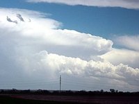
m17scel9.jpg

Above: After bailing on the line segment and LP storms to the west, I rushed east along Highway 34 towards a tornadic supercell near Wray, Colorado during the evening of May 7. This storm produced highly visible tornadoes, and despite being 20 to 30 miles west of the supercell (unfortunately), they were still visible. In this picture, a stove-pipe (later rated EF-2) tornado is clearly visible just left of the roadway with a possible second tornado to the far left just lifting!
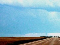
m17tor18.jpg

Above: Weakening phase of the Wray, Colorado tornado viewed from east of Yuma, Colorado at long-range on May 7.
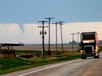
m17tor19.jpg

Above: Another view of the Wray, Colorado tornado viewed from east of Yuma, Colorado at long-range on May 7.
 
Back
Top