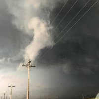
Summary: frustrated by slow traffic in south-central Oklahoma and stuck just ahead of or in the precip core of what was basically a squall line.
I met up with Jeff Snyder at the National Weather Center. We left Norman around 10:30 AM with an initial target of Wichita Falls. The warm front lifted gradually, although sometimes in jumps, as we made our way southwest on I-44. It wasn't until we were within a few miles of the river that the sky really opened up, indicating our transect. It was pretty damn soupy on the south side of the front. Obs were in the neighborhood of 81/70.
We lunched near I-44/U.S. 287, then headed up 287 as convection slowly initiated in far southwest Oklahoma. One storm became somewhat dominant as it passed through Altus, and we turned up U.S. 183 towards Frederick/Snyder to get in front of it. We never made it all the way to that storm, as new development occurred to its south as we were approaching Manitou.
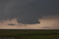
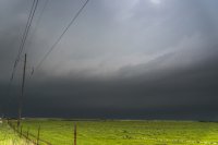
The scenario was a little puzzling as we moved north from Frederick. As we approached the storm, it became apparent that it was having trouble getting ahead of a boundary. We didn't think it was the cold front, but the storm never made any progress getting ahead of it, and was restricted to behind the boundary the whole time. This behavior manifest as a shelfy whale's mouth appearance to the front of the storm. There were numerous dusty spin-ups along the gust front as we moved north on 183, all gustnadoes, none particularly photogenic.
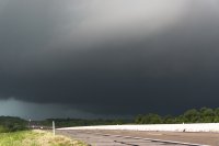
It became apparent how outflow-dominant this storm was as we went east on Baseline Rd. east of Manitou. We had to get at least 10 miles ahead of the precip core to stay in the juicy air east of the outflow. Not only that, but cloud bases were rather high for 10 F dewpoint depressions. As Jeff later commented, it seems likely that this storm was not truly surface-based. There must've been a parcel source level above the surface that had less CIN than the surface parcel. This evolution is consistent with there being no warm sector convection in Oklahoma west of I-35.
As we approached Lawton, the original storm, still well north of us, started to attain a more traditional supercell shape, and rotation developed and intensified. We decided we would ditch our current crapvection and try to get ahead of that storm, but it was fast approaching I-44 and we were going to have to make a decision about what to do to avoid getting stuck in blinding rain and large hail or driving into a tornado with no escape route (the H.E. Bailey Turnpike has very few exits between Lawton and Chickasha). We decided to jump off I-44 at a side road that went east from Lawton, not expecting traffic to be an issue. First problem: we couldn't find the exit. A few of the exits on the north side of Lawton are for Fort Sill only, and we missed the one we wanted the first time around. So we lost time there. Then, when we finally got off where we wanted to, it was 3:30 on a Friday in Lawton, and it seemed like every single resident was out and about, even as far east in town as we were. Perhaps they were freaking out about the looming storm which did end up dropping giant hail on parts of Lawton. Also, my map deceived me. I thought we would have a clean east road for miles all the way to OK-65. Wrong. Our road turned south without giving us a choice to stay east. Apparently the road I thought we wanted was just inside the boundary of Fort Sill. So that mistake slowed us even more.
Finally we reached OK-65 as reports of tornadoes near Elgin and Fletcher were starting to roll in. We needed to get north in a hurry. Unfortunately, as we approached Sterling, we started getting stuck behind traffic driving slower than the speed limit. The core caught us as we arrived in Sterling. We had no choice at that point but to turn east on OK-17 and hope we could get to U.S. 81 and north in time to get back ahead of the supercell. Doppler velocities on that storm looked nasty at that time, and it was obvious we were dealing with an HP storm (it probably only produced because it finally latched onto the lifting warm front). Even so, we still had a narrow berth to get ahead of it.
Not if Oklahoma traffic had anything to say about it. We couldn't manage more than 45-55 mph eastward and essentially made no progress on the leading edge of the heavy precip. We just barely started to poke out ahead of it as we approached the U.S. 81 intersection. By that time, we had just a few minutes to get north at least 8-10 miles, and the cars that were slowing us down were also turning left. I convinced Jeff to abandon hope on that storm and turn back south, towards the yet undisturbed air ahead of the squall line.
We tried blasting south on 81. For segments where it was four lanes, we were able to make good time. But we had to go through Marlow, which was bigger than I remember, and south of there and on the Duncan bypass it was two lanes, and we almost always had a slow driver in front of us. In fact, south of Duncan we had to follow some idiot with a Texas license plate driving no more than 45 mph, even though it was raining heavily. He seemed to have no interest in making quick passage southward. When we finally got by him near Commanche, we saw he was holding his phone camera in front of him, apparently recording his drive through heavy rain. Alright...
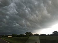
We had basically fallen behind the core by the time we reached Commanche. The line was pretty thin at that point, and there was little remaining hope of anything organizing on the south end of the line even though it remained open. We finally got back ahead of the rain going east on OK-53. Around Loco, we pulled off to watch the shelf cloud catch us once again. It revealed a rather pretty looking cloud texture within the whale's mouth, but we were both frustrated, and didn't care much to photograph it (Jeff snapped a few photos, but I didn't). We "officially" called the chase there and made our way back to I-35, happening to clip an embedded core with torrential rain and some small hail as we turned north on I-35 at the Davis interchange.
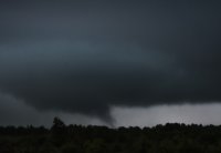
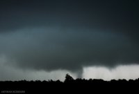
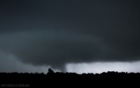
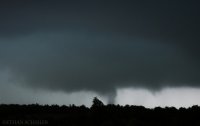
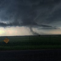
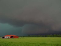
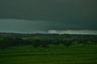
Picture of the only decent looking wall cloud anything south of the one tornadic storm ever put out. It had impressive vertical motion on it's right side for a few minutes before fizzling out. Never exhibited any obvious rotation.
