2016-04-26 REPORTS: NE/KS/OK/TX/MO

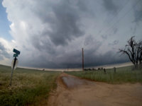
I have now finished my full report on my observations the southern Kansas storm. It includes a number of additional photos beyond the ones I originally posted here, a video segment with a clip of a funnel and two of the wall clouds, and a map of my chase route. You can view it at:

http://www.johnefarley.com/chase42616.htm

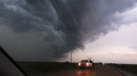
After review of my video and analysis of times and locations, it turns out I definitely did see the feature reported as a tornado WSW of Mayfield. However, from my observations and my video (that part of which was also messed up by a rookie mistake similar to James's) I cannot say one way or the other whether it really was a tornado. But I am still happy with my chase, as I got on the best storm in the southern KS/northern OK area almost from initiation, and did see multiple funnels and rotating wall clouds.
 
Even disappointing chase days have some fun elements and deserve a little love - at least for the lessons learned (i.e. don't get overly excited for negative tilts, make sure all your cameras are recording at the same fps, be aware of outlook hype inertia).

Out of the whole huge moderate risk, I think I chose probably the worst spot of the day for our chase - between Clinton and Fairview, OK. My initial target was SW OK, but I got suckered into following some of the early development along the dryline north of I-40. Like @Mike Marz, I couldn't help myself and got pretty pumped when the PDS came out - figuring I was missing something that the SPC was seeing. I think that made me more jumpy than usual and I felt compelled to get on the early towers initiating near Thomas, OK.
4f1d99d2f759ce1ebb432936fbb37f17.jpg

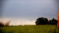
While we waited I chatted with another chaser from Amarillo and he told me a little about chasing Red Rock, OK 25 years prior. As our storm matured, it briefly took on a subtle bean shape on radar and I was getting more excited. The storm was pulling away to the north a little, but there was definitely a little lowering in the haze - and the cell was still young.
b3aa64ecb611bc513c1ad187758891df.jpg

Pursuing north, however, the ugly wind profiles started taking their toll and the cell elongated out and became more messy. At one stop just south of Canton, some locals started yelling at me from their porch - not sure if they wanted an update or wanted me out of there, I didn't stay to find out. Things were looking pretty grim for our cell by the time we got a view over Canton lake.
38319516a329176e80e4b8d658c65277.jpg

After getting stuck at a one way bridge near Cleo Springs, we finally let the cell go, but sadly there was nothing else around worth chasing. I briefly aimed south towards a little cell trying to get established in the open warm sector, but it collapsed when it heard I was heading it's way. Finally, we decided the only thing worth looking at was the LEWP starting to rage near Fairview. We got some decent gusts near the bookend vortex.
4276420d2ed1e01f4da76b893df51188.jpg

After that we had a nice sunset and then watched the hyped up OK news talking about the storms as we ate a late dinner at the Elk City Huddle House. Sometimes after a bust, just chillin at a humble restaurant licking your chase wounds ends up being a special memory. Anyway here's our melodramatic chase vid from the day with some timelapse. Full write-up with more pics and chase-radar overlay can be found at http://www.wxlog.com/events/apr26_2016.html

 
Back
Top