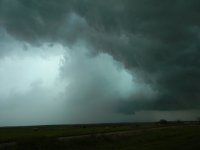
2016-04-26 REPORTS: NE/KS/OK/TX/MO

John Farley

Supporter
Joined
Apr 1, 2004
Messages
1,839
Location
Pagosa Springs, CO
Kind of surprised there is no thread for yesterday, given how many chasers were out there. Seems like increasingly, people only report if they get a spectacular, backlit tornado, but that is a subject for another thread. Anyway, I targeted southern KS, initially around Attica or Harper. I was interested for a couple days in the southern KS area. I considered northern KS closer to the triple point, but was concerned that storms there could be messy and low-based, so even though there was somewhat better potential for tornadoes there, they might be hard to see. And then the predicted position of the triple point shifted north, making that a longer drive. The TX target was an even longer drive, and I was determined to avoid central OK because I do not like chasing within 50 miles of OKC due to the crowds. So Monday I drove to Dodge City to pre-position and then decide on a more precise target. I was concerned that morning models were predicting a lot of convection in the woods east of I-35 rather than on the dryline, but I did see signals from several models that somewhere near the OK/KS border west of I-35 might have potential. They were breaking out more isolated convection in that area, and also showing signs of some backing of the surface wind there. Hence, my morning target was around the Attica-Harper area. I drove to Harper, had lunch, and checked data. It was clear that the dryline was a little farther east than I had figured, so I decided to head a little farther east. I soon could see towers going up to my south, so I went far enough to get east of them and then headed south.

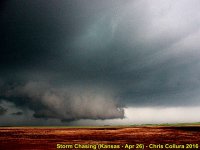
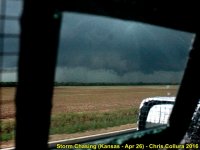
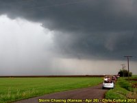
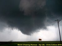
Long story short, this strategy ended up working well for me and allowed me to get on the best storm in the northern OK/southern KS area almost from the time it initiated near Wakita, OK. I was able to stairstep the back roads and stay with the storm from the stateline northeastward for better than two hours until it moved into the Wichita metro area, at which point I let it go. I did not see anything that I could confirm as a tornado with this storm, but did get a couple likely funnel clouds as well as a couple impressive wall clouds. I will post a full report later, but here are a few pictures from the chase:
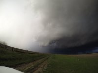
39fa9c75c9e34cfed081cbd7a06ae017.jpg
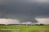
This wall cloud formed right around the time when the first TOR warning was issued, west/NW of Caldwell.
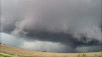
856757cfc4e7a79520c7ba7236d52601.jpg
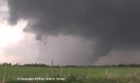
Within a few minutes, the wall cloud wrapped up in rain. It really looked like there could have been something in there, but there were no reports of tornadoes at this time. (video capture)
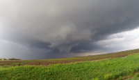
bd88cebc0ab8010d6d13b8b154b86835.jpg
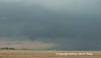
Likely funnel cloud about 15 or 20 minutes later. (video capture) I was driving when this formed so could only video out the window. By the time I could find a safe place to pull over amid the chaser crowds, it was gone. I thought for a while this could have been what led to the tornado report, but it was a half hour earlier, so probably not.

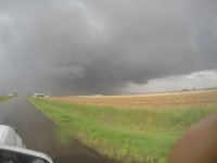
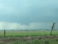
Closer to the time of the tornado report, I observed two lowerings. One looked to me like a skinny scud feature extending most of the way to the ground. To its left (south) was another lowering that had much more the look of a funnel, but only went perhaps 1/3 of the way down at most. Unfortunately, I messed up the video of this by having auto focus off when I thought it was on, so I have no decent pictures of these features. I wonder if either 1) a spotter mistook the scud feature for a tornado, as it was close to the ground, or 2) the more likely funnel had a dust swirl or other evidence of ground circulation that I was too far away to see.

I will write up a full report as time permits and will post a link in this thread when it is ready.
 
Started the day at 7AM at Junction City. I got up early to keep all possible target areas in play. Noted an outflow boundary from the overnight storms near/along I-70, and as the morning evolved, I saw no good reason to leave this area for other targets farther south. The day ended up a big mess. The OFB was not favorably oriented for the storm motions. I observed several storms as they crossed I-70 between Junction City and Topeka, and saw nothing worth taking out a camera. The largest hail I saw was around an inch.
The following is my now-standard format 4K dashcam archive of the entire chase (posted publicly in the event of future news coverage about chasers):


My dashcams captured two vehicles hydroplaning off of I-70 in rural Riley County. Both were very hard to see due to the pouring rain. I only posted the one that is somewhat visible. You can see the car spinning followed by the big spray of mud as it leaves the road:

 
This was an interesting chase day for us. We were in 3 tornado warned polygons, but didn’t see much except for a brief view of the funnel after dark that confirmed as the EF-1 Howe, TX tornado.

My chase partner and I meet about 10:30 AM and I made the target forecast with and initial target of Wichita Falls, TX. I drew a couple of maps based on the 12Z NAM and GFS valid at 4 PM. CAPE was off the charts everywhere and deep sheer was decent. CIN seemed a little high in eastern OK. As I noted in the events thread earlier, low level shear seemed to be lacking everywhere, although it seemed a little better in TX with the exception of my target where it was nonexistent in the GFS (but was OK with the NAM). The only reason I chose that area was it I knew I had to be near the dry line to get the storms before they lined out and it gave me good options to go north to OK or south to TX. I did a brief look at the 4KNAM, HRRR, and RAP and we headed out about 11 AM.

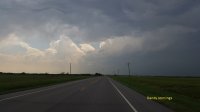
We kept driving past Wichita Falls and hung out in Burkburnet just on the TX side of the river, first at Braham’s then at the historical marker close to the river. Convection started to fire to our west and we headed across the river on I-44 at about 3:45 and turned on 70 and drove west. Here is our view as we drove west on 70 between Grandfield and Davidson, OK.
20160426_161854_small.jpg

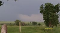
We hung out in Davidson for awhile and then headed a little north on 183 to get a better view as some trees where blocking us. Just outside of Davidson we saw the rain free base and a wall cloud and stopped to take it in. My partner and another chaser who stopped swear they saw a tornado. I wasn’t convinced. Contrast was poor and the pics didn’t turn out well. While we were there, OUN issued TOR warn #6 at 4:59 for this cell. As an FYI, the only major cell carrier that worked in this area was AT&T. We headed to Frederick and stopped on the northwest side of town (Country Club and E1800) around 5:14. At this point, the storm was to our north and the rain in the RFD kept obstructing our view. Here is a picture of the storm structure as well as a close up of one of the times the wall cloud briefly poked out from the RFD.
20160426_171513_sm.jpg
20160426_171819_sm.jpg

We drove back to Davidson hoping the southern end of what had become the OK line of storms would fire some more and we hung out for a while. The OK line and the TX line of storms started to fill in, so at 6:25 we decided to head back to TX as the storms west of DFW caught our eye as they were the only ones still discrete. At Henrietta we decided to take 82, as we didn’t want to get sandwiched between the MCS and the discrete cells by driving down 287. We barely stayed in front of the MCS the whole time.

At 8:42 we entered the west side of Gainesville TX, right as the upside down U shaped cell started to enter Gainesville. 4 minutes latter NWS FWD issued TOR Warn #19 for the Gainesville area. Seeing the rotation and hail on the radar to our south, we hurried thru the leading edge of the forward flank and stopped on the western edge of Gainesville and turned around to look about 8:48. We couldn’t see anything because of rain and we noted on radar that another group of semi-discrete cells was forming to our southeast just like the tor warned cell had. At 8:54 we left and headed east on 82.

We passed thru Whitesboro, TX at 9:04. We didn’t see it, and it wasn’t warned, but NWS FWD conformed at EF-1 tornado hit Whitesboro between 9:22 and 9:23.By this time we were getting gas in Sherman, TX (16 miles to the east). If you are thinking the storm is chasing us instead of us chasing it, you would be correct.

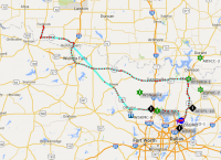
We drove south on 75 and the lighting show was so good we stopped on the southern side of Sherman from 9:31 to 9:43 to take in the lighting. We drove thru Howe, TX at 9:49. I was worried about the MCS and some hall that was to our west, so I was looking out the passenger window to the west. Just south of Howe I saw a lighting strike directly behind a wall cloud and funnel and told my partner we had a possible funnel cloud to our west. He pulled off at Farmington Rd at 9:51 and we took it west for 0.7 miles to get around the trees. We saw a lowering, but didn’t see a funnel. The MCS was catching up to us so we returned to 75 south at 9:55. At 9:58 NWS FWD issues TOR warn #20 for this storm. I look at radar and it is clearly rotating and I’m kicking myself for not calling it in. We get off at County Line Rd (375) at about 10 PM. We see power flashes to out north and I call and report to NWS FWD at 10:01. NWS issues update at 10:05 saying tornado is confirmed by spotter (may have been someone else). NWS confirmed this as an EF-1 tornado in Howe from 10 to 10:05. By 10:08 we are back on 75 going south. The MCS catches us. The cross wind is high, but I estimate it was close, but not at severe levels. NWS appeared to agree, as they didn’t issue a thunderstorm warning for Collin County, TX. This same system produced another confirmed EF-0 tornado as it moved northeast thru Grayson County. We arrived at my home in Plano about 10:30. It was an interesting 12 hours. From being out there I can confirm that had the low level shear and the cap been just a little different, this would have been a major event. APRS track from my chase partner (KD5UMO) is bellow.

20160427aprs.png
 
I had stayed overnight around Cherokee and just couldn't find any reason to move from there. A little before 1 I saw some really healthy attempts along the dry line near Jet and eventually that area is what popped into that first storm near Wakita. 2f85014b117622176436b998c184b525.jpg

I drove into the core just west of Wakita (around 2:30) and found a few golfball size hailstones .63da20583bf0b614989fd1f8e29c35a4.jpg

From there stayed with the storm until Wellington with several nice wall clouds and tornado attempts. c6e4b8e498aef1376312f473d1084b45.jpg

Drove back down to a few miles west of Caldwell and checked out the next storm down which looked great with a nice hook though I don't think it ever was torn warned.f0b8ac81d83c75f13a6482259680dcac.jpg

With storms looking blah after that I thought I'd give a chance to the storms coming out of SW OK to OKC. Made it to I40 just in front of the line and stayed just in front well into Arkansas. I was in Checotah shooting lightning when got caught in 70mph winds/zero visibility and upon looking at radar was happy to find I was right under circ for a just issued torn warning. Fun few moments there as I tried to get back on I40 and get back in front. Got some decent lightning just before that.16134adb7c33d93a7b25ac8b74924f1c.jpg

Was just in front of line for another tornado warned line segment near Ozark, AR before the line begin to weaken 6bdc7c7939e4c3f6b4e47967c31a55b8.jpg


Sent from my iPad using Stormtrack mobile app
 
I chased this day starting in Wichita Kansas heading southwest for a target of Lawton, Oklahoma. I arrived in Lawton by mid-late afternoon watching storms go up to the southwest, waiting for them to move off the dryline. I noted the storm of interest (SW of FDR) didn't really move much first upon inception and kept trying to split and eventually took on a linear organization. I saw a couple of wall clouds with weak rotation on this cell before it mostly grew upscale. The storms were grungy and cold looking, so much so, that I didn't even take my camera out of the bag for the entire chase. Headed back to Oklahoma City where I managed to observe some high winds (~60 mph) with a squall line that was moving through the city upon my arrival. Overall a very lackluster and uneventful chase day. However given how things looked late in the day with veer-back-veer profiles on the FDR VWP data and the lack of any 0-1km SRH, I shouldn't be too terribly surprised.
 
I ended up chasing after getting off work at around 3pm in Papillion, NE. Drove down to Beatrice where I checked the radar and saw two cells producing hail moving due north towards me. The cell to the East was dropping radar indicated 2.75" or so inch stones and led the MCS while the western cell was producing 1.5" stones and was marginally more isolated/not part of the MCS. There were radar indicated areas of slight rotation on the East side of the West cell and the West side of the East cell, so I opted to drive right through the middle of the two where the hail threat was minimal. I adjusted and targeted Hanover, KS as the East cell hit Marysville, and got caught some .5-.75" hail on the way through, with two stones large enough to put some dents on my roof and trunk. As I got into Hanover, I saw a brief lowering in the area of interest on the West cell as I came over the top of a hill, but that feature quickly dissipated as I repositioned to get a better view.

At this time, I drove back North in the direction of O'Dell with the intent to head home when an embedded cell in the line to the West (Hebron/Deshler) went tor-warned. I blasted West and got on the storm in time for the warning to expire, but dropped south into Republic County with another hopeful chaser to the next cell in the line which looked a little better and showed an inflow notch on radar along with a weak couplet. We drove up to a pretty nice shelf cloud with an interesting area of brief rotation in the updraft base but and noted some very cold inflow and the storm soon went outflow dominant.

In all, it was a long drive for a cool shelf cloud. I also bottomed out and lost half of my splash shield, thankfully the folks in Hebron didn't judge too much when I rattled and scraped into town to buy some bungee cords.ceb0927ddc623387eefd22a7c22cca94.jpg
 
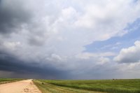
Left Norman around 1 PM CDT and initially moved for Lawton. The SPC threw out the now infamous PDS tornado watch as we were eating and shortly after we began to make our way down towards the Red River. By the time we reached Snyder, the first attempt at convective initiation was underway south of Crowell, TX. We moved west out of Manitou on OK5C and ended up sitting a few miles north of Elmer as the storm began to organize itself. We had a beautiful view over some open wheat fields to the south as the storm split, with the left split's base visible off to the southwest.

0457a36eb30a93715ce8176a40fc5998.jpg

Shortly after we cut back east towards Tipton to stay ahead of any potential hail. After dipping south on OK5 out of Tipton, we stopped for a bit with some other friends to watch the storm take on a nice bell-shaped appearance. This storm also exhibited the first instance I can think of with gravity waves rippling through the anvil as the updraft grew.

56cba2196c5babe1323038f04546a5a2.jpg

2030ba0e2220199625e8a686ad283a63.jpg

eab398ae4eada672d01a906f618cff8a.jpg

About five minutes after the last picture, the storm finally managed to organize a wall cloud under a pretty hazy base. Only one attempt at a funnel ever seemed to get close as the storm rapidly became more and more HP due to seeding issues from the initial left split that had stuck around on its western flank.

b64608708629f62cc555fa1d04baff2e.jpg

We then took a somewhat ill-advised trip up dirt roads that paralleled US 183 to get a better view of the wall cloud. Thankfully we managed to make it back to OK5C west of Manitou to get a view of the now very HP storm where a lot of chasers had congregated. Our final view before leaving the storm to peek at a separate storm just across the Red River was a somewhat dramatic view of the RFD cut giving off a greenish-blue tint with the rear-flank gust front passing directly overhead.

432f40fdcde97a37c46966fe8d8e0482.jpg

14d8deb356916e0a51663aeb2ed2b917.jpg

The last storm of the day we saw ended up being a linear base with widespread precip falling through the middle of it. We were never able to catch back up with the initial storm but did get a decent lightning show on the way home. Definitely not what I was hoping for in the tornado department but a serviceable day overall.
 
Good day all,

Below is my chase log for 4/26...

Apr26_02.jpg

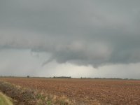
Above: Rotating wall cloud west and southwest of Wellington, Kansas.

Apr26_03.jpg

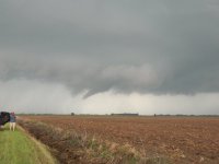
Above: Developing funnel cloud west of Mayfield, Kansas.

Apr26_04.jpg

Above: Weak tornado possible (the feature in the center in poor contrast). West of Mayfield, KS.

Apr26_06.jpg

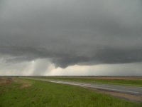
Above: Rotating wall cloud west of Mayfield, KS.

Apr26_07.jpg

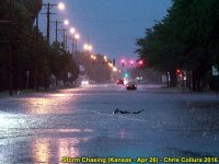
Above: Flooding on the southwest side of Wichita, Kansas.

Chase details (for 4/26):

April 26 was an anticipated day for over a week, but upon checking data and doing a thorough forecast, a few things became apparent. One was the extremely large moderate risk outlook, extending from central Texas to southern Nebraska and almost half as wide as Kansas. The hail outlook was 45% hatched (significant), wind was 30% (with a 45% in Texas), and the tornado outlook 10% (also hatched). Forecasting presented three distinct target areas. One was way north in extreme SE Nebraska and N Kansas. This was near the warm front, and was avoided since storms may move easily north of the boundary and become elevated. Another was south into Oklahoma and Texas, along the southern portions of the dryline. This was a good place to be, but the negatives on that were the dryline sagging too far west and storms not producing tornadoes until very late evening after dark.

I chose a third target area in between these two other targets, pretty much over south-central Kansas. In this area was a dryline bulge, good moisture, and even an outflow boundary from early morning elevated severe storms moving off in response to the low-level jet (nocturnal max). My target area was anywhere from Vance AFB, OK to Pratt, Kansas, and just north of Wichita, Kansas. The negatives I saw was the SSW flow (meridonal) over my target area, but was much better than the warm front farther north. I packed up and headed southwest along I-35 to Emporia, then Highway 50 west to I-135, then south and continued to Wichita for lunch. In Wichita, the dryline bulge became apparent by about 2 PM, and I prepared the chase vehicle for the day, along with installing the ever important hail guards! Convective initiation commenced at about 3 PM to the south and southwest near and just south of the OK / KS border.

The SPC issued mesoscale discussions 456 and 457 for much of the target area(s), including mine. Subsequent tornado watch boxes 108 and 109 (the latter being "Particularly Dangerous Situation", or PDS). The valid times were until 9 PM for box 108, and 12 AM the next day for PDS box 109 south of it. My target area sat pretty much where these two watches overlapped (near the OK / KS border). An intense storm developed to my southwest, so I headed east on I-235 to I-35, then south on Highway 81 towards Wellington, Kansas to meet the cell. This storm quickly became a supercell storm, and would produce a weak tornado west of Wellington and near Mayfield. The storm tried to intensify, but eventually became a cluster of severe storms (upscale evolution, due to the meridonal flow aloft). I pretty much stayed with the storm near Highways 81 and 160 until it was clear they would not intensify farther.

Later on April 26, and despite the likelihood of giant hail and strong tornadoes, pretty much every storm in the large moderate risk area became northing more than a flooding MCS / storm cluster (with only brief tornadoes being reported, including the Wellington storm I was on). The northern target (warm front) was the least active, while the southern one in Texas did not produce a significant tornado (near Sherman) until well after dark. I wrapped up the chase and headed back north along and near Highway 49 and 42 near Viola, and eventually back to the western side of Wichita for dinner and to spend the night. Flooding was observed in these areas, as well as hail. I stayed off Highway 400 on the west side of Wichita and met up with a few chasers at the Hangar One steakhouse (including Lindsey Fowler, Alice and Kirk Short). The next plan was to get up early the next day and follow the "system" back east.
 
The day before I had liked the triple point target increased SRH but by morning noticed unfavorable storm motions to the pinching OFB and anticipated messy rainwarpped storms like John Farley noted. Re-targeted South central Kansas trying to get to where the dryline turned more straight N-S rather than NNE-SSW like it was in central Kansas. Eventually made it to south of Wichita right as the supercell went up south of Wakita, OK. Intercepted on the north side on Caldwell, KS and observed several wall clouds before rotation really increased between Mayfield and Milan, KS.

Observed this Funnel about 5 miles or so southwest of Mayfield, I didn't call it a tornado but ICT NWS has called it tornado and for good reason as they have a picture of it from an individual, which shows a very clear dust cloud. My angle does not show any ground contact.
DSCN4598.JPG
DSCN4592.JPG

It rapidly occluded and wrapped up just east again in about 10 min just west of Wellington, KS. This bowl-like funnel was rotating quite rapidly, hence my calling it a funnel. I thought for sure it would fully condense at this point
DSCN4610.JPG

After this occluded and vanished not much else of significance occurred. observed a few wall clouds later on the next cell coming up from west of the Medford, OK area. Overall NOT really a disappointment considering I had greatly tempered my expectations over the day or 2 before, but man... I thought for sure a couple times there I was gonna get full condensation under those 2 rapidly spinning funnels. Once again ICT NWS has a picture on their event summary page showing clearly that first funnel was indeed a brief tornado, always hard to count it when you cant tell for sure from your vantage point

ICT NWS PAGE: http://www.weather.gov/ict/event_20160426
 
Last edited:
Played the Triple point near Salina and had an ok day filled with wall cloud after wall cloud, funnel cloud after funnel cloud, and two possible tornadoes, although none were ever reported.
If they were tornadoes they were rain wrapped and brief.

Shot of a nice funnel cloud that was quickly overcome by its high precip RFD.
GOPR4787.JPG


Pretty nicely rotating wall cloud here, you could see funnels moving around the circulation. My chase partner has a shot where you can see more of the shaft of what he is pretty sure was a tornado. I'm not 100% sure so I don't count it. But the motion in the wall cloud was pretty great!

Tornadoqqq.PNG
When we first came up on this storm we were treated to one of the many rotating wall clouds. This one had the best separation from its HP Core.
rotatingwallcloud2.2.PNG
About to core punch...
GOPR4730.JPG

+1 to the discrete supercells that sprang up after midnight on the drive back to Denver that night. I swear I saw something at the base of the storm closest to us, but I wasn't filming anymore, and it doesn't count, but some of them had rotation. It looked like another low had developed behind the main low of the day. Incredible lightning show also. I was so tired driving back to Denver due to 3 hours of sleep each of the two previous nights that I wont even bother trying to explain it.

Next trip is mid to late May
 
Not too much to say for this chase. It was about as disappointing as I had been predicting it could be.

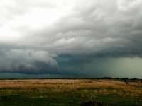
Initially staged near Cooperton awaiting initiation. While several big towers tried to go in our immediate vicinity, we were eventually pulled to the southwest by the storm that popped in northwest TX. We stopped off of U.S. 183 south of Snyder to watch it roll in. It never looked impressive visually, nor on radar. Finally after sliding around a little on 183, we noticed a lowering form ahead of a surge of precip. I would hesitate to have even called it a wall cloud at that point. It had some upward motion on the right side, but nothing to write home about. We eventually dipped west on the dirt roads as some hint of rotation finally showed up on radar, but sort of buried within the rain. We found more upward motion and turbulent motion along the leading edge of a push of outflow, but close enough to the core to make things interesting. As we got back to 183 and went north, we got hit by what seemed to be moderate RFD winds out of the southwest along with pretty heavy rain. A lowering moved across the road and into the field southeast of the 183/62 intersection as we arrived, getting hit by a few larger hail stones in the process. There were a handful of close CGs then, too, which kept things entertaining. We sliced across the north side of the wall cloud and went up OK-54 to stay with it, encountering more RFD as the lowering moved off to our northeast and we fell behind it. We knew OK-49 was closed on the west side of the WMWR, so we went back down to 62 and cut up on OK-115 through the middle of the refuge and up to Meers (we also knew that 49 had a lengthy construction delay in Medicine Park). We stairstepped northeastward towards Anadarko where we finally called off the chase after another failed attempt at a rotating wall cloud resulted in nothing worth writing home about.

We were back in Moore by 7:30. We ate at the Genghis Grill off I-35 as we watched the overexcited OKC broadcast meteorologists fly off their respective handles over some dustnadoes and random weak spin ups. Funny thing was we were the only customers in that restaurant, and the manager told us she had considered closing before we walked in.
 
This day just got worse and worse as it approached, based on all of the model runs. I was still excited about being out there with a trough coming in, and some decent moisture, but it was becoming pretty clear that the wind profiles were likely to mess things up pretty badly. My expectations weren't super high, and then the PDS Tornado Watch came out... I couldn't have been more excited. I had never chased a PDS yet, and as silly as it may sound, I have always wanted to chase one. I thought, "hey, maybe the SPC is seeing something much different than the rest of us". At this point I got my expectations quite a bit higher. I was originally targeting SW Oklahoma because it looked like the 500s down there may be a tad less meridional, and the HRRR kept showing some nice cells firing down there (which they eventually did). But I also noticed the HRRR firing off some cells earlier in NW Oklahoma, so I stayed up there for a bit. About 45 minutes after the PDS watch comes out, I am positioned perfectly east of an exploding supercell and gorgeous updraft tower, which was beginning to look nice on radar. It started sucking in moisture and gave a few awesome wall cloud attempts, game time! Sadly though, the wind profiles took over and this once gorgeous supercell elongated, and split, and turned to garbage.... that is pretty much the entire story of this day.

cc34fceac87335e260aa4acf68315f99.jpg

cfd34268b5d54c536c29dd7d2e7d294c.jpg

61373a570d309d835ce0efd15c41d4d3.jpg

0233d1471517b66c24f08709ac305338.jpg


Sent from my iPhone using Stormtrack mobile app
 
Last edited:
First off no video due to noob mistake of not manually setting focus to infinite and only cell photos which will not usually capture a very brief touchdown … Grrr

We targeted the TP by Salina Kansas and were encouraged with the OFB in place. Once the first storms started we went after them … small hail and rain was all these produced so we headed South. We ended up South of Manhattan on the tornado warned cell and South of that we saw a likely brief tornado North of Dwight and West of Alta Vista. We had another chance on a funnel right on 177 that would have been 50 yards in front of us but it quickly disappeared. Disappointing day for us but a brief tornado and a funnel is better than some people had that day … better than nothing.
Brief Tornado.jpg Brief Torn Fingers.jpg
 
Back
Top