Greg McLaughlin
EF5
I went on an impromptu solo chase down to northeast Texas. I left Tulsa around noon with Greenville, TX as my target. Overall the environment didn't look that favorable for tornadoes, especially low-level shear, however an outflow boundary present and surface-based supercells forecast to develop and interact with the boundary. That was enough to get me out the door.
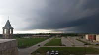
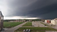
I arrived in Greenville around 4pm as a developing supercell latched onto the boundary. I followed this storm as it tracked east-southeast along the boundary. For most of the chase the storm was outflow dominant as the outflow boundary was being reinforced by new convection. By this point I was becoming convinced the storm had no chance to produce a tornado and began to consider breaking off to set up for a sunset photo op. Then a tornado warning was issued and the chase was on!
Around 7:13pm the storm's updraft was finally able to balance out with the RFD and a low-level mesocyclone quickly materialized. I was in the thick of trees with limited visibility, but managed to find a decent view as a brief multi-vortex spun up about a quarter to half a mile east of me. This tornado touched down about two miles west of Marshall, TX.
Here is video of the tornado


