chrisbray
EF4
Surprised no one has posted this yet, must be people are still focused on today's event. I have been watching this for a while. Still not sure if I will go or not.
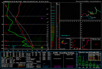
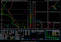
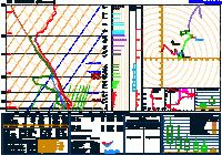
A fast moving upper trough and surface low with trailing cold front will move out over IL/IN/MI tomorrow afternoon. NAM has been kind of an outlier in terms of system speed and location for days now, but the Euro and GFS seem to have slowed down to match up with it a bit as of late. My target, should i choose to go, will be the IL/IN border, as far North/West as possible, so I will focus on that area. NAM insists on bringing 60+ Tds as far north as Chicago (we sit here 24 hours in advance with a dewpoint of 41, so we shall see), and showing much more cape than other models (what else is new), 1500-2500 North to South, with 70-80 knots of bulk shear progged!
It isn't all roses, however, as NAM is kind of an outlier as having a trailing, secondary surface low feature over N. IL at 21z. That helps to keep surface winds SSW across this area, but if the center of the low is farther NW, winds will be much more veered and the shear will be almost entirely speed without direction. Another negative will be very fast storms speeds, up to 55 knots (!), as well as LOTS of forcing, making me worry this will rapidly become a squall line. ON top of that, we have to see how early morning rain/convection goes before we know if this area will destablize under the sun or not.
I am hoping models continue the slowing trend as the day approaches, giving more room for a warm sector closer to me.
Last edited:


