2016-02-23 EVENT: LA/MS/AL

Joined
Jan 12, 2015
Messages
51
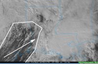
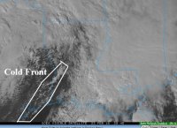
Over the past 48 hours or so, models have been converging on a very dynamic system that will affect portions of the Gulf Coast states on Tuesday. Recent runs have upticked even higher, so as of right now its looking like a very potent surface low will form over TX and then move north and eastward into MS and eventually up into western TN. Ahead of this, a very powerful trough will round the base and crash into parts of coastal LA, MS, and AL Tuesday, with a screaming 850 jet plowing into the same area on top of adequate instability and lapse rates. The surface low has been trending a bit more north with each run, so if the warm sector continues to push north there could be more areas that get into this threat. However for now, a potentially dangerous situation is unfolding for parts of coastal LA, MS, and AL Tuesday afternoon into the evening.
 
Ahead of this, a very powerful trough will round the base and crash into parts of coastal LA, MS, and AL Tuesday,

Just FYI, I think you mean a shortwave or a jet streak will round the base of the trough. The trough itself has a base, so it would be kind of weird to say it is rounding its own base :p

Definitely looks like a potent disturbance from a dynamical standpoint. I've been impressed watching this come in on the models, as they have been pretty consistent about it for a long time. I also find it interesting the shape this particular disturbance has. It looks to be driven strongly by ageostrophic motions associated with a strong jet streak rather than DPVA, which seems to dominate the forcing for pressure falls in most systems (at least, in my opinion).

It looks like moisture may not be as high as in other events so far this year. Even though there are mid-60s dewpoints sitting along the Gulf coast right now, the models don't bring that moisture onshore really, probably partially in response to poor advection, a result not only of weak winds ahead of the cyclone, but also the southerly location...the warm front is going to stay close to the coast until the center comes across the southeast US. If moisture could manage to get a little bit higher, we could be looking at a more serious tornado threat. As it stands, the lack of land in the warm sector of this cyclone may be the "saving grace" that keeps this event from being more extreme.
 
Questions remain regarding instability, but I believe the coastal/warm front lifting north will usher in the dewpoints for the Deep South. Mid South public probably gets saved by other rain and no true warm sector. Another issue will be somewhat unidirectional winds 250/500/700 up toward the Mid South.

Deep South Moderate Risk is justified for a few reasons. Looks like no Gulf Coast MCS spoiler. Wind fields will be strengthening with time as the warm front lifts. Rate of change of parameters can sometimes be more important than absolute values. Instability will increase during the event. Wind fields will be strong and turning from 700 down to surface will be impressive. The 850/925 fields down to surface indicate high local helicity along the lifting WF. Other boundaries left over from the morning will promote high local helicity.

Looks like some supercells will get going during the day; however, the bulk may be at night. Storm motion should be seasonably fast, but maybe not super fast with the late blooming jet stream level. Still the mid-levels will push them along. Could be tough to chase. For the public concerns include the storm motion at night and rapid destabilization where in places that get warm fropa.
 
Just FYI, I think you mean a shortwave or a jet streak will round the base of the trough. The trough itself has a base, so it would be kind of weird to say it is rounding its own base :p

Definitely looks like a potent disturbance from a dynamical standpoint. I've been impressed watching this come in on the models, as they have been pretty consistent about it for a long time. I also find it interesting the shape this particular disturbance has. It looks to be driven strongly by ageostrophic motions associated with a strong jet streak rather than DPVA, which seems to dominate the forcing for pressure falls in most systems (at least, in my opinion).

It looks like moisture may not be as high as in other events so far this year. Even though there are mid-60s dewpoints sitting along the Gulf coast right now, the models don't bring that moisture onshore really, probably partially in response to poor advection, a result not only of weak winds ahead of the cyclone, but also the southerly location...the warm front is going to stay close to the coast until the center comes across the southeast US. If moisture could manage to get a little bit higher, we could be looking at a more serious tornado threat. As it stands, the lack of land in the warm sector of this cyclone may be the "saving grace" that keeps this event from being more extreme.


So if this low comes ashore a little earlier and moves northeast earlier, could that also mean a higher tornado threat if it means the warm sector is going to expand further north?
 
So if this low comes ashore a little earlier and moves northeast earlier, could that also mean a higher tornado threat if it means the warm sector is going to expand further north?

Not sure about timing changes, but if the cyclone takes a more northerly track, it should cause the warm front to form farther north and thus allow the warm sector to be farther north as well, with more of it intersecting land. That would expand the area susceptible to severe weather.

So yes.
 
Not sure about timing changes, but if the cyclone takes a more northerly track, it should cause the warm front to form farther north and thus allow the warm sector to be farther north as well, with more of it intersecting land. That would expand the area susceptible to severe weather.

So yes.


Ah. I pretty much agree with everything else you said as I looked at the GFS on both Twisterdata and tropicaltidbits.
 
In fact the threat of a strong tornado may be more than is currently anticipated; As most of us are probably aware, that whilst environmental instability looks somewhat limited. This could well be superseded by extreme vertical shear below mid levels. In fact whilst we may often look above 500mb for the strongest jet stream winds. On this occasion the strongest jet level looks much lower. This looks to result in fairly strong numerical increases in wind velocity from surface to mid levels. Forecast hodographs are currently reflecting this. There are a number of conducive conditions which might be compared with historical similar early season strong tornado events for SE states associated with ElNino; A classic closed surface low marginally off set to upper low, pronounced speed and directional shear within the lowest 1000mb, enhanced divergence along the front left exit region, and probably the most important condition...low level 'potential instability'. This dry air incursion looks to rapidly drive in as low as 700mb and overrun surface frontal activity. It is therefore likely that the lack of general thermal instability will be compensated by this process; ambient temperatures surrounding updrafts will cool very rapidly increasing buoyancy and hence stronger updrafts.
Whilst I currently do not see the risk of wide spread multiple tornado events. I do see a potential risk of a small number of isolated significant tornado events directly associated with the development of just a few isolated supercells. In addition to this the, the increase in buoyancy at lower mid levels looks very rapid indeed and may develop supercells to a dynamic state very quickly indeed. This gives very little time to warn the public? Though whilst the current 15% SPC tornado risk would seem appropriate regarding spatial coverage. I am concerned that the general public might underestimate the potential significant risk of any, one tornado?
PS. Vis satellite will become a very good tool today in identifying this dry incursion. The speed of these storms could render any other now casting useless!
 
Last edited:
I propose we are looking at two lifting boundaries today, the synoptic warm front into the Mid South and the more dangerous coastal front in the Deep South. Part of my reasoning is South pattern recognition. Also one can barely make it out in the latest HRRR charts. In addition a pre-frontal trough will be ahead of the cold front. One could argue it looks like a quasi dry line south of Montgomery to Auburn by morning. Regardless we have plenty of boundaries to work with today and tonight.

If I were chasing I would target the intersection of the prefrontal trough and coastal front. HRRR has a beast going into northeast Mississippi near the triple point but I might favor south and east of that, more on the leading edge of storms. Rather than name a target by location, I call the other boundary intersection. Track the prefrontal trough and especially coastal front. Since this will get going right before sunset I am sitting out; but, I expect an interesting desk chase this evening.

Agree with all the above discussion regarding mid-levels and turning. Storm motion will be seasonably fast. Also 0-3 km CAPE will be more than adequate for this early season and nocturnal event. Mid South should have a nice shelfie show on the synoptic fronts, but I think the worst tornado risk is down in the Deep South overnight.
 
Yes as per above (and thanks Steve) , Already and even this early the basic conditions might be already building. Though the HRRR as Jeff has mentions looks to be much more restrictive regarding CAPE running inland to any great measure?.. At this point it might suggest that tornado risk remains coastal from LA Louisiana through to Florida Panhandle. Though the upper jet looks to become strongly divergent which may well in turn draw a very narrow line of moisture and CAPE northwards just ahead of the predicted pre frontal boundary. Though based on current model output risk would now appear marginal spatially, but still potentially severe regarding an isolated event.

Below Vis Sat image shows current dry air incursion moving east from SE TX. In short it is occurring but will still require some accumulation of northward advected CAPE to become a viable risk?
 

Attachments

  • 0k.JPG
    0k.JPG
    132 KB · Views: 124
Last edited:
Wish I were out chasing this setup...actually wish it were in a more "chase friendly" area. Anyway, if I were chasing I would probably be setting up somewhere east of the current going complex of convection (messy). Somewhere probably in Southeast MS/Southwest AL, RAP shows an increase in instability/shear in this area later on pegging the significant tornado values rather high. This is particularly concerning after dark when it shows ESRH values approaching or exceeding 600-800 (!) m2/s2 over a rather large area. It shows this coinciding with MLCAPE values ranging from 500-1000 J/KG. If we get anything semi-discrete in that environment, it should spin like a top. Like I said, SE MS/SW AL, think there might be something noteworthy there later on. As far as "chase-ability" goes, I'm not sure, pick a storm and say a prayer! Literally.
 
Pretty much chased most central states over the past 16 years but never really got down to Dixie Alley or SE State coast. I remember SE TX (Galveston coast 2001) nice landscape but not that good for a storm chaser?. But I suppose the most important point is the road network?

PS. Do we have any Stormtrack members chasing this risk today?
Current suggestion is that the COLD FRONT and not pre frontal trough could now become the main secondary focus!
Also sadly as much as I want to stay with this outlook we are 6hrs ahead of you guys over here in the UK so need to sort some shut eye soon... Hope all pans out well and any bad storms at least avoid population!
 

Attachments

  • Capture1 copy.jpg
    Capture1 copy.jpg
    140 KB · Views: 125
Last edited:
The swamps/flood plains make the road network pretty sketchy outside of the major cities and the lakes in eastern Louisiana just tend to complicate it further since you get bottlenecked. That and the random forests that materialize on the only serviceable and well-maintained roads.

Back on the meteorology, looks like the main threat is finally shifting east with more cells coming onshore into better wind fields just south of the warm front.
 
Yeah, I chased today from Hammond to Prairieville, LA, then to Paincourtville, LA. Very sloppy HP setup. Kinda whit knuckle driving when new cells pop up and train right at you.
 
SPC has issued an MD highlighting a "possibly cyclic tornadic supercell" just offshore from the Orange Beach/Gulf Shores area. Latest radar out of Mobile shows a very strong couplet, however quite a bit of rain is wrapping around on the northwest side of this cell, so I think any type of chasing would be dangerous, especially since its dark now. Looks to be cycling too with the couplet having a more northwest trajectory on latest scans. Not good if you are just west of Gulf Shores along the coastal areas. Latest meso-analysis shows about 500 j/kg of MLCAPE in the vicinity of this cell and very strong ESRH of around 450 m2/s2, which should increase with time. Buoyancy here I think is one of our limiting factors, especially losing any "day-time heating" we might have had.
 
Back
Top