• While Stormtrack has discontinued its hosting of SpotterNetwork support on the forums, keep in mind that support for SpotterNetwork issues is available by emailing [email protected].

2016-02-02 REPORTS: MS/AL/TN/IL/IN/KY

Joined
Jan 10, 2014
Messages
106
Location
Sheridan, WY
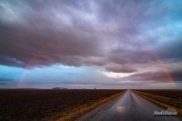
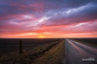
I just got back from my first storm chase of the year. I didn't see anything noteworthy, but it was still nice to get out. And any day that ends with a spectacular sunset and rainbow is a good day.

I had initially targeted further south, but once I reached the Litchfield area, I realized it just wasn't worth it to drive any further. The newly issued tornado watch just barely included the southern tip of Illinois. I waited for this small storm that showed weak rotation at times as it came up from St. Louis.

192e2e8403287468166f0ebdbe4c1852.jpg
Litchfield Storm Base by Kevin Palmer, on Flickr

a1ef7ab892d24dacd760512a3bf1a4f8.jpg
Dim Rainbow by Kevin Palmer, on Flickr

66eb71833d81220d2396dbf57e4ad711.jpg
Farmersville Sunset by Kevin Palmer, on Flickr
 
Nice work @Marcus Diaz! I saw your video last night on TWC when I returned from my own chase. Needless to say, I was incredibly jealous. My day was nowhere near as spectacular...
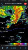
I needed to be back home so I could work Wednesday, so I couldn't go as far south. I thought I'd take a chance with the northern area of the Enhanced Threat area in W Kentucky and NW Tennessee. I thought that if I was able to get in position I could grab a discrete cell that fired in the lesser CAPE before everything went QLCS.
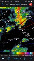
When I got to my target area, things seemed like they might be going as planned. A mass of storms initiated south of Paducah, and I targeted "Tail-End Charlie" because it had the best chance to feed on the southerly inflow. I was able to get positioned to the SE quadrant as it advanced northeast.
At this point I was feeling pretty good as I advanced down Rt 70 near Waverly, TN. As I approached the storm, already severe warned at this point, my phone screamed a tornado warning. Awesome, right?

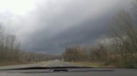
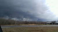
Well, no. As was the case with other chases last year in this region, the terrain made it quite hard to see anything. The storm was right on the edge of the cloud cover so some of the edges were lit up with sun, and the shadows down in the hollers and ravines made it spooky, but getting a clear view of the base was virtually impossible.

To add insult to injury, this storm almost perfectly paralleled Rt 70, then Rt 13, and had the terrain been flat, it would have been an amazing setup for a chase, tornado or not.

The storm went through two warnings and I tried my best to keep up as it raced off to the NE at about 50-60 MPH. I never saw a funnel the entire time I was on this storm and there are no reports of a tornado. I'm guessing it just didn't have the CAPE that far north, and because of the competition as other weaker cells fired up when the cap broke...

... but that ONE wind report in Tennessee? That lone blue dot near Clarksville? Yeah, that was my storm.

On the bright side, I have a company car this year with unlimited personal mileage, so busting a bit only cost me some McDonalds and beef jerky, taking some of sting away. Below are a couple of photos I was able to get through breaks in the terrain/trees, and my positioning on the warning, so you can understand my frustration of being so close..
 

Attachments

  • image.jpg
    image.jpg
    117 KB · Views: 150
  • image.jpg
    image.jpg
    141.2 KB · Views: 147
  • image.jpg
    image.jpg
    283.4 KB · Views: 140
  • image.jpg
    image.jpg
    287.4 KB · Views: 141
Monday, February 1, the clock reads 7:27pm and I get a message from Connor McCrorey asking if I want to chase the following day. Within 5 minutes, I agree. I was enjoying a nice evening at the coffee shop, so I closed my tab and rushed home. Took a quick shower, threw some clothes and other stuff in a bag, and left Amarillo by 8:30pm. I trucked through the evening and arrived at Mike Scantlin's place around 1:00. After a couple of hours at looking at fresh data, we hit the road eastbound. We stopped in far north central MS along highway 72 to reanalyze data. Everything seemed to be going as planned. Although we were socked in with clouds at our location, plenty of large breaks in the clouds were evident south of us via satellite. We were carefully watching an early line of storms to our west that showed signs of rotation. We followed one storm into Fayette County, MS briefly before deciding we needed to go south. The better shear profiles and instability combos were going to be confined to eastern MS/western AL. Storms were rolling out of the Jackson area, and we knew those would likely be our play. New plan was to get to Tupelo and reassess. Well before we could, storm near Ackerman went T-warned. New plan was to get to Columbus asap. We played with one storm near Aberdeen before watching 2 isolated supercells fire way south near Meridian. So, we went south. Seemed like an eternity driving through the jungles. What if these don't produce? What if this day totally flops? What if the storm does produce but it's rain wrapped? Or it waits to get out of sight in the trees to put down? These were all thoughts I was rolling around in my head as I took curve after curve of tree lined back highways.

We finally got in position northwest of Aliceville, AL to be in the path of this storm that's already produced in MS. As we look for some sort of clearing, we pass a prison that's been cleared out of trees. We park at the facility and wait. The storm grows closer, and it's evident there's something on the ground. The northern inflow jet is screaming in. You'll notice in this picture, the water tower that get's enveloped by the outer edges of the wedge in the video I posted above. Shows that we were smart to move out of the way.

View media item 981
As we got back on the highway, we went a few yards south to a clearing back towards the tornado. We were amazed to be staring at a very rapidly rotating wall cloud and a stout tornado planted on the ground. I could literally feel the earth vibrating from how close we were. The roar was almost deafening. We had to shout at each other just to even hear each other.

View media item 982View media item 983
We then bailed SE down the highway as the tornado raced to cross the highway where we just were. We drove about 1/4 and turned around. The huge swirling mass was snapping power poles and large trees where we just were less than a minute ago. The water tower was almost completely swallowed up. We crept back towards the tornado's path. Our road we were just sitting at going into the prison was now blocked by debris. The road was blocked by trees. We watched as the tornado kept churning away from us as a large multi vortex tornado.

View media item 984
We drove south into Aliceville and back north towards Carrollton and Reform, AL. We called the chase at Reform as the storm was racing NE and darkness began to fall. We processed video and spent about an hour at a gas station trying to absorb what we just witnessed. First major tornado of the year, in February, in the heard of Dixie Alley...and we were a stone's throw from it. I wish I could've taken more pictures but being the driver, I was limited. Still, Mike got lots of great HD footage. I'm so ready to do this again.

Miles driven: 2,042
Hours driven: 34:03:06
 
An interesting way to start of the chase season. I really thought that the big action was going to be in northern Mississippi to western Tennessee, but it didn't play out that way.

I was in New Orleans for dinner on Monday night and wanted to get to a hotel and keep the southeastern target (near AL/MS) in play, so in addition to wanting to have time to conduct a severe weather briefing, I set up shop near Jackson, MS that night. (The original thinking was to get closer to the TN border, but I opted not to)

In the morning, I was in no rush to leave, as some of the high resolution guidance (mainly HRRR) was showing a long-tracking cell developing near JAN and moving off to the northeast. I believe that was the junky string of line segments that prompted tornado warnings up into the Starkville area. I was on these storms for a while and was all set to bail north, but it didn't feel right. Seeing a richer warm sector to the southeast and more sharply backed winds, I started diving southeast. It wasn't long before a couple of cells between Hickory and Philadelphia, MS caught my eye.

I headed down US-45, barely staying ahead of the northern cell. It was the southern cell that was looking the most prominent, so I cut over into AL and dropped down AL-17. Once near Geiger, the visibility was terrible due to trees, so I turned toward Scooba. I had a glimpse of what was probably a tornado, but I decided to get back onto AL-17 and head north for an intercept. Once coming to a point near Panola, I finally had a clearing to the west and had views of a strong tornado in progress. The tornado headed toward Memphis and I paralleled it up AL-17, all the way to just north of Reform. By Aliceville, it was really too rain-wrapped to see from my vantage point. I attempted to take some back roads to avoid getting caught up in the circulation, since AL-17 was turning right into the storm's path, but trees were down everywhere and I called the chase off. It was dark by this time anyway and I felt pretty accomplished for the chase.

After seeing the NWS surveys, it looks like there were two separate damage paths, as the initial tornado near Scooba lifted shortly before the AL border. Just as the storm crossed over, it touched down again and left a swath of damage into the Carrollton area. Two tornadoes in two states on the first chase of 2016, in February, not bad at all.

The footage above are some rough cuts I rushed to put together Tuesday night. I was testing out a new "1080p HD" waterproof camera, but the footage looks very mushy and more like 720p or even 480p. I had an HD panoramic camera on the roof, but that was riddled with raindrops, also leaving the video at a lower quality than I would have hoped for. I guess I can't complain too much that I was able to chase the storm at all, given the road network and tree issues.

For shorter attention spans, a 14 second clip.

It was a birthday "chasecation" of sorts, with my birthday being on Wednesday. I think Mother Nature gave me a very appropriate present. The original plan was to go to Florida for a vacation, but with the severe weather potential, I split up a road trip into several smaller stops (FL Panhandle on Sunday, Gulf Coast/New Orleans Monday, chasing Tuesday and Nashville/Tennessee on Wednesday).

As far as models go, the HRRR struggled significantly. The 4km NAM picked up on the idea of discrete cells in the warm sector near the AL/MS border from about 60 hours out, even if the timing was a little off. This was another example of why meteorology often trumps modelology when chasing.

Here is a quick Vine video I had of the likely tornado over Scooba:
https://vine.co/v/iJMe5PUO5KT

Damage 4 ESE Kennedy that signaled the end of my chase:
https://vine.co/v/iJOB7e9KIt6

Time to dust the cobwebs off and gear up for the next chase!
 
Back
Top