2015-6-22 REPORTS: MO, IA, IL, MI

@chrisbray Indeed! Looks like we were very close to each other!! (and both had to deal with 3G, ugh)

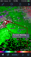
You don't happen to drive a silver pickup do you? I remember I turned down the same road as someone in a silver Isuzu (I think) for a little bit, right about the time of your photo. 4 minutes after my photo I would have been on the west side of 67, almost exactly where your picture was taken at 7:25. There were quite a few chasers in that area, especially a little bit more to the south, so I'm trying to remember what vehicles I saw. It seemed like we were all playing leapfrog along 17, trying to find pullouts, pacing the storm eastward through the turbines
IMG_7942.PNG
 
Yeah, silver pickup. I really thought the storm was going to produce again based on the radar presentation, it would have been an absolutely gorgeous site with the sunset light and wind turbines...
 
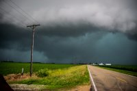
Noticed the storm west of Clinton IA was finally looking like it was going to become surface-based, so took off north after that. On the short drive north the storm quickly organized into a surface-based storm, with the tell-tale kidney bean look of a maturing sup on radar. As much as I wanted to drive right up to it and watch it take off, that would have meant crossing the Mississippi into a populated area, so just hung out on the IL side and waited. Shot a time lapse of the early development, which was pretty cool. One of the longest beaver tails I've ever seen quickly developed, and stretched from the east-northeast portion of the sky, all the way back west to the west-northwest horizon. Huge positive strike bolts started striking out of the anvil to the east, which is usually a pretty good sign you have a beast in the making. Followed the sup east-southeast towards Sterling. Didn't take long for it to wrap the RFD core completely around the south-southeast side of it to where you couldn't see much. Passed through the west side of Sterling, and that's where the RFD core overtook me. Nearly got blown off the interstate as I tried to escape east out of it. Finally punched through the wrapping rain curtains to the southeast of Sterling. Followed it down to west of Harmon, where apparently it produced again. Never did see any actual tornadoes, as you would have to be tucked up in the bears cage to see them with this thing. Kudos to Adam Lucio and others who were able to pull that off.


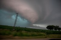
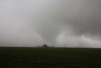
This is the only time I think I may have seen what may have been the actual tornadic circulation. This was shortly before the Harmon tornado looking north here. The couplet was wrapped up inside the hook like a cinnamon bun. Rain curtains were screaming left to right here, and the lowering behind the curtains to the left of the highway was probably the circulation.
732006f1efbaadc81a68dd658644ca97.jpg

A few more pics. Typical view of an HP from the south side lol
e85896da506832b04d8b4981167cda5d.jpg

d2bec855830a321bbb6b36a576570c4c.jpg
 
Living in southern WI, I was hoping to finally get a decent home state chase on this date. Model runs in the days leading up to Monday looked very promising for this prospect, but alas, the morning MCS killed off much of any severe threat in WI.

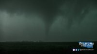
I did a quick check of satellite and obs, after getting off of work at 1pm, and figured the ofb in northern IL would be my best bet. I then headed to Rochelle to grab some lunch, and decide whether to keep going south, or head SW. There were ongoing, elevated storms in eastern IA, so I made the decision to head SW toward the Quad Cities, and meet them as they approached the better conditions in IL. I fueled up in Moline, and a check of radar showed a discrete storm south of Iowa City, and moving my way. Not wanting to get stuck on the wrong side of the river, I headed towards Muscatine, and waited just east of the river. I was eventually greeted with a raggedy wall cloud, and the storm looked somewhat disorganized on radar. I continued to follow it east through Illinois City, and towards Edgington, stopping a few times along the way. Eventually, I stopped just east of Edgington, as I noted the storm was looking better, and was inhaling warm easterly inflow. I figured if it was going to produce, this was the time. Sure enough, I soon saw power flashes in the rain , as I looked west towards Edgington. A few moments later, the tornado emerged.d330d21b3f3d5227c07165f96349e131.jpg

It seemed to be moving directly at me, and I let it get within about 3/4mi. before I bailed east.0109e2c0d1b3da5c6dcecb9cb5d771f6.jpg

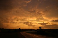
The tornado dissipated not too long after this, and I let the storm go. I then began heading for home, and caught a nice mammatus sunset along the way.fbb328144e0f2c508cb94a14a648a1c1.jpg

All in all, it was a fun chase day, especially since it was only 2.5 hrs from home!
 
Back
Top