2015-6-22 REPORTS: MO, IA, IL, MI

Joined
Aug 2, 2009
Messages
72
Location
Cabot, AR
Today turned out to be a pretty cool day. Originally targeted Northern Illinois. I saw discrete storms going up in Southeast Iowa and decided to head that way. Too many times I have stuck to my target and ended up missing better storms. Well my original target ended up producing, but this one did too so it was all good.

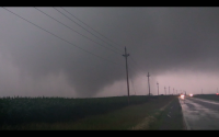
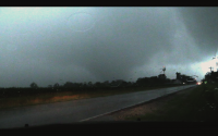
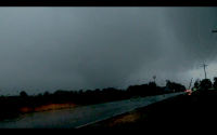
Followed the dominant cell into Northern Missouri which I believe was only a 2% hatched area for tornadoes on the SPC outlook. The storm was HP which is something that has plagued me all year. I managed to find a good road and positioned myself right in the notch. Saw a nice tornado and decent structure for an HP cell. I also had the storm all to myself which is something I don't think has ever happened to me lol. Very good last chase day of the season for me.


Mods please add IL/IA to the title.

Ridiculous day in Northern Illinois yesterday. Tracked the long tracked sup from Morrison all the way to Morris (huh, just noticed the irony in that)

Storm was ridiculously HP, and you had to be deep in the notch to even have a chance to see anything but managed to snag at last 1 tornado near Harmon. I noted multiple "trunk touchdowns" from what appeared to be a much larger circulation, almost like a multi vortex, but the suction vorticy "trunks" were much further apart. One of these got really close.

Here is some video, more later.

 
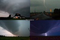
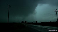
I hesitated on choosing my storm yesterday, which caused me to miss the tornado near Davenport by 15 minutes. I stopped near Galesburg for about 20 minutes for a look at radar trends to make my final choice of either the storm in SE IA or the up-and-coming Davenport storm. That's all it took to ruin the day - 20 minutes. The IA storm began lining out, so north to DVN it was. After I got on the storm, it was done producing - my theme for this year. It began spinning up again just west of the interstate near Andover, but just couldn't get it done. Like Adam said, ridiculously HP. I played closer than I really should have, and still only had visual on things for 30-60 seconds at a time before rain engulfed the meso and/or me. Lightning was pretty intense, but amazingly paused the three times I stopped and set up my DSLR for stills.

june2215a.jpg

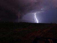
Top left: A family gets ready to flee their home as the tornadic supercell approaches in Swedona, IL. The circulation was only about a half-mile west of the house here, and if it had produced, likely would have impacted it. Top right: dashcam view of lightning striking a wind turbine near Andover. Bottom left: Storm and wind farm near Andover. Bottom right: Storm and lightning near Galva.
 
Crazy day. Wasn't expecting to end up in NW IL, but stranger things have happened. Saw Adam multiple times all day from Morrison to Mendota before giving up at dark to head home to Norman. Will be going through my video and pics after I get some rest and will be posting to my website including a long write up of the forecast. I feel like 2010-06-05 was very similar and both days played out somewhat the same way. I busted hardcore on 2010-06-05 and hate that day to this day, but I'm starting to feel lessons I learned that day lead to a successful chase yesterday.

We were right next to Adam in his footage above. Insanely close to a weaker tornado. The rain made everything impossible to see if you weren't right up in it. Story of 2015 and this one might qualify as the most HP supercell I have ever chased.
 
I chased Ohio into Michigan. I was hoping to see something before nightfall come. Lightning in se Michigan was crazy with the cells near that ef-1 tornado. A lot of small branches down even on the main highway south of Ann Arbor. I got some video of strong storms west of Toledo, Ohio just before a "disturbance" enhanced the convection to minimally severe although it is the same cluster that caused funnels near Sandusky, Ohio. Thought about chasing it but wanted to get to my target in sw Michigan. Lightning seemed to be aggressive compared to most nontornadic storms, not just quick frequent flashes but multiple stroke and longer lasting strokes at times.
 
Last edited:
I paced the tornadic HP supercell from Amboy to near Mendota, IL. I was very close to the Woodhaven Lakes tornado but can't say I saw it, for all the rain.

Started the day anticipating a much more local chase due to the forecast parameters over Wisconsin, but as is common around here an ill-timed MCS put the kibosh on things despite several hours of afternoon sunshine in its wake.

I made my way down to Davis Junction, IL by late afternoon, partly to indulge in another one of my hobbies - railfanning (the Wisconsin and Southern Railroad's business train was there) - and at the same time put myself closer to possible development along the outflow boundary. A check of radar after I got my train shots revealed a cell developing over Clinton, IA heading east, and I decided to make a play on it.

I headed down 251 to IL-64 west, noting "shredded" appearance to trees near the intersection from the big tornado in April, and was passing through Oregon when the initial tornado warning went out. I turned south down IL-2 to Dixon, and soon encountered very heavy - not quite blinding, but close - rain. Finally I reached Dixon and turned southeast on US 52, still stuck in very heavy rain.

The tornado sirens were blaring in Amboy when I reached there, and I pulled up radar for the first time since before leaving Davis Jct. to see a much more impressive than I had anticipated couplet just west of town! Yikes!

At this I bailed southeast out of town, still on US 52. I finally began to break out of the rain here and stopped at the intersection of 52 and Dry Gulch Road. This was my view to the northwest, illuminated by lightning flashing within the clouds:


I continued southeast on 52, pulling off for another look at the intersection of 52 and Green Wing Road:


Looking approximately north across 52, these clouds were moving rapidly from right to left:


I continued southeast and pulled into a gas station just on the northwest side of Sublette. The tornado sirens were blaring here, too. However, moments after I stopped the wind abruptly shifted direction, accompanied by a blast of wind-driven rain, toward where the tornado would be. At this I bailed back onto 52 once again, through Sublette and non-stop through Mendota to make sure I would be clear of any tornado path.

South of Mendota along 251 I got my only decent DSLR shot of the storm:


I continued south, trying to stay ahead of the rain as best I could. West of Troy Grove, looking toward Triumph:


At this point I broke off the chase and begun my trek home, noting numerous streets blocked in Mendota by either downed limbs/trees or high water.

 
Last edited:
Thought this day would get wiped out by morning convection. Seemed that way until late afternoon when the sun finally came out in full force. Saw the cells developing in Eastern Iowa just in case they didn't go linear (which proved to be a good decision). Went for the northern cell near Clinton (which also proved to be a good decision). Finally arrived on it west of Sterling just before it went tornado warned. Structure was kind of grungy but precip was staying out of the way for the most part.
upload_2015-6-23_18-10-13.png

upload_2015-6-23_18-10-58.png

upload_2015-6-23_18-47-37.png


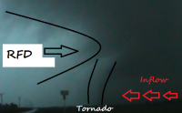
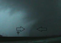
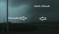
Went east as the RFD overtook us and started south and east out of Sterling. We had some trouble getting out ahead of the storm again, but luckily we were able to get far enough ahead of the RFD to apparently see what I'm pretty sure was the EF2 tornado that struck Woodhaven Lakes and Sublette. I believe we saw it just as it struck Woodhaven Lakes since there was a bit of visible dust and a little debris at the base of it. Rain quickly wrapped around the tornado cutting off our view after about 45 seconds. Although I've heard lots of people saying that you couldn't see any tornado unless you were right near it, there was quite a bit of clear air in the inflow area and that could also be seen on radar, allowing us to see it even a couple miles to the south. But I really find it hard to believe that it wasn't a tornado especially given dust and some visible debris getting taken into it.

These are some frame grabs from my low quality (480p) camera with poor low light capability (very poor camera for HP modes or later in the evening). However, you can make out the tornado.
upload_2015-6-23_18-43-36.png
upload_2015-6-23_18-45-8.png
We then quickly went east again to south of Sublette where we could see the incredible inflow into the storm. Inflow band had very rapid motion into the where the tornado (which was not visible from our perspective) was. Would've gotten photos but was too focused on video with little time before RFD would catch up. Tried to go around Mendota on back roads instead of going through as we didn't want to get caught in traffic with a tornado possibly bearing down. Finally gave up as we got to
I-39 west of Troy Grove as it was getting dark and we likely wouldn't get out of the RFD.

But man, oh man what a storm that was. Started in Iowa and likely produced over ten tornadoes. Definitely not your typical Illinois storm (except for the HP mode). Thoughts are with those who were impacted.
 

Attachments

  • upload_2015-6-23_18-44-9.png
    upload_2015-6-23_18-44-9.png
    406.1 KB · Views: 256
Last edited:
Tracked a large, fairly significant tornado from east of Illinois City through the small town of Edgington doing significant damage to several homes unfortionately. Tornado continued east of town and exhibited a dramatic display of multiple vortices before dissipating and becoming totally rainwrapped. Run-time for this from my count was about 13 minutes from birth to death. Quite a great chase, especially only 45 minutes from home! My photograph is taken near the Rock Ridge High School in Edgington looking south.
Edington%20IL%20Wedge%20Tornado_zpsr6mvmcve.jpg
 
After reviewing video and dashcam footage, it appears I have a "maybe" on the strong circulation near Swedona, IL, on Highway 7 west of Interstate 74 (south of the Quad Cities). This was about 20 minutes after the Illinois City/Edgington tornado. Motion was rapid with condensation halfway down. I was roughly a mile or less east of this. I'm hoping there was someone with a better angle that can confirm whether or not this was legit, otherwise I'll have to put this in the growing file of dreaded HP "so close but not sures".

Video:

Frame grab:
june2215c.jpg
 
I ended up chasing the south-central Iowa storm after a long and frustrating day of indecisive repositioning, and ended up with very little as a result.

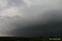
I got a very early start and ended up waiting for the remnants of the morning's MCS to pass over me at a rest area on I-39 near Paw Paw, IL. I then decided that eastern Iowa was going to be the better play, so I headed west and eventually had lunch in the Quad Cities. Southeast Iowa then began to look better in terms of destabilization, but in retrospect my big mistake here was leaving the outflow boundary from the morning's storms. So, off to Muscantine, IA I went, arriving at about the time that the Iowa cell fired way off to the west near Des Moines. I pulled the trigger and headed west toward it as it became tornado-warned. It took quite a while to intercept, but eventually I got to Ottumwa as the storm was doing damage to the west in Albia, IA. I headed south on U.S. 63, watched the storm approach from near Drakesburg, IA, and then skipped quickly through Bloomfield, IA as the storm bore down on the town. By now the storm cluster has both lined out and gone completely HP, and I wasn't willing to dive into the core. Here's what the storm looked like from just south of Bloomfield on IA-2. The view is to the northwest:

IMG_3719.JPG

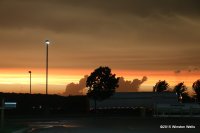
I continued southeast on IA-2 as the storm moved further south into northern Missouri, where it did considerable wind damage in Memphis, MO. I eventually re-intercepted the line near Wayland, MO, where the only thing I saw of note was a nice sunset from a truck stop:

IMG_3738.JPG
IMG_3753.JPG

Somewhat to my surprise, NWS-Des Moines found that the storm did in fact produce a strong, hour-long EF-3 tornado that moved along a 25-mile path from Columbia, IA to Albia. I have yet to see any pictures of this tornado, and I know that there were a number of chasers who looked to be deep in the core who might have witnessed it. Unfortunately for me, this was one of those days where every town I previously stopped in - Mendota, IL, Sterling, IL, and Muscantine, IA - would have been a much better choice if I had only stayed and waited for convection to fire along the OFB.
 
Last edited:
I might as well add to the sentiment here, because I experienced the same thing as several others, it seems. I drove out of Cincinnati, originally targeting the hatched area (Significant Severe) in the first Day 1 Outlook. I figured the southern fringes of the Rockford area would be a good start,but I wanted to stay far enough away from the heavier populated areas.

I stopped at the same rest area Winston referenced and hung out there for a bit to fine tune my next play. The winds were screaming out of the south at the time, but there was still significant convective debris from the earlier MCS. It looked like the most promising area was shifting to the south of my original estimate, and about this time, the first supercell was firing south of Des Moines. I didn't think I'd make that cell, but I dropped south of I-80 and headed west toward the border south of Davenport. The sky cleared up and the atmosphere was much more humid south of the boundary, so I thought I had made a good decision. In my haste to head west, I found myself on a road that turned to gravel (which doesn't play nice with my car) past the point where it made sense to turn around. This slowed my progress but my target cell hadn't been warned and was still growing and rotating. I made it to SE of Edgington right about the time the warning went up for that storm.

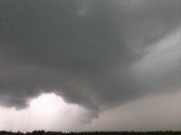
Unfortunately, where I was located left me only one route (Rt 67) to head north and intercept. There was nothing that provided a decent diagonal route to where I wanted to be; well maybe there was, but I didn't want to chance another bad road. As the storm approached 67, it was incredibly rain wrapped.
IMG_7953.JPG

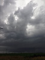
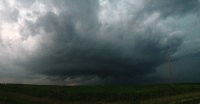
I attempted to punch through the core, but I already have a cracked windshield and didn't want to chance hail finishing it off, so I turned back and repositioned south. I paced the storm as it continued west through Andover, et al, in the same area as Dan.
IMG_7959.JPG

IMG_7970.JPG

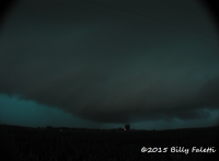
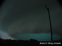
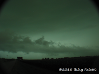
The storm was still inhaling the humid air from the south and cycling a bit, with a visible wall cloud at times, so I didn't want to leave. However, it was done producing after Edgington, and transitioned into a photogenic structure with some absolutely amazing CG. I got some decent photos near the wind turbines in this area.
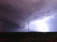
IMG_7992.JPG

IMG_7988.JPG
(I love the cloud detail on this one)

I stayed with it after dark and through another couple of warnings but nothing materialized. I headed back east toward home, thought I may be able to catch the last of the other cell that had spawned the tornadoes to the north and east. I was in decent position to intercept the cell that produced the confirmed EF0 near Herscher, IL. The wall cloud for this cell was very low and looked positively evil lit up only by lightning.
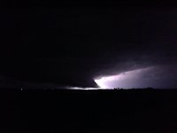
IMG_8036.JPG
Sometimes the lightning does a decent job of illuminating the structure, but in this case, the CG was so intense and close that it actually was somewhat blinding. It was hard to make out structure when my eyes had to continually adjust following each bolt. I was taking some photos when a local told me that there was another touchdown in a field near Chebanse, IL. I did not witness that or the Herscher tornado, nor could I confirm a funnel due to it being pitch black.

Overall, I should have just stayed where I was and stuck to the original plan. Maybe I got anxious and overlooked some details that could have led me to stay put near the rest area, I dunno. The structure and CG was nice, but it's always frustrating as hell to choose the wrong cell and then see your original target area produce after you've left... If anyone else was in the area and saw a blacked-out Maxima, that was me.

Oh, and on the way home, a deer jumped out in front of me on I-74 and clipped my bumper, so my car is currently in the shop. Just a reminder that the biggest danger isn't always the weather.
 
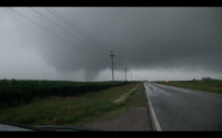
Here is a rotating cell looking nw of Toledo Ohio. Part of the same cluster of storms that had tornado warnings and funnel reports in Sandusky.
 

Attachments

  • 6-22-15 NW Ohio just west of Toledo2.jpg
    6-22-15 NW Ohio just west of Toledo2.jpg
    131.4 KB · Views: 220
  • 6-22-15 NW Ohio just west of Toledo3-10sec.jpg
    6-22-15 NW Ohio just west of Toledo3-10sec.jpg
    139.7 KB · Views: 199
  • 6-22-15 NW Ohio just west of Toledo4-10sec.jpg
    6-22-15 NW Ohio just west of Toledo4-10sec.jpg
    140.3 KB · Views: 200
  • 6-22-15 NW Ohio just west of Toledo5-10sec.jpg
    6-22-15 NW Ohio just west of Toledo5-10sec.jpg
    140.4 KB · Views: 226
With upcoming pattern change looming, I figured I'd give the 22nd a go and flew into Chicago early that morning. Welcomed by the early ongoing MCS, I shot west towards eastern Iowa. I was too far out of position for the initial storm near Albia so I played the next developing cell south of Iowa City. Stayed with it as it crossed into Illinois south of Davenport and viewed the beginning of the Edgington tornado. (all bad quality video stills - story of 2015 for me)
Screen Shot 2015-06-23 at 10.36.37 AM.png
Screen Shot 2015-06-23 at 10.37.20 AM.png
This tornado developed rapidly with such low bases and had fairly significant motion before becoming too rain wrapped from my view. I moved east of Edgington to follow along with it. Should have stayed closer not thinking of the rain wrapped nature of it, so I got bad views as it grew larger and neared the Taylor Ridge area.
Screen Shot 2015-06-23 at 10.40.24 AM.png


I thought it was interesting how I never encountered any hail at all throughout the life cycle of the storm and also how warm the rfd and even the ffd were.
 

Attachments

  • Screen Shot 2015-06-23 at 10.40.08 AM.png
    Screen Shot 2015-06-23 at 10.40.08 AM.png
    1.1 MB · Views: 195
@Ethan Schisler and @sdienst I was on that storm as well. In fact, @Chris Dickerson I am pretty sure we were almost in the exact same spot and following you for a while around sunset as I have some remarkably similar lightning shots. I picked up my friend from Des Plaines, IL and we we took 88 west to the quad cities, noting blasting winds and rain all along the interstate. We sat in the quad cities until about 4:30 when we saw the Iowa storm go warned and some new cells developing. We figured they would develop further so we targeted just west of Muscatine, IA, not realizing what would happen with the northern band of rain showers as they clustered and strengthened into the storm of the day.

We got in great position west of town and new we had limited time before we had to figure out the river crossing ahead of the storm. The cell looked great when it came into view.
P6224557 by chris bray, on Flickr
P6224561 by chris bray, on Flickr

Not long after these we escaped through Muscatine across the river towards Illinois City. Here, we made a mistake. We got a good ten miles ahead of the storm, and while we did so the storm looked weak. We stopped and debated flying towards the main storm by i80/39 or to stick with this one. By the time I realized the radar scans were showing rapidily developing rotation, it was too late to really get in good position. The tornado was on the Northeast side of the Bear's Cage and we were on the southeast. We backtracked a bit and found a spot near Reynolds, IL to view the storm.
IMG_0398[1] by chris bray, on Flickr

panoramic:
IMG_0402[1] by chris bray, on Flickr

normal shot
P6224565 by chris bray, on Flickr

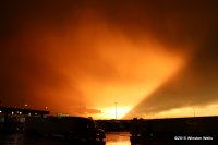
Eventually, we went out ahead of the storm again to find a good location as it seemed to strengthen again. The sun started to set and we were treated to an amazing orange colored storm and background as we hoped it would tighten up one last time before dark. I thought for sure it was tightening up based on radar, but it never could quite produce again. Near Bishop Hill, IL
P6224576 by chris bray, on Flickr

The storm died not long after, and I had to spend the rest of the night driving 2.5 hours back towards Chicago to drop my friend off. I had to watch helplessly as cyclic supercell of the day kept producing tornados on a path directly towards my home in Bourbonnais. An EF-1 did develop in town but fortunately did not cause much damage and was a mile or so northeast of my home!

Another tough outcome without a tornado, salvaged somewhat by a good looking storm with killer lightning.
 
Back
Top