• While Stormtrack has discontinued its hosting of SpotterNetwork support on the forums, keep in mind that support for SpotterNetwork issues is available by emailing [email protected].

2015 12-23 EVENT: LA/AR/MS/AL

Joined
Jan 12, 2015
Messages
51
Things have been trending towards a possibly significant severe setup across Dixie Alley over the past few runs or so on pretty much every major model. A large, negatively tilted trough looks to eject across the south on Christmas Eve, with a very potent and sizable warm sector blanketed across the region with CAPE ranging as high as 2000 J/kg, and a 65+ LLJ racing across the region at this time as well is pointing towards a very troublesome setup for one of the busiest travel periods of the year.
 
Should probably change the date to the 23rd but I concur, definitely a volatile setup in the deep south. Things seem to be getting juicier each model run. Sig Tor's of 5+ showing up through LA and MS. Only fly in the ointment I can see is possible early convection messing things up a bit. Other than that, it has deep south cold season tornado outbreak written all over it. I will definitely be out there Wednesday.
 
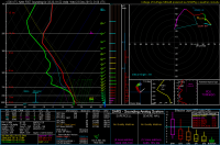
The latest NAM run is still showing the possibility for a fairly potent setup here. If there is enough clearing behind the early morning storms and the amount of CAPE that the NAM is forecasting verifies, things could get interesting along the southwestern edge of the morning activity I think. Here is a nice sounding from SE Arkansas. cb2f6a6f07db5091e3621eae84670a39.png
 
I'm curious why that run you show Mike doesn't have more matches to previous severe weather.
 
This event has all of the makings of quite a volatile situation across particularly the Mid South, Lower MS Valley and TN Valley through the day (and well into the evening). We have a large, very broad-based/slightly negatively tilted trough with a strong surface low deepening through the day with expansive pressure falls extending well to the south. This type of setup highly favours discrete cells with relatively nebulous/diffuse forcing ahead of the boundary and favorable orientation of deep layer shear (in the 50-70 kt range) and very strong low level shear with ESRH in the 250-300 m2/s2 range and possibly much higher in some locations.

On top of that, we have a very spring-like warm sector in place (widespread MLCAPE >1000 J/kg) thanks to a rather absurd 594 dm Bermuda ridge, which would be rather impressive in April/May, let alone December. If Gulf convection associated with the ascent from the eastward progressing ST jet doesn't do much to limit the northward extent of the warm sector, this could be a very nasty day. There is also the possibility this extends north due to cold temperatures aloft allowing appreciable instability to develop north of the Ohio Valley. This is more questionable, but shear profiles also favour fast moving storms with tornado potential should this happen.
 
If I were able to chase this event, I would be targeting the Montrose, AR, area. I believe being on the southwest edge of where the SPC currently has the enhanced risk will be a decent play. For one, the terrain in this part of Arkansas is actually pretty great. Second, this area is forecast to get around 2000 MLCAPE and even if it only ends up with 1000-1500, that would be plenty. Surface-1KM shear is forecast to be close to 40 knots. Although a target further to the north and east seems more likely to have better storm coverage, I think this area in far southeast Arkansas could have the possibility to get a couple isolated cells starting in the early afternoon, and they should have the most CAPE to work with. It will probably be smart to stay close to a known river crossing tomorrow if you plan on starting the chase west of the Mississippi, because storm motions will be fast. I really wish I had the time off from work to chase this event tomorrow.......here is a google street view of some of the terrain that can be found in this area.

https://www.google.com/maps/@33.2872057,-91.4936986,3a,75y,102.77h,92.14t/data=!3m7!1e1!3m5!1stBlN9pXZqh9fGBDycaHOLg!2e0!6s//geo3.ggpht.com/cbk?panoid=tBlN9pXZqh9fGBDycaHOLg&output=thumbnail&cb_client=search.TACTILE.gps&thumb=2&w=392&h=106&yaw=161.99336&pitch=0!7i13312!8i6656
 
Last edited:
Concerned a bit about storm coverage down south, daylight being sparse by initiation, and stuff firing pretty far east (TN down to MS) if you believe the 12z NAM (4km/12km) suite. I'm also liking a secondary area up here in Illinois tomorrow afternoon/evening. 4km NAM showing an area of 1500 SBCAPE developing with 70+ knots of bulk shear and cells firing by 23z). Backing of low level winds up here doesn't look the greatest, which I think is thanks to the surface low moving so fast to the northeast (Northern WI by 00z). Really torn on making the trip down south or just sticking it out with the home turf. I think if this were April/May, I would be more towards the south trip given less "daylight concerns".
 
Definitely a complex setup that has some higher-end potential, but not without some caveats. Shear is particularly impressive as far north as central Indiana, where the 18z 4km NAM is showing 80-90+ knots of bulk shear. However, early day junk looks to contaminate areas such much of Arkansas, central to southeastern Missouri and Illinois, which could preclude a more widespread outbreak. Delayed initiation until overnight is a serious, scary thought for areas like northern Alabama, which makes it an unrealistic chase there and dangerous for locals. (In fact, NAM verbatim suggests there's really an awfully narrow window to chase before it gets dark, over western Tennessee, far northwestern Mississippi and perhaps further north near the Mississippi River, IF a few discrete storms can develop)

The most consistent signal appears to be from northwestern Mississippi into central/Middle Tennessee and south-central Kentucky. Here I think there's potential for at least a localized outbreak of severe thunderstorms, with swaths of damaging wind and multiple tornadoes, some strong. Further north, I think the threat really hinges heavily upon how much convection is ongoing during the morning hours. Not only is the NAM ugly overnight for northern Alabama, but as Andy has mentioned, it's popping a few robust cells in central to southern Indiana as well.
 
I am contemplating a chase tomorrow. I'm traveling from Dallas up to Indy anyway, so might as well stop near Memphis and see what happens, right?! Some potential issues from a chasing standpoint are of course the poor terrain in this part of the country, the storms traveling at just under the speed of light, and as others have mentioned a narrow window of opportunity before dark on one of the shortest days of the year. I'd like to see things shift west a bit, as NE Arkansas is actually pretty flat and clear. My current thinking based on the 18z model runs is that initiation will happen 1-2 hours before dark somewhere near Memphis or south/southwest of Memphis. It looks like a long night for western TN from Memphis to Nashville, and on up into central KY. CAPE values are really high for this time of year, and I don't think I even need to mention the shear, as that's obvious. Definite outbreak potential, depending of course on the early AM activity. I won't even entertain chasing this after dark due to the storm speed and horrible terrain and road networks. As it stands, highways may be the only option anyway.

Whoever is going out there tomorrow, be safe!
 
I'm curious why that run you show Mike doesn't have more matches to previous severe weather.

The sounding analogs depend on there being pretty similar soundings in our development database. We've got a wide assortment of cases, but not every possible event. Perhaps SARS can be improved in
the next 1-2 years as we complete some ability to automate the collection of proximity soundings, including cases going back several years.
 
Based off tonight's 00z NAM and the latest RAP, I'm committing to the "north target" tomorrow. Probably will leave home early afternoon or so and adjust from there, but as things look right now, I don't think I will have to venture too far from home. Thinking somewhere in SE Iowa into WC Illinois could yield a surprise or two as dew points into at least the mid-upper 50's get advected northward and you have the surface low moving in from the west, down to at least 984MB by late afternoon. Lapse rates in this area are fairly steep which is giving decent instability values for this time of year....

If we can get a few hours of clearing behind the early morning wave, we may manage 1000-1500j/kg SBCAPE. Again this is highly contingent on getting good solid clearing to occur. Shear looks strong as well with 0-1km SRH values at least 150-200m2/s2. Bulk shear values are 50-60 knots over this area as well. My only concern would be some slight veer-back-veer in some of the soundings I'm seeing for this area. We shall see what happens though! I think it will be fun to get out in December regardless of what happens.
 
If we can get a good clearing in IL near the low, I think we might get a good sleeper low topped event across W Central Illinois. While the overwhelming main event may be to the south, I think the better chase terrain and the proximity to the low may yield some surprises. We won't know until after the morning wave. Shear looks strong and with the NAM and HRRR currently indicating SBCAPE values nearing 1500j/kg, I think there may be something interesting. This is highly contingent on the morning rain, but my target would be around Galesburg to Macomb, IL if this HRRR upward trend verifies.

Good luck to everyone tomorrow! Be safe, Especially chasing in the jungles.
 
Amazing that not a single news station in the region is covering this event on live TV, despite multiple reports of large and dangerous tornadoes, with one coming very close to (or over) Holly Springs, MS.
 
Per SPC: MULTIPLE INJURIES REPORTED JUST NORTH OF ASHLAND. A COMMAND POST HAS BEEN SETUP AT THE FIRE STATION. POWER IS OUT THROUGHOUT THE CITY. Any chasers in the area with medical experience might consider heading that way.
 
Back
Top