• A friendly and periodic reminder of the rules we use for fostering high SNR and quality conversation and interaction at Stormtrack: Forum rules

    P.S. - Nothing specific happened to prompt this message! No one is in trouble, there are no flame wars in effect, nor any inappropriate conversation ongoing. This is being posted sitewide as a casual refresher.

2015-11-16 REPORTS: TX/OK/KS/NE

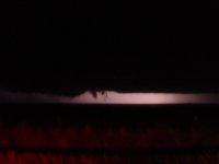
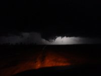
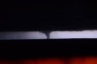
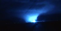
I chased the storm that went from Liberal KS, just after sunset, to Dodge City. Despite a storm motion of supposedly about 55mph, it actually was not too hard to chase. It was unusual in how rapidly it kept changing shape and going up and down. At one point it sort of looked like it was about a mile wide, but that seemed to be just a ground-scraping wall cloud with rapid rotation. It is impossible for me to call it. All told, it never went for more than a few seconds at a time without being obviously on the ground over the course of close to an hour. I didn't get very good video due to the darkness, but here is one vidcap:

151116.PNG

Once I was going north on 23, north of Meade, I came across a grass fire just off the road, so I slowed down and looked around to see what else might be visible. I ran over something I never saw, then soon saw an entire vehicle's transmission in the middle of the road. Now I'm thinking there's been an accident and somebody may be seriously hurt, so I was about to turn around and look for a vehicle in the ditch.

I came across another chaser and exchanged some info with him, and he explained that he had lost his "driveshaft". Weird. The tornado was about 8 or 10 miles north of us at the time.

Then, approaching Dodge City, there was... I think... some railcars in the middle of the road, so I had to detours a few miles on a muddy road.

First November tornado for me. Heck, it was my first November chase!
 
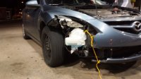
This chase easily goes down as my worst of 2015, and likely one of my top 3 worst lifetime. The chase can be summarized using the following image, which should serve as a reminder to everyone that the MOST DANGEROUS aspect of chasing is DRIVING, not just during the chase, but to and from the target area, when it's likely to be dark, you to be tired, and to drop your guard:
20151116_202756.jpg

That's what the front right corner of my car looks like after hitting a fawn or small doe at 60+ mph.

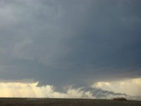
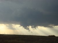
Summary: saw zero tornadoes, although we saw several likely funnel clouds and some rotating wall clouds, as well as a very suspicious feature well off in the distance after dark. This was despite being on the two storms of the day in the TX panhandle well before sunset. Then we hit the deer.

I left Norman with @Tim Supinie at around 11 AM. We initially staged a mile north of I-40 on FM 294, just a few miles northwest of Groom. Oh, if only we had just stayed there...

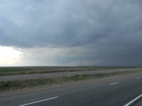
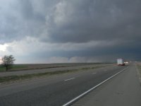
After watching several towers start to go up and get sheared apart to our immediate SSW, we decided to move south a little to get a better vantage point of showers/weak convection well to our southwest. We moved to a spot near the intersection of FM294 and FM1151 about 10 miles east of Claude, where we sat for almost an hour before we got impatient with the one good looking cell that was approaching Tulia at the time. We booked it west and south through the canyon on TX-207, turning around a few miles after popping back out of the canyon. What initially appeared to be a ragged disorganized base a few miles to our west evolved into a weakly rotating, but high based wall cloud that we intercepted near Wayside. It had a moderately strong RFD push. We went back into the canyon, fighting with data availability, when we saw it get tornado warned. It was still rather high based at this time and there wasn't much low-level rotation.

Eventually we cut east and north using FM 2272 through another canyon south of Goodnight. On our way east we saw a pretty tightly rotating wall cloud. It was pretty narrow, and it appared to spit out one or two funnels, but we never saw anything come close to the ground. Then we started to lose it in the fading light and in the canyon. By the time we got back up to US 287, we were about ready to call the chase. We let the initial storm go since it did not appear to be doing anything interesting, and because we were already behind it. We watched the second storm approach us from the southwest for a good 30 minutes. Even after we left our spot at the Goodnight intersection and went back to I-40, we took our time going back through Groom to double check before heading home. All we could see was a black featureless base. So we started home...

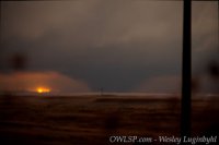
Then we started hearing about the "large and extremely dangerous" (at night, who knows what that means) tornado reports near Pampa. After some deliberating we decided to make another attempt, getting off I-40 at McLean and heading up towards Lefors. As we neared Lefors I swear I saw two power flashes way off in the distance, then we saw what looked to be a dark mass contrasting with background orange light, probably from Pampa. We only saw it for a few seconds. Who knows what it was.

We called the chase there. To save a little time, we decided not to go back to I-40 through McLean, but instead to cut through to Wheeler and Elk City. So we kept east on FM 2473. About a mile west of the Kellerville intersection (note: there's no actual town there, just some abandoned buildings), a fawn or small doe popped out of the tall grass to the right of the road and began running across from right to left. I saw it about 1-2 seconds beforehand, but at 70-75 mph all I could do was veer left and hit the brakes. It wasn't enough - we slammed into it around it's shoulder-neck-head region on the front right quarter. We never saw the deer after that, so I presume it died. We cleaned up the damage as best we could (as desolate as it was, and with low clouds and a howling moist wind, it was pretty eerie and pitch black, too) and were actually able to get back to Norman in a reasonable amount of time.

I'm guessing the damage will be in excess of $3000. All things considered, though, this was probably the best possible outcome: neither of us were hurt, and the car was driveable. In fact, it doesn't appear there has been any significant frame or axle damage. Had it been a bigger deer, or if I hadn't veered left, it probably would've finished off the car and/or injured us. We were some distance from the nearest help.

This is also why I'm not a big fan of chasing after dark.
 
Saw 8 tornadoes, including 3 wedges and two stovepipes in the Texas Panhandle and western Oklahoma. We had very little time to get any stills but Gabe shot over 2 hours worth of footage following at first the storm S. of Claude that would become the Le Fours super cell to Miami, TX and then following the Pampa storm from N. of Miami, TX all the way to the KS border. I'm glad Jeff and as far as I know, other chasers are ok after this unprecedented November outbreak in the Panhandle. Honestly will go down as the best night chase I've ever had.
 
Witnessed the 2 large long track tornadoes training near Pampa TX last night. The second training storm dropped a gorgeous satellite rope while the Pampa city lights lit it up. It moved out of the light before i could get a picture, but damn, what a sight! hopefully somebody caught it. Also the the daylight funnel cloud South of Claude TX. Had a great view of it and could not confirm a touchdown.
 
Crazy day in the TX Panhandle yesterday, especially for November. Just shows what 1000-1500 mlcape and a 100kt jet can do overhead.

On the first storm near Groom, was not impressed, dropped S towards tulia storm and watched from the top of the canyon. Great structure, wish it had planted in the canyon. Oh well.

Slender cone tornado further north a little ways south of Claude, then another one near Groom.

Large tornado north of Groom, tracked that until past Miami. Ran into the damage path multiple times.

Dropped back to the next storm and witnessed another large tornado from near Pampa up towards Canadian.

Great chase day
 
I wasn't really planning to post any vid, but I changed my mind.


As an aside, I will mention that this is the first tornado video I have taken with this camera, which is a pretty cheap Sony DSCWX220. It has no ability to be locked on infinity focus, but I'm just stunned at what a good job it did last night considering the darkness.
 
Last edited:
Work took me to Garden City Monday afternoon after getting done with work I headed south out of Garden on hwy 83 looking to the sw I saw two distant tornadoes called weather service and they confirmed what I was looking at were tornadoes. Pulled over and watched the storm move in my direction, rotating with many ragged funnels. Rotation passed me to the north and was hit with strong winds from the west , so moved east and north to get back on the inflow side. Followed the storm north past Garden lots of motion and what I would call some very short touchdowns. let that storm go when the storm near Liberal started producing headed back to Dodge to get out of work van and in to my car, then headed south west out of Dodge as soon as I got clear of trees in town could see the tornado west of Dodge pulled up on a small hill to see better. Called my TV station to report tornado on the ground with power flashes, and that the storm would miss Dodge to the west followed the storm on north in to Hodgeman Co.DSC00766.JPG DSC00767.JPG DSC00769.JPG DSC00777.JPG DSC00779.JPG DSC00772.JPG DSC00767.JPG DSC00766.JPG
 
Had an admittedly average day with 2-3 tornadoes depending on how you want to count. Saw the Claude tornado from birth and decided to let that storm slip up to Groom in favor of the storm right on it's tail. Had a car with low clearance that ended up making it difficult to negotiate the garbage roads down around the Prairie Dog Town Fork and onto the Llano near I-40. Caught a very brief glimpse of the first Groom tornado before trying to keep up with the southern storm and falling flat doing so. Got a decent view of the second Pampa wedge all the way from I-40 as it hit what looked like a transformer judging by the power flash and that was all she wrote. Can't complain about a few tornadoes but it sucks to have missed one of the most prolific High Plains nocturnal events of all time.

4714be6351d0bf56aaec231c5369621b.jpg

c4372dcdde193ab45d5373830c103449.jpg

4106507c59d9e685b2996876a392f3ff.jpg

91038d067b9adf75349fcbd5979c798c.jpg
 
Most of this is just a copy from my blog. Finally got my first Nov tornadoes as well as passing the century mark for tornadoes in my lifetime.

Almost waited for storms to go up from Amarillo, but decided to venture out east and wait at Claude around 2pm. I decided against crossing the canyon to catch the storms that fired down by Tulia, as I didn’t want to be out of cell service that long. With my wife pregnant and about 10 days from her due date with our second kid, that wouldnt be a smart move. Was also set on not venturing too far from Amarillo, for that reason. It took a while for storms to take off. If it looked good on radar, it looked bad visually. If it looked good visually, it looked horrible on radar. Met up with Blake and Chris (other Amarillo chasers) at Claude and tried to figure out if to stay with the northern storm, or wait on the Tulia storm to cross the canyon. The northern storm finally started to organize after it passed us moving +50mph. It was at White Deer before we left I-40. We got fortunate, because as it began to spin, it slowed to 35kts. As it passed between Skellytown and Pampa, it dropped a large bowl that I thought was a wall cloud. Only realized it was a funnel after it began to rope out. By this point I was west of Pampa and the southern storm was just getting north of the Canyon (ever tempting us to drop back south).
105a812baa1c1ead0a78acfe3f70dcce.jpg

We continued north of Pampa as the storm dropped another funnel that would last ~20 minutes. We got all the way up to the Canadian River and watched it rope out slowly. After giving that storm one more chance and no new lowering we finally bailed back south using the FM283 that cuts off Highway 70 to Miami, TX. It was a gamble to beat the fast moving storm that was bearing down on Pampa by that point with multiple reports of tornadoes. Clipping through the outer edges of the core the reports of “wedge” start getting through. Hearing “wedge” makes you want to get out of there faster, but being on that winding 2 lane road in the core at night made that not an option. I was able to clear the core a few miles before Miami while the tornado was still close to Pampa. It was an eerie feeling entering Miami that had already lost power and the only lights were emergency vehicles running around town probably trying to warn as many as they could. With the direction the storm was going I wondered if the town would still be there in 15 minutes as I blasted south out of town to get out of the canyon and try and see the “wedge”.

1913857411eafbbfe8772575a9763a00.jpg
I got to the ridge where I had set on chases before with Marcus and Steve back in 2010, only difference this time was a huge wedge in the darkness coming my way. I could see the large tornado right as I stopped being lit up by the lightning. I got out and set up the tripod, but every shot kept getting blown out by close CGs. On top of the lightning barrage, the inflow winds were enough to blow the tripod over even without a camera on it so I couldnt even leave it out there. I scampered back in the car and used my window mount to take pictures. Not the steadiest shots as the vehicle was being rocked by the winds. I only got a couple shots of the wedge, before it occluded into the rain and disappeared into the darkness. The next cycled tried to produce just a few miles to my north but couldn’t do it.

It was at this time I noticed another wedge with the storm that was behind the first wedge producing storm. The tornado was illuminated, not by lightning, but by a prison that was nearly hit by the tornado. It is very freaky to be able to see a tornado at night by lights on the ground. I lost visual of that tornado till it got closer to Miami. It was still going strong but had shrunk down to an elephant trunk in size. I viewed it for another 5 minutes till it vanished. At that point I called the chase off and began to try and figure out how to get home as I was not sure if I could drive home through Pampa or not. Only encountered some power line and tree damage along the highway, but was able to get through town and back to Amarillo using only 1 tank of gas on the entire chase. $22 for 5 tornadoes, 2 of which were wedges, is a great deal in any month, but insane for November.


e165fca73f11e2bbda26b1ca92471a54.jpg

b31440b4d9313ce810bcf9f7df41ae7d.jpg

For all my other photos: https://www.facebook.com/wluginbyhl...111447.1073741905.9609344&type=1&l=c81fdb9ef0
 
Not having the time (or enough rest) to drive to the TX panhandle like I wanted to, I decided to wait for it to come to me in the DFW area. Since it was night and I knew it was going to be a fast moving squall line, I made plans to get a little bit of sleep and get up around 3 AM to head to a parking garage on the western edge of Plano where I could get a better view, but also could have some cover should I need it. I arrived at the location just after the severe thunderstorm warning went up for Collin County. Just a few minutes later a tornado warning was issued for SW Collin County (where I was) and SE Denton County. A little while later I saw a single power flash to my SW and reported it to the Skywarn net. There was the distinctive horseshoe shape to the base, but the action area on the right was obscured by a building. A little while later the I started seeing more power flashes. The gust front coming thru was not impressive. 17 mph sustained measured winds for a couple of minutes with only a few gusts (around 50 mph I would guess). They cancelled the tornado warning. A few minutes later it became warned again, this time to my NW. I moved to another garage that had a view to the NW, but never saw anything of interest.
 
Here's the chase summary from our team and how we did on the day. Some highlight facts: we chased from Goodnight, TX to Coldwater, KS for over 4 hours and 10 tornadoes recorded within the video including a possible Fujiwara effect with two wedge tornadoes near fort supply, OK. There's an interactive map and if you click on certain storm report icons, you'll see our picture at the time of the event. Enjoy! http://hubs.ly/H01qKTX0
 
Nik Stophel joined me on what would become an incredible chase. We left Tulsa, OK around 10 am and arrived to our target: Groom, TX around 3 pm. We hung out for an hour or so before jumping on the supercell coming up from Tulia, TX. We hung out on the south side of Palo Duro Canyon and followed the lead cell back to the north. Our first funnel/tornado developed just north of the canyon. Another tornado dropped right at dusk with the lead cell. We let the lead cell go and jumped on the tail-end charlie near Goodnight, TX and followed it northeast to east of Pampa as it went tornado crazy. Here are a few photos I took. I may add more later.
Nov 16 2015 tornado 1.jpg Nov 16 2015 tornado 2.jpg Nov 16 2015 tornado 3.jpg
 
What a wild chase for the end of the year. I'll never know the exact tornado count we saw, but its somewhere between 8 and 12. There were at least 2 times we saw wedges with satellites.
The highlight was capturing Pampa wedge #2 as it formed nearly on top of us. Even in the darkness of night we could see it lofting dirt and debris in the field next to us, then it rolled over some power lines causing it to light up a brilliant xenon color.

36a1aa42b8b573def59ba8b0663a23ce.jpg

Video:

We did catch the Claude tornado as well, in addition to some amazing structure over the Palo Duro Canyon. You really can't ask for anything better in the fall.

Full log: http://www.aerostorms.com/november-16th-2015-historic-pampa-texas-tornado-outbreak/
 
Here are a few more photos from this incredible chase. Its hard to believe its already been a week!

tornado 1.jpg
First tornado/funnel cloud near Goodnight, TX

supercell car lights.jpg
Chasers wiz by trying to keep up with the supercell as it races northeast around 50mph. This was a 10 second exposure. Notice how the cloud is blurred due to the incredible amount of sheer blowing the top of the thunderstorm downstream.
supercell before tornadogenesis.jpg
This was minutes before the first wedge tornado develops. Classic!

second wedge wide shot.jpg
This is the second wedge as it races northeast. The tornado must have been 10-20 miles away! I have not had a chance to go back and find the locations from which these photos were taken.
 
Reading others' accounts from the Goodnight - Groom - Pampa area, it sounds like I had a similar chase experience to many. Caught the cone near Goodnight, then the Groom - Pampa stovepipe (this included a too-close-for-comfort encounter with a downed power pole that was lying across the road in the damage path). I also thought that there may have been a brief/distant initial touchdown (broad and weak) prior to the Goodnight cone; this was as the base first came into view with a large bowled wall cloud (see first pic). If anyone else has insight on this, I'd love to hear it? Second pic is from Goodnight looking southwest (let me know if it's you in the pic!), Third is a screenshot travelling north behind the Pampa tornado as it's passing just south of town. Lessons learned: 1) don't take daylight for granted and 2) must improve nighttime photo/vid documentation skills. Full chase account is available here: http://highwaysandhailstones.com/storm-blog/november-16-2015/

1 Tornado.jpg WSMT_Groom Tornado.jpg Pampa tornado-4.jpg
 
Last edited:
This was one of my oddest storm chase experiences of the year. A combination of several tornadoes (most in any single chase since 6/17/14), car/debris issues, storms underperforming/overperforming based off radar and having to bail early.
ph0.jpg
I actually started the day in Fort Worth, where I have driven to from the Atlanta area the night before. My target was the southeastern panhandle of Texas, in literally the same area that I had last chased on September 20th. I found myself wandering around, waiting for storms to initiate. The photo below was from Memphis and the photo above was near Claude.
ph1.jpg
I watched a developing supercell in Tulia, but little did I know that to get into line for this storm, I would drop into a canyon and lose radar data. Once out of the canyon, I approached the storm and had only spotty radar data to run with, so I decided to just rely on my eyes and watch the storm do its thing. This also gave me more time to man the cameras, as I was chasing solo.
ph2.jpg
The wall cloud associated with the storm showed varying amounts of organization and rotation, but despite its appearance on radar, it didn't produce. As it moved northeast, I adjusted back toward the canyon and tons of chasers were lined up. I stayed for a bit to shoot some more video and there was a brief moment with what appeared like two funnel clouds reaching down, but then quickly lifted.
twin.jpg
I followed the storm back north and like the accounts of many others, observed a brief tornado south of Claude, but it lifted relatively quickly.
Sclaude.jpg
I drifted farther north and intercepted one storm that dropped some hail, I believe it was the same cell that resulted in the first long-track tornado south of Pampa. As I was driving east on I-40, I did a double-take to my left. I thought it was a rain shaft, but there was a tornado developing in close proximity. On radar, it was clear that a supercell was forming, but the velocity scans were garbage. The tornado went unwarned for several minutes, perhaps in part due to the crummy representation on radar? I first reported the tornado to NWS Amarillo at 6:39 p.m., but based on the radar images I have saved, it didn't get warned until between 6:47 (debris ball on radar) and 6:50. I don't have video equipment that shoots well under low light conditions, so I only managed one very low resolution still:
groom.jpg
As I moved east, I managed to get to TX-70 in time to shoot north and was planning on intercepting the storm as it approached Pampa. As I was moving north, I had, for a short time, a visual on two tornadoes to the north. One was to the northeast of my position (passing east of Pampa) and the other one to the northwest was the storm that touched down near Groom. Moments later, there were power lines down all over the road and a whole string of cars off the side of the road with damage and flat tires. I attempted to dodge the debris, but ran over a telephone pole before slowing down and getting out of the way. I was losing air in my front passenger side tire, as the rim was damaged. Luckily, a group of three younger guys (locals who were "chasing" for the first time) had a massive hammer and we knocked the rim back into place. After filling the tire up with air, it was far too late to try to chase anything else. I'm really surprised that more damage wasn't done from running over a telephone pole, but I guess I had slowed down considerably before impact.

I went east all the way to Fort Smith, AR that night, anticipating a chase on 11/17 in the Lower Mississippi Valley. It's a shame that few discrete cells formed ahead of the squall line that afternoon, because the area near the Mississippi River in northeastern Louisiana is very chaser friendly for road networks and visibility. I finally went back to Atlanta for work the next day and didn't catch the Mississippi tornadoes that night.

Although the chase was cut short, I managed to catch glimpses of at least three tornadoes and was lucky enough to not have to get towed after the incident south of Pampa. I've had a few close calls with debris over the past few years, but have been able to escape each time. (While stuck just south of Pampa, several tow trucks and law enforcement offered help, but I was too stubborn to take it) Luckily I drove all the way back to Atlanta over the next two days with no issues with the tire.
 
Of course I chased the most prolific November setup west of the 100th Meridian-west. 4 tornadoes in total, including 2 close encounters with EF-3 tornadoes. I stayed with the leading storm the whole time from Palo Duro Canyon until Miami, TX.

Tornado #1 just south of Groom, TX.
View media item 966
Tornado #2 south of Pampa. This is the first one to cross highway 70 and down some power lines (that I just ended up driving over).
View media item 961
Tornado #3, a large wedge that did pass only about 1/2 mile in front of me.
View media item 962View media item 963View media item 965
Tornado #4, a distant stout cone north of Miami, TX.
View media item 964

And here's my video from this day.
 
Back
Top