Tom Stefanac
EF2
It's not a tornado or supercell but I think this event is worthy of a reports post.
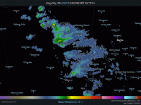
Some unusually cold arctic air with mid level instability moved into the great lakes region on the afternoon of Friday October 16th and sparked convective showers and lake effect rains. The lake effect rains turned into LES overnight and two persistent bands setup in Southern Ontario. One band streamed in off the southern tip of Lake Huron and the other into areas just south of Georgian Bay.
I woke up bright and early to make the 1.5 hour trip north to catch some snow and fall colours. While it's not too unusual to have October snow it's often just a light dusting. Of course, having a rear wheel drive car with summer tires on is not a huge deal for early season snow but boy did I underestimate what I was getting into.
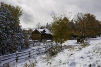
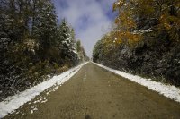
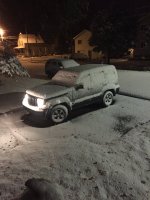
A bright sunny 3C morning turned into a 1C overcast sky as I drove towards the town Singhampton which sits atop the Niagara Escarpment. I slowly began to run into snow and then over the course of maybe 4 kilometers (2 miles) the landscape went from a trace of snow to several inches which eventually became 7 or 8 inches of thick wet mush. It literally turned into a winter wonderland with many victims in the ditch!
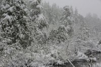
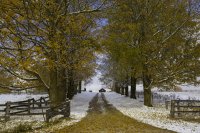
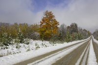
The roads were brutal but I pushed onward and I'm glad I did because it led to possibly one of the most surreal landscapes I've ever seen! The fall foliage just west and north-west of Singhamtpon was at peak colour. That also happened to be where the edge of squall gave way to sunny blue skies revealing colourful, white and contrasty landscapes.


Eventually the squall began to fall apart around 3PM and the snow, once exposed to direct sunlight and rapidly rising temperatures quickly melted in many places (but not everywhere).
Not a bad surprise for an otherwise boring October.
I'll have to eventually post a proper chase log, but for now I have a small album on Flickr.
https://www.flickr.com/photos/vaughanweather/albums/72157660046701065
Some unusually cold arctic air with mid level instability moved into the great lakes region on the afternoon of Friday October 16th and sparked convective showers and lake effect rains. The lake effect rains turned into LES overnight and two persistent bands setup in Southern Ontario. One band streamed in off the southern tip of Lake Huron and the other into areas just south of Georgian Bay.

I woke up bright and early to make the 1.5 hour trip north to catch some snow and fall colours. While it's not too unusual to have October snow it's often just a light dusting. Of course, having a rear wheel drive car with summer tires on is not a huge deal for early season snow but boy did I underestimate what I was getting into.
A bright sunny 3C morning turned into a 1C overcast sky as I drove towards the town Singhampton which sits atop the Niagara Escarpment. I slowly began to run into snow and then over the course of maybe 4 kilometers (2 miles) the landscape went from a trace of snow to several inches which eventually became 7 or 8 inches of thick wet mush. It literally turned into a winter wonderland with many victims in the ditch!

The roads were brutal but I pushed onward and I'm glad I did because it led to possibly one of the most surreal landscapes I've ever seen! The fall foliage just west and north-west of Singhamtpon was at peak colour. That also happened to be where the edge of squall gave way to sunny blue skies revealing colourful, white and contrasty landscapes.


Eventually the squall began to fall apart around 3PM and the snow, once exposed to direct sunlight and rapidly rising temperatures quickly melted in many places (but not everywhere).
Not a bad surprise for an otherwise boring October.
I'll have to eventually post a proper chase log, but for now I have a small album on Flickr.
https://www.flickr.com/photos/vaughanweather/albums/72157660046701065

