Winston Wells
EF1
This was my third chase in Iowa in six days, and probably the most enjoyable. I ended up chasing the cluster of severe and tornado-warned storms that fired a bit north of I-80 west of Des Moines and saw some amazing structure. Yet again morning convection made for a tricky forecast, but it eventually became clear to me that the only part of the target area - essentially the whole state early on - that might work would be in the southwest along U.S. 34. A warm front was slowly moving north and the region was ripe with various boundaries, so I waited for the cap to break with many, many other chasers in and near Osceola, IA.
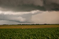
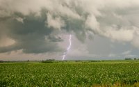
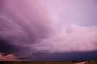
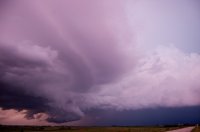
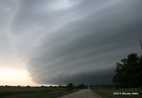
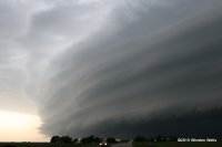
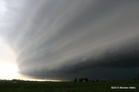
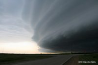
Eventually storms started to fire, but further north than I expected. I waited a bit to see if southwest Iowa would go - the parameters here were through the roof - but I then decided to head north on I-80 for the storms that had initiated. They gradually were SVR-warned by NWS-DMX, and then in quick succession three areas of circulation gained TOR-warnings. Many chasers wisely targeted the western-most embedded cell, but I was closer to the eastern two circulations, so I stayed with them. After moving west on U.S. 6 through Adel, I moved down to westbound I-80 and then headed south toward Earlham, IA. Between here and Winterset, IA the eastern part of the complex put on a great structure show. Here are a few pictures I took between these two towns. The view is to the west in all of them.
Eventually storms started to fire, but further north than I expected. I waited a bit to see if southwest Iowa would go - the parameters here were through the roof - but I then decided to head north on I-80 for the storms that had initiated. They gradually were SVR-warned by NWS-DMX, and then in quick succession three areas of circulation gained TOR-warnings. Many chasers wisely targeted the western-most embedded cell, but I was closer to the eastern two circulations, so I stayed with them. After moving west on U.S. 6 through Adel, I moved down to westbound I-80 and then headed south toward Earlham, IA. Between here and Winterset, IA the eastern part of the complex put on a great structure show. Here are a few pictures I took between these two towns. The view is to the west in all of them.


Last edited:

