The Nebraska panhandle gave me a long and very enjoyable chase day that centered first on the region near Sidney, NE and then later a bit further east near Big Springs, NE. I chased three storms that produced nice RFD cuts, a few funnels, and, as the day ended, great structure.
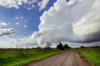
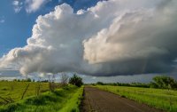
The first storm of the day fired mid-afternoon just to the southeast of Sidney, which was my original target. I hopped off of westbound I-80 at Lodgepole, NE and watched the storm slowly get organized as it moved north and a bit west. I was nearly under the base just west of Sidney when the first of several well-defined funnels appeared. As the storm crossed U.S. 30 I thought it was going to get it done. The surface winds were howling into the storm, but the inflow was much too cold. Here's a picture of the storm's early funnel as it became TOR-warned. The view is to the west from U.S. 30 three miles west of Sidney:

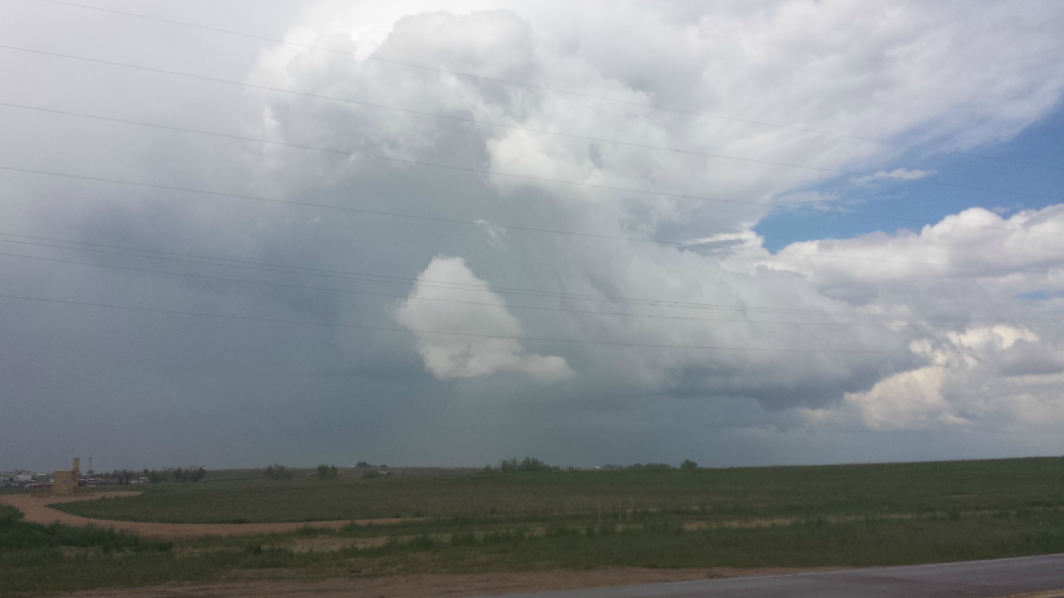
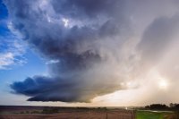
The funnel soon disappeared, but the storm continued to wrap up. Here's a shot of its emerging structure and RFD slot from a few miles further west on U.S. 30. The view is also to the west:

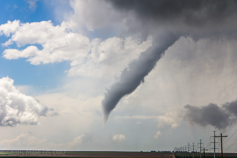
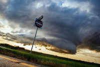
I followed the storm with everybody else on a secondary road for a few miles to the north but I eventually let it go and moved back to the area near the Sidney exit of I-80. After a fairly long wait a second wave of storms moved north from Colorado, with the base of one of them passing directly over the stores and restaurants near the interstate. This cell behaved similarly to the day's first storm. Here's the first lowering of small, compact wall cloud as the storm moved nearly due north. The view is to the west:

I and many other chasers bolted north a few miles on U.S. 385 after it. The storm did eventually wrap up nicely but did little else. This shot looks north from U.S. 385 a few miles north of Sidney:

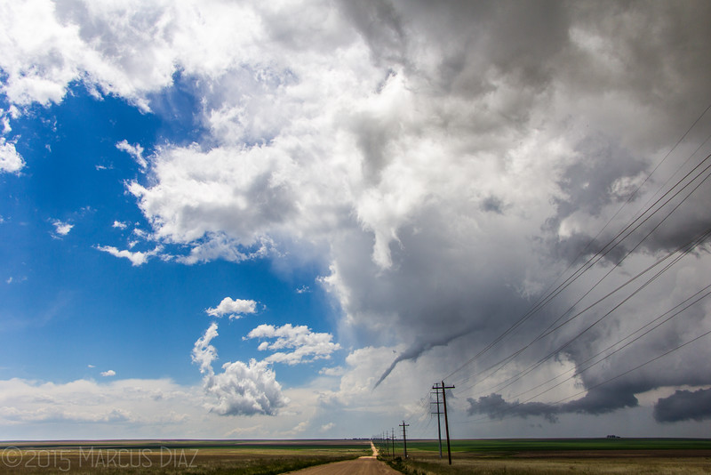
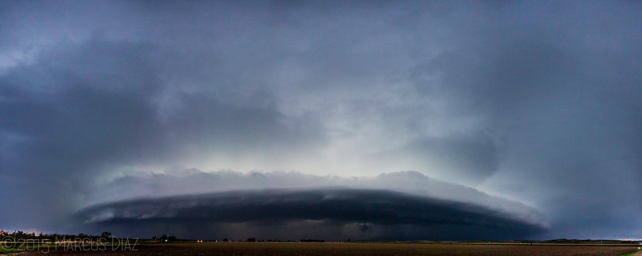
The light and visibility were great all afternoon, but I eventually decided to head back east on I-80. As I neared the Big Springs, NE area yet another wave of convection was moving north from south of the Julesburg, CO area, so I waited just south of Big Springs for it to pass to my north and west. Although it looked junky and elongated on radar, it turned out to be a striated, structured beauty. I took these final two shots, both of which look northwest, near Big Springs:


It was easy to stay ahead of the storm on I-80 as daylight was fading. After shooting some lightning at the Brule, NE exit I called it day and headed for my hotel in McCook, NE.


")


") , we pulled well off Hwy 19 next to, what I assumed, was a gated off
, we pulled well off Hwy 19 next to, what I assumed, was a gated off