Brett Wright
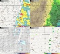
Well this is the first time I ever posted on here, but I feel that Friday is worthy of our attention in the eastern Panhandle area of Texas for a legitimate severe weather event. In my 5 years of chasing, if I am west of 35 and there is non south easterlies at 850, storms turn LP and die most of the time(just my observation), and Friday looks to keep winds @850 at about 130-140 degrees to the SE which is excellent. Good convergence along the dryline, decent instability and good shear(50+kts @500) should set the stage for isolated supercells somewhere near CDS and areas south moving NE throughout the evening. My gut says the tornado drought for many will end in these next few days with this cut off low.
One worry I have is the weaker winds below 700 and a slight veer back veer component but it really doesn't look all that bad.
Either way, good luck chasing and I really should use Stormtrack more often, seems like a amazing forum.
One worry I have is the weaker winds below 700 and a slight veer back veer component but it really doesn't look all that bad.
Either way, good luck chasing and I really should use Stormtrack more often, seems like a amazing forum.