Good day all,
I was chasing out in Iowa and Illinois on April 9, 2015, and was on the storms (and EF-4 tornado) to the north of Rochelle, Illinois. The FULL log for this chase is also below at the link provided (also includes previous day's chase in Kansas on April 8)...
http://www.sky-chaser.com/mwcl2015.htm#APR7
April 9, 2015 - Chase details below...
ABOVE: This is the view north of Hillcrest / Rochelle ... This is a violent EF-4 tornado! Wow.
Below is the details on both the Davenport, Iowa tornadic HP storm and the violent EF-4 producing storm later near Rochelle, Illinois on April 9, 2015...
April 9, 6:00 PM - Interception and subsequent penetration of a very severe and tornadic thunderstorm from west of Davenport, Iowa in Scott County, and points east to near I80 and Highway 61 near the Mississippi River. The storm was encountered again west of Fairdale, Illinois in Olga County and near I-39 as it evolved to a line segment behind the other tornadic storm that affected Olga County (below). This storm was an HP supercell storm, and a weak, possibly rain wrapped tornado was briefly visible from the SE side of the storm before it became outflow dominant. The storm also contained frequent lightning, heavy rains, quarter to golfball sized hail, and winds gusting over 70 MPH. The storm was caused by a warm front / Pacific cold front interaction, surface heating, vertical wind shear, a low pressure system, and an intense upper trough aloft. Documentation was digital stills and HD video. A 2009 Ford Escape was used to chase the storms. A tornado watch was also valid for the area until 11 PM CDT.
April 9, 7:00 PM - Interception and indirect penetration of an extremely severe and violent tornadic thunderstorm in Ogle County, Illinois from north of I-88 near Dixon and towards Rochelle and near I-39 / Highway 251 near Kings and to near Highway 72 near Fairdale. This storm was a violent and cyclic classic supercell thunderstorm. It produced a violent wedge tornado, nearly a mile wide at times that destroyed the small towns of Kings and Fairdale leaving two people dead. The storm developed on the southeastern side and ahead of a cluster of storms, formerly a supercell, to the northwest near Davenport, Iowa. This one cell explosively intensified, and quickly moved to the ENE and NE where it became tornadic near Rochelle and east of Dixon. The tornado started as a cone, then evolved to an elephant trunk, and ultimately a stovepipe. The storm quickly cycled and produced a large and violent (EF-4) tornado northwest of Rochelle just before 7 PM CDT. At one point, the developing wedge had a large satellite (a small stove pipe) tornado rotating around it. This tornado continued until it was out of site to the northeast of Fairdale, where I had to stop and offer assistance (Highway 72 was also blocked there). Ground scouring was noted with the passage of this tornado, along with complete destruction of buildings, homes, trees (with debarking), and vehicles. A semi was overturned by this storm south of Highway 72 on I-39. The ground scouring was along a large swath, oriented SW to NE, with bare dark dirt left. Golfball sized hail was also noted as this storm crossed I-88 earlier. Winds gusting 70 to 80 MPH were observed (RFD) as well as inflow over 60 MPH. Heavy rains and frequent lightning were also encountered. The storm was caused by a warm front / Pacific cold front interaction, surface heating, vertical wind shear, a low pressure system, and an intense upper trough aloft. Documentation was digital stills and HD video. A 2009 Ford Escape was used to chase the storms. A tornado watch was also valid for the area until 11 PM CDT.
Below are pictures from the chase day (April 9, 2015)...
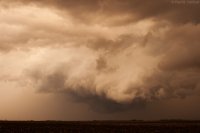
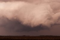
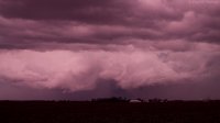
ABOVE: Possible weak tornado becoming rain-wrapped to the west of Davenport, Iowa on April 9, 2015.
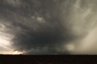
ABOVE: New supercell developing near Dixon, Illinois on April 9, 2015. This will be the violent supercell and tornado to affect the areas north of Rochelle, IL later. The powerful RFD is developing in the center of the image, with flanking line and updraft just right of that. The view is to the east.
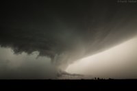
ABOVE: Developing tornado north of I-88 and southwest of Rochelle, IL on April 9, 2015.
ABOVE: Mature elephant trunk tornado north of I-88 and southwest of Rochelle, IL on April 9, 2015.
ABOVE: Close-up view of the large stovepipe tornado north of I-88 and southwest of Rochelle, IL on April 9, 2015. The view is to the north.
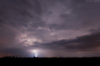
ABOVE: Violent wedge tornado, backlit by a flash of lightning, heading towards Fairdale, Illinois on April 9, 2015. The view is to the north along Highway 251.
ABOVE: View of violent wedge tornado north of Hillcrest / Rochelle, Illinois on April 9, 2015.
ABOVE: Damage in the foreground near Kings and Fairdale, Illinois with the tornado still on the ground moving into the distance. The view is to the northeast.
ABOVE: Ground scarring (black line oriented SW to NW) to the west and north of Rochelle / Hillcreast and viewed from PAC 750 skydive aircraft at about 5,000 feet. The view is to the north on April 11, 2015.
Below is a chase map for this trip (April 7-9) which includes this chase...


