• While Stormtrack has discontinued its hosting of SpotterNetwork support on the forums, keep in mind that support for SpotterNetwork issues is available by emailing [email protected].

2015-04-09 EVENT: IA/IL/MO/AR/MI/WI

Joined
Mar 30, 2008
Messages
1,481
Location
Norman, OK
I know it's still a few days out and Wednesday appears to be the big chase day, but the 12Z GFS is showing some potential for Thursday as well.

A 70-80 kt streak at 500mb seems to overspread MO/IA/IL area with moderate instability (CAPE values near 2000). Storm mode is always an issue, but with the higher shear I don't think supercells are out of the question.

Another focus for storms may be along the warm front in IL/WI/MI during the afternoon, with 60 degree dewpoints pushing northward as this system progresses east.
 
Thursday has my full attention, maybe for the fact that I'll be covering the IL/MO/IA area that evening. Very powerful, compact, slightly negatively tilted s/w and decent instability means trouble. The newer model runs push that WF further north putting Chicagoland into play.
 
Thanks for starting this, I was going to wait until tomorrow and then start a thread if need be. As of now, models like GFS seem to have overnight convection across MO and a lot of IL that really dampens the instability for Thursday, at least in IL. Plus if the system rushes out faster than expected the win fields will not be in as good of shape.

Unfortunately for me, my family is down to one car for the foreseeable future so I may not be able to chase unless I A) get a gofundme for storm chasing lol or b) other Chicago area chasers are willing to grant me a spot in a vehicle for local chases (I'm a very nice and agreeable guy :D)
 
Agreed, Ben. Sure am liking the position of that surface low and WF position on Thursday. Will be watching the next few days to see how this sets up. Likely my first chase day since Nov 17, 2013.
 
Just taking a quick peak at the GFS for Thursday, and I'd say the most appreciable tornado threat would be near that warm front. The GFS just does not advertise much for backed surface flow anywhere else. I'm concerned that the negative tilt of the system will lead to more north/northeasterly storm motions, which would give storms less time to tornado as they approach and cross the front. That said, perhaps a right mover could latch onto the front long enough to get it done.

Obviously much can and will change in the 4 days between now and then, but the potential is obviously there.
 
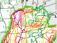
St. Louis University's CIPS analogs look impressive as well.
 
Check out 0z GFS and that deepening low in E Neb. 996...994 by Thursday AM? Negative Tilt and a massive amount of DPVA. I'm a big proponent DPVA being associated with tornado outbreaks, in particular ones that occur outside of classic OK/KS supercells. I would not be surprised to see the storms rolling out of N KS into SE Neb and Iowa maintain severe levels, possibly even rotation all night long and into the day Thursday based on the level of support in the uppers, LLJ and cape. Watch where the MCS ends up Thursday morning and head just south of the cloud shield. Should be interesting.
 
I'm considering playing the WI/IL border near the warm front on Thursday. The wind profiles are okay and there is sufficient instability. Obviously, I won't be in the best area for tornadoes so I'm not expecting much. But with my limited range, this should suffice as Thursday's setup isn't the most impressive. The low and trough look nice but this day is a overshadowed by Wednesday's potential.
 
Pleased to say that I am making casing arrangements! 12z NAM making Thursday look really good across Western IL.
namUS_sfc_temp_081.gif


That low right over quad cities at 4 pm, at 996 mb!
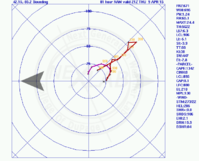
Look at this sample sounding near Galesburg IL
12_NAM_081_41.06,-90.26_skewt_ML.gif

Not too bad, though the surface to 850s aren't THAT strong, and the upper levels never complete a transition to westerly.

Aside from overnight convection and lingering clouds from the night prior, what are some other factors people are looking at in considering targets for Thursday? I will almost certainly be heading somewhere between Rockford and the Quads if the models continue to trend this way
 
Thursday is now in range of the NAM and shear profiles in Eastern Iowa and Western Illinois are quite impressive by 21Z. Deepening low in eastern iowa throughout the day as a very moist and unstable warm sector overspreads IA/IL.Huge curved hodos as you'd expect as the system deepens.

I still think the WF in MI could also provide a good focus with CAPE values reaching 2000 in SW MI by 21Z. The best Michigan severe weather days include a WF draped just north of the IN/OH/MI line and a deep low out in Eastern Iowa.

I definitely will be trying to get up to eastern Iowa for this event.
 
Will be out chasing both WED and THURS of this system. As of right now, THURS has my attention fully as its pretty much in my backyard. Soundings from the KMLI to KGBG area immediately SE of the low pressure per the 12z NAM look quite impressive with CAPE/shear combo. Will have to watch trends over the next couple days to see how things evolve. As of right now though, this is looking like a fairly solid day for my local area. My main concern would be morning convection which is something we won't know likely until the morning of, how that evolves. Nice to have something close to home to monitor after a poor year last year around here.
 
Hi,

I don't usually comment on these progressive spring systems but this one definitely has my attention. With the wave ejecting negatively tilted, boundary layer recovery near the warm from in N. IL looks impressive to say the least, strong pressure falls ect ect. Deep moisture under strong mid level lapse rates will contribute to seasonably strong updrafts rooted in the boundry layer. Also dry mid level air should keep storms isolated, and help maximize daytime heating. My 2 cents, when your out there stay east of the area and let the convection sort itself out before picking an updraft and moving west. Strong forcing scenarios like this tend to cause convection to go up quick before its becomes more organized and isolated under these deep strong shear days. And don't be fooled by the lack of directional shear, the speed shear is good enough to sweep out a good area of the hodo. Best luck to everyone, stay safe and please stream your video for us desk bound chasers.
 
Back
Top