• A friendly and periodic reminder of the rules we use for fostering high SNR and quality conversation and interaction at Stormtrack: Forum rules

    P.S. - Nothing specific happened to prompt this message! No one is in trouble, there are no flame wars in effect, nor any inappropriate conversation ongoing. This is being posted sitewide as a casual refresher.

2015-04-07 EVENT: N TX/OK/KS

I know Monday looks interesting in a conditional sense (i.e., given storms), but I think the "dry" model forecasts could be legitimate. The moist layer looks to be a little on the shallow side E of the dryline Monday in OK, and the mixed layer W of the dryline extends only up to 700-600 mb. This doesn't look like a strong dryline circulation setup to me, and since the ascent along the dryline tends to peak near the height of the moist layer depth on the moist side of the dryline, that peak ascent will be well below the LFC height. The rather quick veering of winds to SW-WSW above 850 mb also suggests that parcels will "detrain" from the narrow dryline updraft zone before the parcels can rise enough to reach the LFC. This problem is reflected in the NAM not triggering convection, likely because there's not quite enough moistening for the BMJ scheme. The same argument could also apply to Tuesday along the dryline.

All of the nifty sounding analogs from SHARPpy won't mean squat without an actual storm. This one may require some sort of ejecting wave that hasn't been identified yet, or a little stronger mesoscale ascent than is currently expected. Still 48-72 hrs to go, so much can change...
 
Is this about Monday or Tuesday? Tuesday is the 7th, Monday is the 6th. :) I think there's already a thread about Monday; mods might want to merge this one.

Oh, and to add to the discussion ... well, I can't really say anything more than what's already been said. Questionable initiation given capping and possible ascent issues. The latest runs of the GFS and NAM do have very slightly falling heights between 18Z and 21Z over KS and OK, but it probably won't be enough to help.
 
MOD NOTE: We're going to make this thread about Tuesday April 7th from here on out. Still looks like a decent chase day with a better chance of storms over Monday. The dryline is a little more NE/SW oriented which is something I do not like as much, but an extra day to advect moisture northward.

We currently have 70 degree dewpoints sitting on the gulf coast and pretty good mid level lapse rates across the the plains near 7.5.

Like Monday, if we can get a storm to fire we could have some pretty nice supercells in OK and KS.
 
Tuesday looks to be the only day that's firing any precip (between Monday and Tuesday). So I'd say there's a good shot at some severe storms over central OK. But with the dryline orientation, and lack of ample upper level support, I expect the storms to become very messy in a hurry. I say Tuesday will spit out some big hail, and maybe a tor if a storm can deviate to the SE. Otherwise, as Ben said, it could just be another day for the moisture to sit under the pressure cooker.
 
As Rich mentioned about Monday, the shallow moist layer seems to stick around Tuesday. Latest NAM and GFS have the same shallow moisture on the east side of the dryline in OK. Due to the NE/SW orientation of the dryline, the lower-level veering winds may actually keep the updrafts within the zone of ascent if storms can fire. But that moisture level drops precipitously at about the 900 mb level which is far below the LFC, especially on the NAM.
 
All of the nifty sounding analogs from SHARPpy won't mean squat without an actual storm. This one may require some sort of ejecting wave that hasn't been identified yet, or a little stronger mesoscale ascent than is currently expected. Still 48-72 hrs to go, so much can change...

Something I have to remind some people from time to time. It's hard to see the data when you're enamoured with how pretty a model sounding is... *drools*
 
Been watching the 00z on both the NAM and GFS. Best potential would be central OK and it does indicate a triple point type of situation. The NAM has a narrow band of cap erosion across central OK where the cape will be 4000 j/kg. The orientation of the dryline could be problematic though.
 
I'm a little biased, but I'm probably targeting my hometown of Paola, KS tomorrow. If not there, then somewhere northeast of there along the KS/MO border. Seems like that's all I get to chase, and it's not long before I have the whole eastern third of Kansas photographically memorized. NAM has a small area of breakable CIN from the Wichita area up to KC, and into northern MO. There's not a lot of forcing, as mentioned, and shallow moisture is still an issue, but NAM has cells firing up nonetheless, and with the moisture in place, I like my chances. CAPE is around 10 million J/kg there (ok, more like 4000), but shear is marginal around 40-45 kts. Low-level shear could definitely be better, but I like the EHIs in place around eastern KS, northern MO. Using this as a warm up chase before the madness that will probably occur Wednesday.
 
Is it just me or does it look like things may fire in SEKS? Just took a look at the 0z NAM and it has cells breaking out north of KCNU with the cap eroding @ 0z Wed...Impressive instability with CAPE values of 4k just not sure we have enough to help erode the cap. Forecast soundings show KCNU with a convective temp of 76F which is definitely possible on Tuesday. May venture out that way for a good 'ol tan.
 
Last edited:
Latest NAM data came in and it shows the cap eroding along the dry line from Wichita southwestward. Same with the GFS though to a lesser extent. However, the GFS is also hinting to a triple point reaction today, so there is hope for today.
 
Interesting day with a lot of moisture/cape. Personally am eyeing KS/OK border area along I-35, where models are trying to develop the westernmost extent of convection. Will be a challenge with storms moving quickly into the netherworld of Osage County -- but it's close enough to home and should offer some decent photo potential. Veering sfc winds won't help tornado potential, but definitely think big hail/structure potential is certainly there.
 
I'm currently in Independence, Kansas and there are updrafts fighting the cap to my west. I would be really surprised if an updraft doesn't overcome the cap in the next 45 min.
 

Attachments

  • IMG_20150407_165531513_HDR.jpg
    IMG_20150407_165531513_HDR.jpg
    983.1 KB · Views: 278
There is certainly some cumulus all along the surface wind shift from near KC back southwest into north central Oklahoma as of 6 p.m. and the SPC mesoanalysis data seems to confirm what earlier-day model-forecast soundings suggested in that MLCIN would be minimized along that corridor by this time. So, it seems like capping at the base of the EML isn't particularly strong right now...but it also seems like forcing for ascent is also rather weak. I often look at 500-MB height tendencies to get a feel for synoptic-scale subsidence and that very often serves as a good proxy for whether surface-based storms will develop in a marginally-forced mesoscale environment like this, and over the last few hours 500-MB heights have been relatively neutral in southeastern Kansas, suggesting the probability of initiation may be somewhat low. There are a bit "better" 500-MB height falls in the KC area per RAP-based data viewed on the SPC mesoanalysis page, and convergence along the wind shift may be a bit better there...so maybe it's that area into west central Missouri that has the relatively greater chance of surface-based development in the next few hours. Recent HRRR simulations key on that, as well as down the line into far northern Oklahoma (like they've been doing), but it seems like something will need to happen in short order for this to turn into something. Composite radar imagery doesn't seem to suggest the cumulus is deepening enough for real updrafts to show themselves yet, so time may be running out before boundary layer cooling starts increasing MLCIN again.
 
Hopefully, we'll get a reaction shortly. These 2 updrafts are trying, especially the one on the left. They're trying.
 

Attachments

  • IMG_20150407_184050767_HDR.jpg
    IMG_20150407_184050767_HDR.jpg
    821.6 KB · Views: 235
88bf05586fb595472068f784dd8a4f79.jpg


Yep these are trying too... off 166 in kansas.
 
This turned out to be a pretty active day, but mostly farther east. An elevated supercell formed in central MO and grew upscale into an MCS as it moved east across the western and southern parts of the St. Louis metro area and on into southern IL and IN and on into KY. Over 80 entries on the NWS St. Louis LSR summary, mostly hail (up to 2" in diameter) and heavy rain/flash flooding, then more in the way of wind damage in the Paducah and Louisville CWAs as the system moved ESE. Did notice one report of baseball hail in the Louisville LSRs, though.

Eventually southeast KS and western MO did fire, with even a couple tornadoes reported in southeast KS, but not until after dark.
 
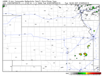
Early runs of the HRRR is wanting to break out some storms this afternoon. The HRRR has actually done a pretty good job the last few weeks.

If only the HRRR had a "trust me this time" flag so we knew when it was on target and when it wasn't... I rarely trust it with convection unless it's a big forcing event.
 
Back
Top