• While Stormtrack has discontinued its hosting of SpotterNetwork support on the forums, keep in mind that support for SpotterNetwork issues is available by emailing [email protected].

2015-03-24 EVENT: OK/KS/MO/AR/IL

If I were chasing this, which I am not due to distance, among other things, I would probably target near or just north of Lake of the Ozarks and hope that the helicity along the warm front can get the job done. The RAP does break out precipitation there during daylight, so there could be a short window of opportunity. Often this time of year these high-shear, modest instability situations can result in tornadoes, though not always ones that are easy to chase. Also, it's poor chase terrain, though not quite so bad once you are a little north/northeast of the lake. It would be an easy chase distance-wise from my old stomping grounds in the St. Louis area, so if I was still there, I would probably roll the dice.
 
Nice lapse rates back at ABQ at 00z, but as many have mentioned, the moisture is underwhelming and no rapid increase is on the horizon based on observations. I'm not sold on the model forecasts showing mid 60s dewpoints - I suspect 58-62 will be more realistic, which means CAPE will also likely be reduced some compared to the NAM. The shortwave trough is fairly compact and its influence won't extend too far S, so it's unlikely that low-level shear will be very strong S of MO. The northern track of the wave also casts doubt on how many storms will form as far S as eastern OK, especially considering the somewhat marginal moisture. Several of the convection-allowing model forecasts look reasonable - a small window for semi-discrete storms in MO before the storms try to outrun the narrow moist sector.

Hey Rich, couple questions...what facilitated the quick decay of the cap today? Evaporative cooling through mixing? (obviously there was tons of forcing...but it seems like the 850 to 700 temps actually decreased considerably.

And (barring convective interference), how can we be sure that the EML over the higher elevations will remain intact as it proceeds east? Can we typically expect the lapse rates upstream to remain fairly consistent? Also, the helicity today and modest CAPE had me expecting at least one tornado out of the 3 wall clouds that I saw on separate cells...was the air just too cold at the surface to get drawn into the supercells? Did cell-to-cell interference have anything to do with this?
 
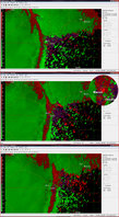
Placing this here vs. reports as I wasn't chasing and welcome your input/analysis. Sorry to not have better graphics to offer but I've rarely needed anything more than the standard issue GR3. If you have access to anything of higher quality as to help with identification I would be grateful. So anyways, late last night as the parent surface low was moving into the area, I noticed that it was going to make a perfect pass with the notch going directly over my home. Being a school night for my daughter, I couldn't be out but for this instance it worked in favor. Hoping for the possibility of a basic lead edge structure with lightning shot to post before bed celebrating the first thunder of the season, I may have got a little more than expected. While on the balcony waiting, I began noticing an unusual sound on the approach. Unsure if it was a rain core or gust front, it grew markedly louder and on passage, stirred things up down the street as evidenced by the noise of things taking a tumble. The sound resonated with me that for lack of better description was "throaty" but I still "blew it off" as the gust front. Normally I shoot time lapse and wish for this experience I had locked it down so to be a perfect sequence. Upon review of my images I was surprised to discover an unusual feature. My settings (ISO800, F5.6, 4s) were tweaked to allow more light and well, you decide. I know what I think is happening but once again, like always, not having a second set of eyes in near total darkness to confirm or refute, I share this as inconclusive. No complaints though.

(11mm through 10-24 wide angle)
150324animation.gif


IMG_9257a.jpg

150324rad.jpg
 
Last edited:
I don't see anything definitive, and radar just doesn't show anything conclusive either. I certainly don't see anything that looks suspiciously tornadic. Could've just been a local meso-circulation with somewhat stronger winds.
 
Back
Top