2013-10-04 REPORTS: OK/KS/NE/IA

James Gustina

Supporter
Joined
Mar 9, 2010
Messages
671
Location
Dallas, TX
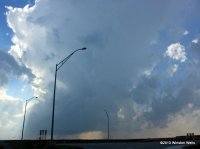
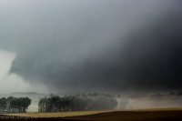
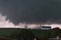
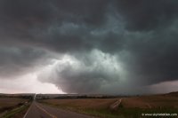
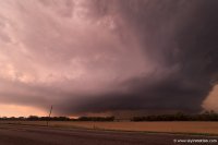
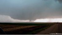
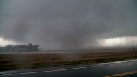
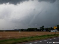
I didn't get a chance to make it up to Nebraska/Iowa for this day but ended up playing out in western Oklahoma near Elk City with the weakly supercellular storm that got its act together to put out an awesome mothership/multi-tiered structure. Started out by stopping in Elk City for lunch and began drifting north as storms began firing up and down the dryline/cold front hybrid. We initially went after some decent looking storms northeast of Hammon.

211546_2197119.jpg


211546_2197121.jpg


211546_2197123.jpg


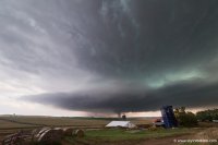
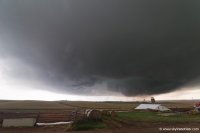
Those storms got munched up as more towers went up further SW along the dryline near Sayre. We decided to drop the storm and head south as the new storm was getting some decent separation from the rest of the junk that was rolling around/along I-40. We got caught in an awkward position due to roads (Foss Lake presents some serious problems in Custer Co.) and so we ended up core punching, where we got a few quarter sized stones, and blasting back east to get out in front and were treated to an amazing tiered gust front/updraft that looked like a mothership early on.

211546_2197127.jpg


211546_2197125.jpg


211546_2197128.jpg


After that the storms quickly began to gust out and we decided to head back to Norman and not even make an attempt at the lightning show that was going on in the core. All in all a great storm for the marginal end of this setup.
 
Last edited by a moderator:
Saw the Wayne beast. Stopped to help in town as they definitely needed it. Left town and caught up with the other beast somewhere west of Quimby but never really saw much other than an ominous edge illuminated by lightning strikes occasionally. Glad to be home and glad to call the season over after a stressful day.

Watch video >
 
Spent most of my day in Seiling, OK where I could just sit and let the storms roll to me. At one point a small wall cloud developed with slight rotation, but never thought it was a threat to put anything down. Later in the evening with the sun lighting up everything orange it made for some beautiful pics. A very satisfying day since it allowed me to just soak up the scenery and the smell of the rain and not spend most of it in the car.

11t7r5l.jpg


vfwln4.jpg


5l2lc5.jpg
 
Quite the humbling day... glad now one was killed with such huge tornadoes. We got pretty close to the Wayne, NE tornado and then stopped our chase short, helping a family a 5 out of their house that was completely destroyed. I am anxious to see how wide this thing ends up being surveyed as.

Watch video >
 
Chased Eastern Nebraska/Western Iowa. I spent the first half of the afternoon waiting in Avoca, IA along I-80 before thankfully realizing around 3 p.m. that the warm front was beginning to light up considerably further west in Nebraska. So, I bolted west on I-680, got stuck in a traffic jam on northbound I-29 near Missouri Valley, IA, then crossed the Missouri River at Blair, NE. At the intersection of NE-91 and US 77 I watched the start of the cell that would eventually produce the Macy, NE and Sloan, IA tornadoes - the view here is to the southwest:

c256168536293124911ccbcb0b375225.jpg

I then followed the cell north on US 77, keeping an eye on the Stanton-Wayne cell that was already producing to my northwest. Just north of Lyons, NE I almost gave up on my cell for the Wayne tornado - which surely would have been a futile move - but while I was at the intersection of US 77 and NE-51 the cell suddenly showed a pretty strong couplet and became TOR-warned. The storm's core was almost overhead at this point and was still visually unimpressive, but I had to decide whether to keep following it north on US 77 or take advantage of the toll bridge crossing just to my east on NE-51, then blast back north on I-29 on the Iowa side. Since there were no other crossings going north until Sioux City, I opted for the latter, missing the Macy, NE tornado as a result. Apparently I wasn't alone - the lady collecting tolls at the bridge asked "How many of you guys are there?"

By now the cell had crossed the river and was still TOR-warned over Sloan, IA. As I approached the Sloan exit on the northbound side of I-29, nearly all of the traffic was pulled over to the side, which made it easy to exit and head east on IA-141. Some of the chasers ahead of me chose to head north at Hornick, IA but I didn't want to get caught behind the storm, so I continued east to Smithland, IA where I then blasted northeast on IA-31. About 15 miles later I finally got a view of the storm, which was several miles off to my southwest. The following shots look west from IA-31, about 3 miles south of Correctionville, IA. The storm was still south of Moville, IA and US 20 at this point. I've pushed the contrast on them, but they're still pretty inconclusive:

36df264bc0fdceffbf1f0dd2581f133d.jpg

b7a75b58ac8ece56f51fc3e449c5141a.jpg

So too is the video that I shot from the same location. The storm's inflow - both aloft and at the surface on my back - was screaming from the east and was some of the strongest I've felt.


I was rapidly losing daylight, so I headed north into Correctionville, IA, turned east on US 20, and then briefly went north again on US 59. I stopped well short of Cherokee, IA, though, and called it a day (and a season).

Winston Wells
Jacksonville, IL
@WellsWx
 
Last edited by a moderator:
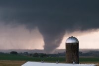
Started the day in Nebraska City and crossed the Missouri at Onawa/Decatur before waiting initiation in West Point, NE. Chased the Wayne, NE tornado from the south until I encountered the damage path. The road into town was a blocked by an overturned trailer. I checked a building briefly, but it was an industrial/farming area and nobody was around. I turned around and continued the chase heading east, stopping twice to clear trees from the road. I took 20 into Iowa and cut through the forward flank of the Moville/Quimby cell before dropping south a couple miles once I had a view of the base. Another large tornado was in progress. I filmed from the tornado's path until it was time to get out of the way, and scooted east out of the path, noting powerflashes in the field to my right. Chased the storm until well after dark, before meeting up with others in Fort Dodge for dinner.

The Wayne, NE tornado 4 south of Wayne at 5:26 pm looking northwest.
4291d938a062680b18aab04ab13aa400.jpg


The Moville, IA tornado 3 miles ESE of Moville, looking southwest from about 6:57 to 7:00pm
[Broken External Image]:https://scontent-a-iad.xx.fbcdn.net/hphotos-ash3/545238_10100717570355271_1408058888_n.jpg
[Broken External Image]:https://scontent-a-iad.xx.fbcdn.net/hphotos-prn2/1381410_10100717570360261_409043450_n.jpg
 
Daniel Betten, Brandon Lawson and I chased both the Wayne and Moville supercells. As the former struggled to organize NW of Columbus, we struggled mightily to agree on whether pursuing it on the northwest fringe of our target zone was worthwhile. Eventually, several SN reports made it impossible to resist, and we rocketed NW from West Point. As if the extreme haze and murk weren't enough, the rolling hills of northeast NE proved to be some of the most frustrating terrain I've ever dealt with; deceptively unmerciful for a landscape so devoid of trees. We approached Wayne from the E on NE-35, but dropped S a few miles E of town when we realized the town proper was in imminent danger. From only a few miles E of the meso, we caught little more than fleeting glimpses of the 1.5-mile-wide beast, confirmed only by an obvious hard edge on its south side. After acquiring some throwaway video and stills, we immediately got back E to pavement on NE-16.

The Wayne storm was visually unappealing from the moment we laid eyes on it, and only continued to grow moreso with time. When several new updrafts appeared in the storm's immediate inflow, we decided it was time for a hail mary: hauling to Sioux City, then (hopefully) scraping the northeastern outskirts of the southern supercell's FFD to get in position. By the time we decided to ditch the Wayne storm near Emerson, the southern cell's radar presentation -- then near Decatur -- already looked on the brink of producing something significant. We shot SE out of Sioux City to Bronson, then E on a paved road that continued all the way to Anthon. A couple miles into the trip down this road, we were relieved to break free from the FFD core and gain visual of fantastic updraft structure just to our S. Within minutes, we stopped 2 NE Climbing Hill as a cone tornado developed rapidly down near Sloan.

4460d67433111946332cef25a71db737.jpg

63380bf487cf9b2c1ecd8c5f22276018.jpg

From this spot we watched the multiple-vortex tornado approach, occasionally exhibiting horizontal vortices. After the cone stage, it spent several minutes as a large ground circulation with only sporadic condensed vortices, perhaps comparable to the Wakita event on 2010-05-10.

0d1025e9913ee5a5192c52e44229db50.jpg

017a4f2b03472c85f66b52fbef540f9f.jpg

Unfortunately, we were compelled to continue E before it finally reached fully-condensed wedge status. This apparently occurred a touch NNE of Climbing Hill, and by this time we were hauling E in the car and shooting shaky video out the window. We finally stopped again closer to Anthon and were able to document the extremely large, but also frequently rain-wrapped, wedge as it plowed toward US-20 between Moville and Correctionville.

c659101fb195daef2ab050dbf92b5942.jpg

891bcc90e0958e18e0cb92f92d9a2bcc.jpg

Finally, when it became clear any remaining tornado was hopelessly socked in by rain, we stopped NE of Correctionville for some nice HP structure at dusk.

291b53be396cb4b0d870ab1a2627e0bd.jpg

It was a long drive in the dark to Topeka for a motel and yet another long drive the next day, but well worth it for this rare high-end October setup.

Video:

Watch video >
 
Chased the Wayne cell with two of my fellow grad students from Creighton University, who were on their first chase. Due to construction on US 275, we decided to move north on Highway 15 well ahead of the storm. We sat a few miles west of 15 to the south of Wayne where we watched an elongated lightly rotating wall cloud rapidly tighten as it moved towards us, before producing a multiple vortex tornado just to our southwest:

3b7ced04a35042170b1277d3ad1cc5dd.jpg

We quickly scurried back to Highway 15 where we crept north as the tornado evolved into a wedge just to our west:

2d2f6b4fbb1259fb573950b304f60f79.jpg

We attempted to keep up with the storm after it moved northeast of Wayne, but the degradation of the road network to the west of Sioux City made that futile. We did briefly observe the end of the Wayne tornado from Highway 35 near Wakefield, as it re-emerged from the west side of the storm:

c5302b214e3e2c5cde1c0ecc44889136.jpg

Video (Warning:Language. Also keep in mind the person filming is seeing his first tornado):

Watch video >
 
Left Lincoln just before 2 with an initial target of Wayne. Ended up in west point at 3:30 and watched storms develop to the west. We decided to target the Wayne storm and caught up with it near Stanton.
IMG_9931.jpg

We then followed the storm north towards Wayne using gravel roads to avoid the construction on Hwy 275. We then intercepted the Wayne tornado as it crossed 15 just south of Wayne.
IMG_9950.jpg

As we headed north after it crossed the road we began to encounter damage and headed east on gravel roads. We ended up briefly getting stuck and got behind the storm. By the time we caught back up the storm was nearing Sioux City. At this point we decided to leave that storm and target the storm that developed behind the Wayne storm. We intercepted it near Jackson, NE and watched it produce a possible tornado as it crossed into South Dakota. At the point it was after sunset so we decided to call off the chase and watch the lightning as storms moved away.
IMG_9977.jpg
 
Stephen, how did you know about the construction on US275? I made a bad choice initially by taking 32 from West Point and then north on Hwy15. I had to stop several times at red light single-lane bridge work and then ran into the backup at Pilger --waiting on a pilot car. Overall, lost almost 10 minutes. However, I did catch the wedge as it crossed Hwy 15 south of Wayne, with one distant photo that even shows a suction vortex. When I left Ft. Dodge that morning, I wasn't sure where I would wind up, just knew it wouldn't be in outflow dominant Iowa. With more time, I might have looked up Nebraska road work on the Internet. - - - David
 
Stephen, how did you know about the construction on US275?

We took 275 northwest from west point when we were initially trying to intercept the storm, so we had already sat about 10min waiting for the pilot car while headed towards Stanton. That is why when we headed back east to catch 15 north we knew it would be a 10 min wait and used the gravel roads to cut a few miles north and east to get back on 15 south of Wayne.
 
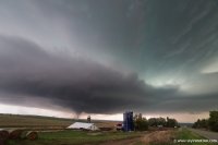
Stephen, while looking through old photographs from the Wayne tornado day, I find myself returning again and again to your classic photo of young chasers near West Point, looking at the distant prospect of what is to come. --This is photographic poetry.-- It is great on so many levels, the calm before the storm, the mix of light and shadow, perfectly posed with distant towers framing the sky, and next to a field awaiting the harvest. It is more peaceful than expectation --as if they wished it could go on forever, just the way it was at that moment. You have an artist's eye, and I look forward to seeing more of your work in the future. - - - David Hoadley
 
Last edited by a moderator:
Back
Top