Brad Nelson
EF1
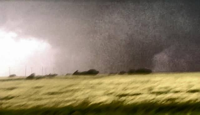
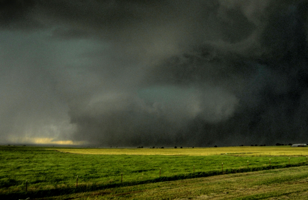
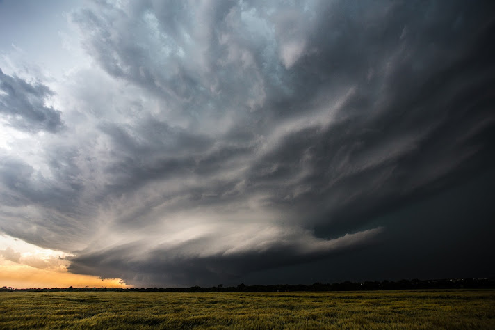
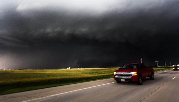
El Reno Tornado from the East
Good day all,
Here are a few photos and the video that I took of the El Reno tornado:


Watch video >
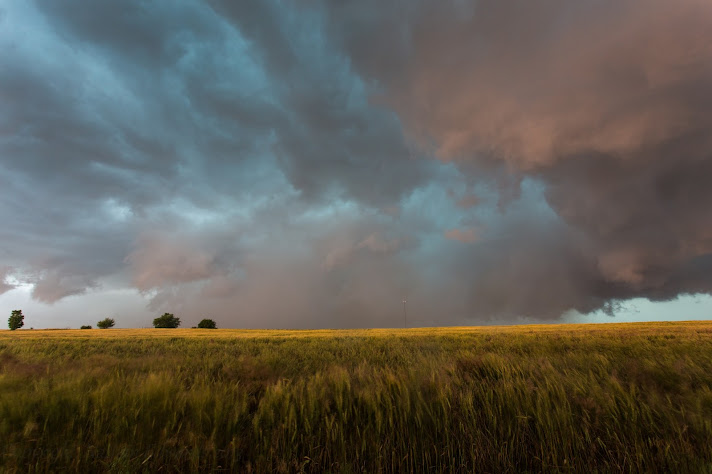
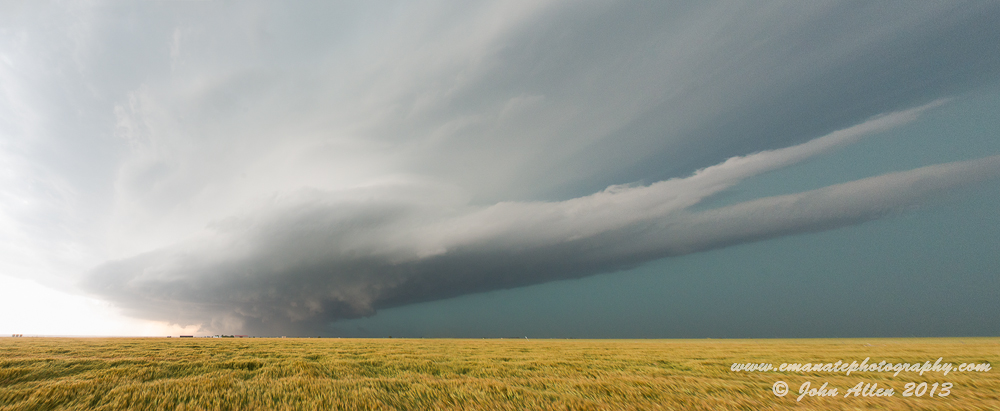
I met up with some friends initially in El Reno and chatted with other chasers as cumulus towers began to develop on the intersection of the stalled front and dryline. Initially, 3 storms went up and congealed into a messy scenario so I thought that maybe this wasn't going to be a big tornado day after all, especially since the past few days before that did not turn out as expected. Boy was I wrong as the southern, tail end storm exploded in the mid/upper 70's dewpoint air and stayed rooted on the stalled front, while drifting east and quickly developing a massive hook echo as we came back down near Yukon and got ahead of the storm. Already traffic was really congested as it was rush hour, so I had an uneasy feeling from the start about chasing this thing. But I managed to get out of traffic and head west on a gravel road that had no traffic, while approaching the developing wedge from the east. We got right out ahead and stopped roughly 3 miles to the east-northeast of the hook to watch it approach. I was thinking, wow, this hook really has quite the core wrapping around but quickly realized that it was entire tornado that was partially rain-wrapped (but still visible) coming at me. Playing it safe, I bailed to the south to get out of the way and then watched it pass a few miles to my north as it made the north turn towards the interstate. It was hard to get real excited about this tornado knowing there were probably people and many homes in it's path and due to how strong it looked. If you watch my video, you can get a sense of my uneasiness with the whole situation.
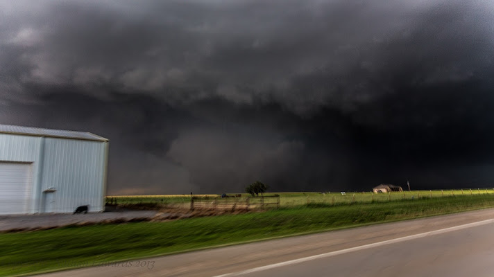
After leaving this tornado, we paralleled the storm to the east into the south part of Yukon, seeing power flashes occur to my northeast along the way. This is when the traffic started to become really a problem. I attempted to bail south and get out of the way of the second and third couplets that were on storms approaching from the west and taking a dive to the southeast. I became stuck in bumper to bumper traffic trying to get across one of the few routes across the Canadian River (hwy 4) on the southwest side of the OKC metro. This is when a couplet on radar passed just behind me and my car was hit by ~50 mph RFD winds and people really started freaking out. It was mass chaos as people started abandoning their cars and running for any shelter that they could. There were vehicles running into other vehicles and a total loss of laws and rules that you would see more in a movie rather than playing out in front of you in real life. I witnessed several accidents and people just kept driving, leaving others stranded with disabled vehicles. After that debacle, they police started opening up all lanes across the river and south and not allowing traffic to go back north so we got out of there and over to Tuttle before the next and stronger couplet on the third storm reached the area. I can honestly say that this is the first time that I thought about leaving my vehicle to find shelter from a tornado as we were not sure if we could beat the third couplet due to the horrendous traffic. It was the first time that I thought I was trapped in a bad situation with a tornado and no place to go. It was a scary ordeal. I then drove west around the storms and north on Hwy 81 through the damage path and could see overturned cars along the road and in fields and the eery scene of police and ambulance lights as far as I could see to the east.
I consider myself a rather cautious chaser, but this whole experience and the deaths of Tim, Paul, and Carl have certainly made me reevaluate things a little bit, especially chasing around large urban areas. It was one of those near worst case scenarios that I was seeing play out in front my eyes...a large tornado heading for a major metro area towards later rush hour, the mad scramble to get out of the way, and additional tornadic supercells directly behind the initial storm. Rest in Peace to the good people of Tim and Paul Samaras, Carl Young, and others that lost their lives on this day.
Good day all,
Here are a few photos and the video that I took of the El Reno tornado:
Watch video >
I met up with some friends initially in El Reno and chatted with other chasers as cumulus towers began to develop on the intersection of the stalled front and dryline. Initially, 3 storms went up and congealed into a messy scenario so I thought that maybe this wasn't going to be a big tornado day after all, especially since the past few days before that did not turn out as expected. Boy was I wrong as the southern, tail end storm exploded in the mid/upper 70's dewpoint air and stayed rooted on the stalled front, while drifting east and quickly developing a massive hook echo as we came back down near Yukon and got ahead of the storm. Already traffic was really congested as it was rush hour, so I had an uneasy feeling from the start about chasing this thing. But I managed to get out of traffic and head west on a gravel road that had no traffic, while approaching the developing wedge from the east. We got right out ahead and stopped roughly 3 miles to the east-northeast of the hook to watch it approach. I was thinking, wow, this hook really has quite the core wrapping around but quickly realized that it was entire tornado that was partially rain-wrapped (but still visible) coming at me. Playing it safe, I bailed to the south to get out of the way and then watched it pass a few miles to my north as it made the north turn towards the interstate. It was hard to get real excited about this tornado knowing there were probably people and many homes in it's path and due to how strong it looked. If you watch my video, you can get a sense of my uneasiness with the whole situation.
After leaving this tornado, we paralleled the storm to the east into the south part of Yukon, seeing power flashes occur to my northeast along the way. This is when the traffic started to become really a problem. I attempted to bail south and get out of the way of the second and third couplets that were on storms approaching from the west and taking a dive to the southeast. I became stuck in bumper to bumper traffic trying to get across one of the few routes across the Canadian River (hwy 4) on the southwest side of the OKC metro. This is when a couplet on radar passed just behind me and my car was hit by ~50 mph RFD winds and people really started freaking out. It was mass chaos as people started abandoning their cars and running for any shelter that they could. There were vehicles running into other vehicles and a total loss of laws and rules that you would see more in a movie rather than playing out in front of you in real life. I witnessed several accidents and people just kept driving, leaving others stranded with disabled vehicles. After that debacle, they police started opening up all lanes across the river and south and not allowing traffic to go back north so we got out of there and over to Tuttle before the next and stronger couplet on the third storm reached the area. I can honestly say that this is the first time that I thought about leaving my vehicle to find shelter from a tornado as we were not sure if we could beat the third couplet due to the horrendous traffic. It was the first time that I thought I was trapped in a bad situation with a tornado and no place to go. It was a scary ordeal. I then drove west around the storms and north on Hwy 81 through the damage path and could see overturned cars along the road and in fields and the eery scene of police and ambulance lights as far as I could see to the east.
I consider myself a rather cautious chaser, but this whole experience and the deaths of Tim, Paul, and Carl have certainly made me reevaluate things a little bit, especially chasing around large urban areas. It was one of those near worst case scenarios that I was seeing play out in front my eyes...a large tornado heading for a major metro area towards later rush hour, the mad scramble to get out of the way, and additional tornadic supercells directly behind the initial storm. Rest in Peace to the good people of Tim and Paul Samaras, Carl Young, and others that lost their lives on this day.